
Where Are The Best Beaches In Wellington, New Zealand?
Wellington’s coastline boasts lots of calm harbour bays and family-friendly stretches right in the city. Beyond, however, spread across the Kapiti Coast, Wellington city, Lower Hutt, and the Wairarapa, you have some of the best beaches in the country here:
Best Beaches on the Kapiti Coast
⛱️ Ōtaki Beach
General Location: Ōtaki Beach is on the lower western coast of New Zealand’s North Island, underneath the Taranaki Bight. Nearest Civilisation: Ōtaki Beach settlement is a six minute drive (4 kilometres, or 2.5 miles) from Ōtaki the town.
Immediate Surroundings: Ōtaki Beach is at the top of the Kapiti Coast and opens out into the Cook Strait. Ōtaki River Mouth is on the beach and Ōtaki Beach Recreation Reserve is the area behind the beach just north of the river mouth.
Beach Name: Ōtaki translates to ‘the place of a staff, stuck in the ground.’ Getting There: Mill Road runs down from Ōtaki the town to Ōtaki Beach (Tasman Road). Access to the beach is from Marine Parade. Vehicle Parking: Yes, vehicle parking can be found at Ōtaki Beach.
Walking Options: From the southern end of the beach, head on up the Ōtaki River Trail as far as you want to go (four hours one-way, if you like, which is 3.4 kilometres, or 2 miles). Swimming: Lifeguards patrol Ōtaki Beach in peak season to ensure safe swimming. Surfing: There is good surfing to be had at Ōtaki Beach.
Dogs: Dogs are welcome at Ōtaki Beach but need to be on lead. Amenities: Public toilets are available at Ōtaki Beach, as well as a picnic area, barbecues and changing rooms. Camping: Yes! Self contained campers can freedom camp at Ōtaki Beach.
Go, Because: Ōtaki Beach is wild, not too busy, scenic, and close to the village of Ōtaki – the gateway into the Tararua Ranges. Something Extra: Go in March to attend the Ōtaki Kite Festival, when lots of kites and market stalls come to Ōtaki Beach! Last Updated: May, 2026.
⛱️ Te Horo Beach
General Location: Te Horo Beach is on the southwestern coastline of New Zealand’s North Island, a little further north than Kapiti Island. Nearest Civilisation: Te Horo Beach is a ten minute drive from Ōtaki, 9 kilometres or 5.5. miles.
Immediate Surroundings: Te Horo Beach sits on the Kapiti Coast – north of Waikanae and Peka Peka, but south of Ōtaki Beach.
Beach Name: Te Horo translates to ‘the landslide’. Getting There: Te Horo Beach is accessible from the roads that lead down to it with no walking involved.
Vehicle Parking: Vehicle parking is available at Te Horo Beach. Walking Options: The Te Horo Beach Coastal Walk is a popular one, a meander up the beach itself that will take you three quarters of an hour. Swimming: Te Horo Beach is not a safe swimming beach.
Surfing: There is awesome surfing at Te Horo Beach. Dogs: Dogs can run off lead at Te Horo Beach. Amenities: There are toilets and changing rooms at Te Horo Beach.
Camping: There are no campsites at Te Horo Beach. Go, Because: Te Horo Beach is a really great surfing spot, no matter your level. Something Extra: Stop by at Bus Stop Cafe for a coffee and to say hi to the alpacas – it’s a very short walk! Last Updated: May, 2026.
⛱️ Peka Peka Beach
General Location: Peka Peka Beach is down in the southwestern corner of the North Island, along the Kapiti Coast. Nearest Civilisation: Peka Peka Beach is situated down from Ōtaki and up from Waikanae and Paraparaumu. The little town of Waikanae is closest to Peka Peka Beach (which only has a small settlement there) and is a 10 minute drive away (8 kilometres, or 5 miles).
Immediate Surroundings: Peka Peka Beach is directly down the coast from Te Horo Beach, north of Kapiti Island.
Beach Name: Pekapeka is the name for the native bat, and also refers to a greenstone pendant (pounamu). Pekapeka is also an area in the Hawkes Bay region, on the other side of the North Island. Getting There: Peka Peka Beach is accessed from the end of Peka Peka Road, just off the main state highway.
Vehicle Parking: Gravel carparks are available at Peka Peka Beach. Walking Options: 12 minutes inland is the Hemi Matenga Memorial Park, and the Parata Track, a 3.5 kilometre (2 mile) – return – ascent with views over to Kapiti Island from the top. Swimming: There are no lifeguards at Peka Peka Beach, so swim with caution – and avoid the water for a few (2-3) days after rainfall as the water quality is the other concern here.
Surfing: The surf at Peka Peka Beach is fantastic! Dogs: Dogs can run off lead at Peka Peka Beach. Amenities: There are no facilities at Peka Peka Beach. Use what is available at the neighbouring beaches (Te Horo and Waikanae) instead.
Camping: No freedom camping is allowed at Peka Peka Beach. Go, Because: Peka Peka Beach typically boasts the biggest waves for surfers along this stretch of coastline and is a great surfing hotspot. Something Extra: Catch a sunset here! This is the perfect westward facing location, with Kapiti Island on the horizon. Last Updated: May, 2026.
⛱️ Waikanae Beach
General Location: Waikanae Beach sits on the Kapiti Coast on the southwestern coastline of New Zealand’s North Island. Nearest Civilisation: Waikanae Beach is a coastal settlement all of its own, with the main town of Waikanae a six minute drive away (4 kilometres, or 2.5 miles).
Immediate Surroundings: Waikanae Beach sits north of Paraparaumu Beach and south of Peka Peka Beach, and faces out into the Cook Strait and over to Kapiti Island. Waikanae Estuary Scientific Reserve and Waimanu Lagoon are just south of the beach, at the mouth of the Waikanae River.
Beach Name: Firstly, Waikanae Beach is separate from the Waikanae Beach in Gisborne! It translates to ‘waters of the yellow eyed mullet’. Getting There: Waiakanae Beach sits just off the main state highway and is very accessible.
Vehicle Parking: Vehicle parking is available at Waikanae Beach. Walking Options: The trail around the nearby Waikanae Estuary is 1.6 kilometres (1 mile) each way, featuring wetlands, stretches of boardwalk, and a plethora of different types of birds.
Swimming: Waikanae is a beloved swimming spot. Water quality varies after rainfall so stay out for two days after rain. Lifeguards patrol in summer.
Surfing: Waikanae Beach is a great surfing spot. Dogs: In warmer months, dogs need to be on lead at off-peak times and are prohibited in popular spots during the day – whereas they can run more freely in the colder months when Waikanae Beach is less populated. Amenities: Changing rooms, toilets – and an electric vehicle charger are all available at Waikanae Beeach.
Camping: Freedom camping for self contained campers is fine at Waikanae Beach in the designated spots. El Rancho Holiday Park is the place to go for those in tents or wanting cabins. Mostly it’s for camping groups, but some weeks of the year they open it up to anyone wanting to stay.
Go, Because: The adjacent estuary at Waikanae Beach (Waikanae Estuary) is a prime bird watching location. Something Extra: Spot native white herons, spoonbills, or catch some whitebait in the Waimanu Lagoon. Last Updated: May, 2026.
⛱️ Paraparaumu Beach
General Location: Paraparaumu Beach sits on the Kapiti Coast in the southwestern corner of New Zealand’s North Island. Nearest Civilisation: The settlement of Paraparaumu Beach surrounds the Paraparaumu Beach area, with Paraparaumu (the town) just inland a few minutes. Immediate Surroundings: Paraparaumu Beach sits across from Kapiti Island – only 5 kilometres (3 miles) between them. It sits below Waikanae Beach, enroute to Wellington.
Beach Name: Paraparaumu translates to ‘scraps from an earth oven’ and refers to a war party returning to the area in the early 1800s to find only scraps in earth ovens in the village here. Getting There: The state highway runs through the town of Paraparaumu, with the beach only a couple of blocks away. Vehicle Parking: Lots of roadside parking is available at Paraparaumu Beach.
Walking Options: Walk on up to Waikanae Beach via Kotuku Drive, the estuary crossing, and Weggery Drive – a 5 kilometre (3 mile) walk that will take you an hour (one-way). Swimming: Paraparaumu Beach is fairly shallow and a good one for swimming. Surfing: The water at Paraparaumu Beach is sheltered because of the island just offshore, so surf further south, instead.
Dogs: Dogs can largely be off lead at Paraparaumu Beach in winter months but need to be on lead in summer and are banned entirely from the more popular areas of the beach. Amenities: Toilets, skatepark, picnic areas and playgrounds are available at Paraparaumu Beach, as well as many eateries along Marine Parade. Camping: Kapiti Holiday Resort Campground is the spot of choice for campers at Paraparaumu Beach, although some freedom camping is also permitted at the southern end of the beach.
Go, Because: Being a West Coast beach, you get great sunsets at Paraparaumu Beach – and right there in the foreground, views of Kapiti Island. Something Extra: Get yourself on a tour and take the 20 minute boat ride over from Paraparaumu Beach to Kapiti Island, a bird sanctuary. Kapiti Island Nature Tours are your guys! Last Updated: May, 2026.
⛱️ Raumati Beach
General Location: Raumati Beach sits on the Kapiti Coastline just north of Wellington, our capital city at the bottom of the North Island. Nearest Civilisation: The town of Paraparaumu is a five minute drive (3 kilometre, or 1.8 miles) from Raumati Beach.
Immediate Surroundings: Wharemauku Stream winds its way down to Raumati Beach, which looks out toward Kapiti Island and the Cook Strait. It sits just south of Paraparaumu Beach and north of Paekākāriki Beach, separated by Queen Elizabeth Park. Beach Name: Raumati translates to ‘summer’.
Getting There: Raumati Beach is easily accessed from Raumati Road, which comes straight off the main state highway.
Vehicle Parking: There is lots of vehicle parking at Raumati Beach. Walking Options: Head through the dunes (Queen Elizabeth Park) down to Paekākāriki Beach, which is two hours return (4 kilometres, or 2.5 miles). At the time of writing, walkers need to avoid a partial closure by resorting to walking on the beach itself. Swimming: Water is calm and gentle for swimming at Raumati Beach.
Surfing: The surf at Raumati Beach is particularly suited to beginners. Dogs: Raumati Beach is a great off-lead dog beach! Amenities: Raumati Beach has toilets, a waterfront restaurant, picnic area, splash pad, barbecues, miniature railway, sandpit, flying fox (in the adjacent Marine Gardens park) and two other playgrounds along the beachfront. It really has it all!
Camping: Freedom camping is allowed at Marine Gardens at Raumati Beach. Go, Because: Raumati Beach has all the makings of a great day/weekend away – an incredibly family friendly spot, and so close to Wellington! Something Extra: Raumati Beach is a good one for kayaking! Head on out for a paddle and enjoy the views over to Kapiti Island. Last Updated: May, 2026.
⛱️ Paekākāriki Beach
General Location: Paekākāriki Beach is located in the bottom left hand corner of New Zealand’s North Island, along the Kapiti Coast north of Wellington city. Nearest Civilisation: Paekākāriki Beach is a ten minute drive from the town of Paraparaumu, 10 kilometres, or 6 miles. Immediate Surroundings: Paekākāriki Beach is south of Raumati Beach and Queen Elizabeth Park but north of Porirua and Wellington city.
Beach Name: Paekākāriki translates to ‘the perching place of the kakariki’ which is a native parakeet. Getting There: Paekākāriki Beach is accessed from The Parade, which runs parallel to the main state highway.
Vehicle Parking: There is lots of roadside parking at Paekākāriki Beach, and parking at Queen Elizabeth Park, too. Walking Options: A fabulous instagram-famous walk is the. Paekākāriki Escarpment Track which connects Paekākāriki Beach with Pukerua Bay below. It’s 10 kilometres one-way (6 miles) and takes three or four hours to walk – predominantly up stairs. It’s called the Stairway to Heaven and has over one thousand steps! Views are unreal. Definitely make time for this one!
Swimming: There is good swimming to be had at Paekākāriki Beach. Lifeguards patrol during the summer. Surfing: The surf at Paekākāriki Beach is good for beginner surfers. Dogs: Dogs need to be on-lead at certain parts of Paekākāriki Beach to protect the penguins, and in summer can only be on the beach outside peak hours.
Amenities: Paekākāriki Beach has Campbell Park just offshore, with its playground, skatepark, soccer fields, water fountain, toilets and picnic areas. Camping: Paekākāriki Holiday Park is the go-to for campers. Go, Because: Some would say the best beach on the Kapiti Coast is Paekākāriki Beach!
Something Extra: Explore Queen Elizabeth Park, north of Paekākāriki Beach, as much as you can – whether that is on foot, bike, or horse. Last Updated: May, 2026.
Best Beaches south of Kapiti
⛱️ Titahi Bay
General Location: Tītahi Bay Beach is located in the southwestern corner of New Zealand’s North Island, north of Wellington city, south of the Kapiti Coast area. Nearest Civilisation: The city centre of Porirua is a five minute drive from Tītahi Bay Beach (3 kilometres, or 1.8 miles).
Immediate Surroundings: Tītahi Bay Beach sits on the Whitireia Peninsula, across the Pauatahanui Arm of the Porirua Harbour from the Kapiti Coast and beaches listed above. It sits just south of Whitireia Park at the tip of the peninsula. Beach Name: Tītahi translates to ‘single cabbage tree’.
Getting There: Tītahi Bay Beach is accessed from Tītahi Bay Road off the main state highway. Vehicle Parking: Lots of roadside parking on Beach Road is available for visitors to Tītahi Bay Beach. Walking Options: The Tītahi Bay Beach Walk will see you walk down the shoreline, past the colourful boatsheds, through Stuart Park and back, which will take you less than an hour and is just over 3 kilometres (1.8 miles).
Swimming: Tītahi Bay Beach is a great swimming beach and lifeguards patrol in summer. Surfing: Surfers of all levels can enjoy the waves at Tītahi Bay Beach. Dogs: Dogs can be off lead at Tītahi Bay Beach in winter months and in summer months if out of peak times – and are banned during the summer days.
Amenities: Multiple playgrounds and toilets are available at Tītahi Bay Beach. Camping: There is no camping at Tītahi Bay Beach, although freedom campers can go to nearby Paremata. Go, Because: Titahi Bay has some sea caves at the northern end, and is lined by colourful boat sheds, which make for a cheerful photo.
Something Extra: Check out the Tītahi Bay Fossil Forest at mid or low tide at the southern end of Tītahi Bay Beach. You’ll see fossilised tree stumps from 100,000 years ago!! Last Updated: May, 2026.
⛱️ Mākara Beach
General Location: Mākara Beach sits well below the Kapiti Coast and below the Whitireia Peninsula too, below Porirua city, immediately west of Wellington city on the western coast. Nearest Civilisation: The settlement of Mākara Beach is a half hour drive from the city centre of Wellington – 17 kilometres, or 10 miles.
Immediate Surroundings: Mākara Beach sits tucked in alongside Ohariu Bay and Wharehou Bay and faces directly into the Cook Strait. Beach Name: There are several possible explanations for the name Mākara, so noone is really sure whether it refers to white stone (which is how it translates) or ‘head of the fish’ or a place from where you come and go – which also fits, given its position on the Cook Strait. Getting There: Mākara Beach is accessed from Mākara Road which runs from the city to the coast.
Vehicle Parking: There is a big carpark at Mākara Beach. Walking Options: The Mākara Beach Walkway is a 7 kilometre (4.3 mile) loop that you should allow three or four hours for, due to its ascent. Swimming: You can swim at Mākara Beach but be cautious of strong currents.
Surfing: Yes, there is surfing at Mākara Beach. Dogs: Dogs can be off lead at Mākara Beach. Amenities: Toilets and changing rooms are available at Mākara Beach.
Camping: There is no campsite at Mākara Beach. Go, Because: Mākara Beach: it’a wild, windy and western – a great little escape not far from Wellington city. Something Extra: Keep an eye out for seals on the walkway and on the beach! Last Updated: May, 2026.
Best Beaches in Wellington City
⛱️ Red Rocks Beach / Pariwhero
General Location: Red Rocks Beach / Pariwhero is located at the fringe of the Wellington Harbour, on the southern edge of the North Island. Nearest Civilisation: Wellington city centre is a 20 minute drive from Pariwhero – which is 11 kilometres, or 7 miles.
Immediate Surroundings: Pariwhero makes up the Red Rocks Scientific Reserve. It sits just next to Sinclair Head and looks directly out onto the Cook Strait.
Beach Name: Pariwhero translates to ‘red rocks’ and is named for the rocks on the beach that are stained red by iron oxide. Their presence and colour points to the volcanic activity in the area 200 million years ago, when they oxidised from volcanic flow. Getting There: Pariwhero is reached by road, coming south out of Wellington city toward the southernmost coastline of the North Island.
Vehicle Parking: Vehicle parking for access to Red Rocks Scientific Reserve is at Te Kopahou Visitor Centre. Walking Options: The Red Rocks Coastal Walk is a popular coastal track between Sinclair Head and Owhiro Bay – past the red rocks – and will take you two or three hours. It’s 7.5 kilometres (4.5 miles) and you may see seals on the rocks, the the famous red rocks, and the ferry crossing the Cook Strait.
Swimming: Currents can be strong at Pariwhero so swim with caution, give any seals a wide berth, and avoid the water after rainfall (for a couple of days) to avoid potentially contaminated water. Surfing: Advanced surfers may be able to catch a break at Pariwhero. Dogs: Dogs need to be on a lead at Pariwhero. Give seals a berth of 20 metres. Amenities: Toilets and a visitor centre (with further toilets) are available east of the red rocks.
Camping: Freedom camping for self contained campers is permitted at the Owhiro Bay carpark – at the other end of the Red Rocks Coastal Area. Go, Because: Red Rocks Beach is home to the Sinclair Head seal colony, and you’ll see them in winter! Something Extra: There is a popular 4WD track through here – open Mondays to Saturdays – if you fancy taking your 4WD our to see the seal colony. Last Updated: May, 2026.
⛱️ Ōwhiro Bay Beach
General Location: Ōwhiro Bay Beach is located on the south coast of Wellington city, at the base of the North Island. Nearest Civilisation: Wellington city centre is a 15 minute drive (8 kilometres, or 5 miles) from Ōwhiro Bay Beach. The Ōwhiro stream opens out into the bay which sometimes affects the water quality.
Immediate Surroundings: Ōwhiro Bay is located between Pariwhero and Island Bay on Wellington’s south coast. It is a narrow little bay with a small beach tucked between the rocks. Beach Name: Ōwhiro translates to ‘moonless night’ referring to the new moon at the start of the lunar cycle. Getting There: Ōwhiro Bay Beach is easily accessed from Ōwhiro Bay Parade, a short drive from the city centre.
Vehicle Parking: You can park at the Te Kopahou Visitor Centre on the Ōwhiro Bay Parade. Walking Options: From Ōwhiro Bay Beach, head up Happy Valley Road to find the trailhead for the Tip Track, which is an ascent up Hawkins Hill. It’s steep, and it’s 3.5 kilometres (2 miles) up, with awesome views, as you can imagine. Allow an hour for the ascent and some more to come down again.
Swimming: At the time of writing, conditions are good for swimming at Ōwhiro Bay Beach. Sometimes there is contamination so check local council notifications before going in. Surfing: Only experienced surfers will be able to catch the waves at Ōwhiro Bay Beach.
Dogs: Dogs need to be on a lead at Ōwhiro Bay. Amenities: There are toilets, changing rooms and a boat ramp at Ōwhiro Bay Beach.
Camping: Freedom camping in self contained campers is permitted at Ōwhiro Bay Beach. Go, Because: You can access the route out to the Pariwhero Red Rocks from Ōwhiro Bay, the namesake for neighbouring Red Rocks Beach. Something Extra: Stop in at the Te Kopahou Visitor Centre to learn about the geology/volcanic history of the area first. Last Updated: May, 2026.
⛱️ Island Bay Beach
General Location: Island Bay Beach is located on the south coast of Wellington city, right at the bottom of the North Island of New Zealand. Nearest Civilisation: Wellington city is a 20 minute drive from Island Bay Beach (which is a suburb in and of itself) and the city centre is about 8 kilometres (5 miles) away.
Immediate Surroundings: Island Bay Beach is located within Island Bay, which looks out into the Cook Strait. It is on the south coast of Wellington city and just offshore is Taputeranga Island, only 200 metres from the beach! This area is also part of the Taputeranga Marine Reserve. It’s a fantastic spot for snorkelling and seeing some of the 180 species of fish that live in the reserve.
Beach Name: Island Bay is clearly named for the big island in the middle of the bay – Taputeranga Island. The name’s translation refers to it being a rising out of the sea that is marked as sacred. Getting There: Getting to Island Bay Beach is easy from Wellington city, whether you take public transport, private vehicle, or other means (it’s not far).
Vehicle Parking: There is parking at the Marine Education Centre and along the Esplanade at Island Bay Beach. Walking Options: Make a day of it and attempt Wellington’s City to Sea Walk, which is from the CBD down to Island Bay. It’ll take you six to seven hours as is nearly 15 kilometres (9 miles), and you’ll see some notable attractions on the way down to the sea.
Swimming: Island Bay Beach is a good swimming beach and has a floating pontoon that swimmers like to head out to and jump off. Surfing: The island shelters a lot of Island Bay Beach, so rather go to neighbouring beaches to the west to catch a break. Dogs: Dogs are permitted on the western end of Island Bay Beach. Amenities: Island Bay Beach has an adjacent park (Shoreline Park) with a playground, toilets, barbecues and picnic areas. There’s also a pier, pontoon, café, and a small aquarium!
Camping: No camping is permitted at Island Bay Beach. Go, Because: Island Bay Beach’s pier, coupled with the marine reserve here, mean it is an excellent fishing spot. Something Extra: Do check out the Island Bay Marine Education Centre. They offer guided snorkelling tours into the marine reserve! Last Updated: May, 2026.
⛱️ Houghton Bay Beach
General Location: Houghton Bay Beach sits on the southern edge of Wellington city – and the North Island, for that matter. Nearest Civilisation: Wellington city centre is a 15 minute drive from Houghton Bay Beach, 9 kilometres, or 5.5 miles.
Immediate Surroundings: Houghton Bay Beach is located within Houghton Bay, one over from Island Bay, on the southern coast of Wellington city. Beach Name: The name of the beach is a nod to Captain Robert Houghton, who operated the Mount Albert Signal Station above in the mid 1800’s. Getting There: Houghton Bay Beach is easily accessed from the Esplanade that runs its length.
Vehicle Parking: Limited parking is available at Houghton Bay Beach. Walking Options: The Esplanade Coastal Walk will take you from Houghton Bay back westward to Owhiro Bay. That’s 6 kilometres return (3.7 miles) unless you extend it to see the red rocks as well.
Swimming: Stay out of Houghton Bay Beach if you are a swimmer, due to dangerous undertow currents. Walk five minutes next door to Princess Beach instead – it faces a different direction, making it safer. Surfing: Surfing can be undertaken at Houghton Bay Beach.
Dogs: Run your dogs off lead at Houghton Bay Beach, any time of year! Amenities: There are no facilities at Houghton Bay Beach. Camping: There is no campsite at Houghton Bay Beach.
Go, Because: Houghton Bay is a dog beach, and dogs are free to run around off lead, always. Something Extra: There’s lots of rock pools here! Come at low tide to see them. Last Updated: May, 2026.
⛱️ Princess Beach
General Location: Princess Beach is located on the southern coast of Wellington city at the base of the North Island. Nearest Civilisation: Wellington city centre to Princess Beach is a fifteen minute drive (9 kilometres, or 5.5 miles).
Immediate Surroundings: Princess Beach is one over from Houghton Bay Beach, still contained within Houghton Bay. It looks out into the Cook Strait. It covers part of the Taputeranga Marine Reserve.
Beach Name: It is unknown if Princess Beach is the namesake for anyone in particular, but instead named for its sheer beauty. Getting There: Princess Beach, like those above, is accessed from the Esplanade.
Vehicle Parking: There is lots of parking at Princess Beach. Walking Options: Consider the kilometre long (half a mile, approximately) ascent up to Te Raekaihau Lookout (Te Raekaihau Lookout Loop Walk) – a great option that will take you less than an hour. Start from the Princess Beach carpark and ascend the headland separating it from the next bay over.
Swimming: Princess Beach is a great one for swimmers – snorkellers and divers, too. Surfing: Surfers are better off going to Houghton Bay Beach next door, or further westward along the southern coast. Dogs: Dogs are not allowed on Princess Beach.
Amenities: Toilets and changing rooms are available at Princess Beach. Camping: There is no campsite at Princess Beach. Go, Because: The Taputeranga Marine Reserve extends here so divers and snorkellers will find lots beneath the surface! Something Extra: Spot the ferry crossing between the North and South Islands from the top of the lookout – they come right past here! Last Updated: May, 2026.
⛱️ Lyall Bay Beach
General Location: Lyall Bay Beach sits near the entrance to the Wellington Harbour, at the bottom of New Zealand’s North Island. Nearest Civilisation: Wellington city centre is a 15 minute drive from Lyall Bay Beach (9 kilometres, or 5.5 miles).
Immediate Surroundings: Lyall Bay Surf Beach is located within Lyall Bay at the entrance to the Wellington Harbour, facing the Cook Strait, and adjacent to Wellington Airport. A good one to see ships and planes from!
Beach Name: Lyall Bay Beach is the namesake for Dr David Lyall, who surveyed the area in the mid 1800’s. It was once known as False Bay, as ships kept thinking it was the actual entrance to the harbour! Getting There: Lyall Bay Beach is accessed from Lyall Bay Parade so has easy vehicle access.
Vehicle Parking: Lyall Bay Beach has abundant parking all along Lyall Bay Parade. Walking Options: The Lyall Bay Beach Walk is 4 kilometres (2.5 miles) along the beachfront and will take you an hour there and back. Swimming: People love swimming at Lyall Bay Beach! It’s patrolled by lifeguards during weekends in peak season.
Surfing: Lyall Bay Beach is a great surfie destination too! (Head to Surfer’s Corner). Surf lessons operate here, so you can catch a break even if you are just a beginner.
Dogs: Dogs can be off lead at the eastern end of Lyall Bay Beach. Amenities: Toilets, changing rooms, a playground and lots of of cafés are all available at Lyall Bay Beach. Camping: There is no campsite at Lyall Bay Beach. Go, Because: Lyall Bay Beach’s proximity to Wellington Airport means you can do a bit of plane spotting from the beach itself!
Something Extra: Engage in a surf lesson at the best surfing spot in the city! Last Updated: May, 2026.
⛱️ Seatoun Beach
General Location: Seatoun Beach lies on the southern edge of New Zealand’s North Island, at the entrance to Wellington Harbour. Nearest Civilisation: Wellington city centre and Seatoun Beach are a 15 minute drive apart (9 kilometres, or 5.5. miles).
Immediate Surroundings: Seatoun Beach lies within Worser Bay and is at the entrance to Wellington Harbour as it comes alongside the Miramar Peninsula. Beach Name: Seatoun Beach (named after an estate in Scotland) has a Maori name too, Te Turanga o Kupe, which translates to ‘the landing place of Kupe’.
Getting There: Seatoun Beach is accessed all along from Marine Parade and is very easy to get to whichever way from the city centre.
Vehicle Parking: Seatoun Beach has free roadside parking along Marine Parade and paid parking by the wharf.
Walking Options: Embark on the Eastern Walkway for views from the top of the Miramar Peninsula. Head up to the Atatürk Memorial, an icon of friendship between the ANZAC countries (Australia and New Zealand) and Turkey, after Gallipoli in 1915. It’s an hour and a half’s walk and is 2.5 kilometres (or 1.5 miles). If you go early or late you may see little blue penguins as you pass through Tarakena Bay!
Swimming: Swimming is good at Seatoun, a sheltered beach!
Surfing: Seatoun Beach lends itself to kitesurfing more than regular surfing. Dogs: Dogs need to be on lead during peak time in summer and can be off lead during the colder months at Seatoun Beach. Amenities: Toilets and nearby eateries are available at Seatoun Beach.
Camping: There is no campsite at Seatoun Beach. Go, Because: Seatoun Beach has calm water so is a great, swimmable city beach. Something Extra: Jump off the wharf at Seatoun Beach on a hot day! Last Updated: May, 2026.
⛱️ Scorching Bay Beach
General Location: Scorching Bay Beach is nestled along the entrance into Wellington Harbour at the bottom of New Zealand’s South Island. Nearest Civilisation: It’s a fifteen minute drive from Wellington’s city centre to Scorching Bay Beach (8 kilometres, or 5 miles).
Immediate Surroundings: Scorching Bay Beach is located within Scorching Bay, up on the Miramar Peninsula, tucked into Wellington Harbour.
Beach Name: Scorching Bay’s name likely comes from it’s position toward the sun, where it gets scorching hot. Getting There: Scorching Bay Beach is accessed along Karaka Bay Road and involves driving onto the Miramar Peninsula first.
Vehicle Parking: There is a gravel spot and some roadside parking at Scorching Bay Beach. Walking Options: Climb up to Fortification Road – 188 steps ascending up from Scorching Bay Beach – a good quick workout! Swimming: Scorching Bay Beach is great for swimming and on weekends during summer is patrolled by lifeguards.
Surfing: Scorching Bay Beach is too sheltered for surfing – head westward along the south coast instead. Dogs: Dogs are strictly prohibited from Scorching Bay Beach. Amenities: Scorching Bay Beach has toilets, changing rooms, showers, a playground and a café.
Camping: You cannot camp at Scorching Bay Beach. Go, Because: People love Scorching Bay Beach for its calm waters, suitability for swimming, and proximity to the city centre. Something Extra: Stay for low tide to look through the rock pools at Scorching Bay Beach – find a starfish or two! Last Updated: May, 2026.
⛱️ Freyberg Beach and Oriental Bay Beach
General Location: Freyberg and Oriental Bay Beaches are located within the Wellington Harbour at the base of the North Island. Nearest Civilisation: Oriental Bay Beach and Freyberg Beaches (known as “Oriental Bay”) are within the city centre of Wellington – incredibly popular shorelines a short meander from the CBD.
Immediate Surroundings: Freyberg and Oriental Beaches are part of the wider Oriental Bay, which is located in the city centre of Wellington, in the Wellington Harbour. It’s one over from Evans Bay, which forms the western edge of the Miramar Peninsula at the opening to the harbour.
Beach Name: The name can be a bit confusing with this one! People commonly refer to ‘Oriental Bay’ and mean the Oriental Bay Beach section of Oriental Bay – but the Freyberg Beach section is another small sandy beach that is part of the wider beach/bay. I’ll just refer to it as Oriental Bay – as it is commonly known – henceforth. The Oriental is the name of a ship that docked here in 1840. And the name Freyberg comes from our Governor-General in the mid 1900’s – Lord Bernard Freyberg. Getting There: Oriental Bay is along the waterfront in the Wellington city centre and is easily walked to from main attractions.
Vehicle Parking: Parking down Oriental Parade is paid – walk, if you can. Walking Options: Walk the Oriental Parade Path – it’s 2.5 kilometres (1.5 miles) and will take you under an hour. The end of it marks the start of the Southern Walkway – a few more hours walk, if you have them. Swimming: Oriental Bay is a very popular swimming spot.
Surfing: Oriental Bay is too sheltered to go surfing at. Dogs: Dogs are banned from the main part of the beach in peak season but allowed off lead in winter months. Amenities: Oriental Bay has toilets, a playground, an indoor pool, changing rooms, a park, restaurants and cafés.
Camping: There is no camping at Oriental Bay. Go, Because: Freyberg Beach, part of the famous centrally-located Oriental Bay, is loved for its soft sand, calm water, central city location often associated with the colourful bikes you can hire to ride the length of it. Something Extra: Go ahead and hire one of those famous colourful bikes, to pedal the length of the parade! Last Updated: May, 2026.
Best Beaches in Lower Hutt
⛱️ Petone Beach
General Location: Petone Beach sits within the Wellington Harbour at the base of the North Island, in downtown Lower Hutt. Nearest Civilisation: Petone Beach is in the waterfront section of the city of Lower Hutt itself.
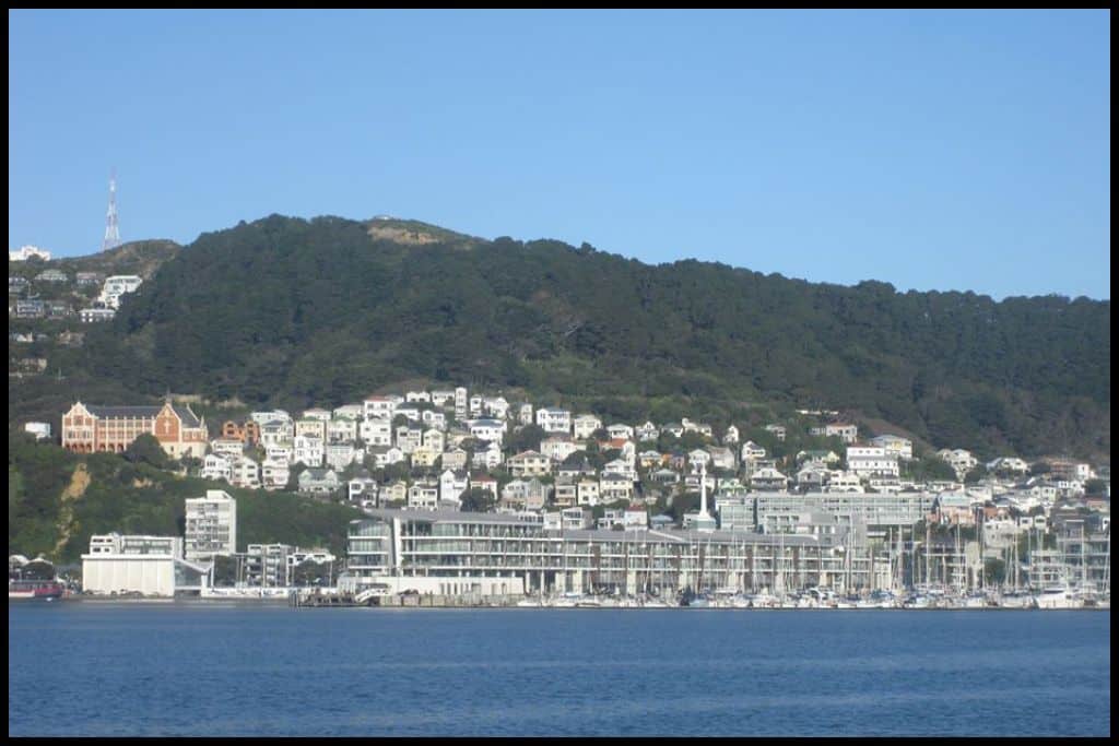
Immediate Surroundings: Petone Beach sits right up the top of the Wellington Harbour, at the mouth of the Hutt River. Somes Island sits in the middle of the harbour, three kilometres (1.8 miles) off shore. Beach Name: Petone translates to ‘end of the sand’. Getting There: Petone Beach has easy access from the Esplanade that runs its length.
Vehicle Parking: Parking along the esplanade at Petone Beach is free of charge. Walking Options: The Petone Esplanade Walkway is a good one – the whole thing will take you just under two hours and is 7.2 kilometres (4.4 miles) in full. Swimming: Petone Beach is shallow and sheltered and makes for good swimming.
Surfing: Petone Beach is too sheltered for any good surf to be had. Dogs: Dogs are not allowed on Petone Beach during peak times in summer but can be off lead in a specific area. They have more off-lead freedom in colder months.
Amenities: Petone Beach has a playground on the foreshore, a café, picnic areas, more places to eat, toilets, walkways and a miniature railway line that runs on Sundays.
Camping: Wellington Top 10 Holiday Park is only a few minutes drive from Petone Beach. Go, Because: Petone Beach is just a really scenic, safe beach with great views over the Wellington Harbour that locals love. Something Extra: Get some fishing done off the edge of the wharf. Last Updated: May, 2026.
Best Beaches on the Eastbourne Coastline
⛱️ Days Bay
General Location: Days Bay is located inside the Wellington Harbour at the bottom of New Zealand’s North Island. Nearest Civilisation: Days Bay is a 15 minute drive from the city centre of Lower Hutt, 10 kilometres or 6 miles away. Immediate Surroundings: Days Bay is situated between Rona Bay and Sunshine Bay, on the eastern side of Wellington Harbour.
Beach Name: Days Bay is the namesake of George Day, who settled in the area in 1840. Getting There: Days Bay can be accessed along Marine Drive, by vehicle, or even by ferry from the other side of the harbour – or Somes Island in the middle.
Vehicle Parking: Roadside parking for access to Days Bay is available along Marine Drive. Walking Options: Try the Kererū Track which starts at the park within Days Bay (Williams Park). It heads inland into the East Harbour Regional Park, climbing up to the ridge and down, and taking just over two hours. It’s only a kilometre long (half a mile) but steep. Swimming: Days Bay is a sheltered swimming beach.
Surfing: Days Bay is not a suitable surfing beach due to its harbourside location. Dogs: Dogs are welcome north of the wharf at Days Bay but need to be away from the other end during peak times in summer. Amenities: A park, toilets, playground, ferry terminal, a café and picnic areas are all available at Days Bay.
Camping: You can camp at East Harbour Regional Park, an extensive park behind Days Bay and the neighbouring bays’ shorelines. Go, Because: Days Bay is a great day trip over the harbour from Wellington CBD, a sheltered and safe swimming beach that is popular for good reason. Something Extra: Pop over to the nearby hirage facility to get your hands on a kayak or paddleboard to best explore Days Bay! Last Updated: May, 2026.
⛱️ Rona Bay Beach
General Location: Rona Bay Beach is located in Wellington Harbour at the base of New Zealand’s North Island. Nearest Civilisation: It’s a 20 minute drive (10 kilometres, or 6 miles) between Lower Hutt’s CBD and Rona Bay Beach.
Immediate Surroundings: Rona Bay Beach is one over from Days Bay on the eastern side of Wellington Harbour.
Beach Name: Rona Bay is named after the boat of an Italian man who immigrated here in the 1890’s. Getting There: Rona Bay Beach is accessed from Marine Parade – a separate one to the one on the other side of the harbour! You can also ferry to neighbouring Days Bay and walk over.
Vehicle Parking: Lots of vehicle parking is available at Rona Bay Beach. Walking Options: From Rona Bay Beach, head up the MacKenzie Road Track, another ascent up onto the ridgeline in East Harbour Regional Park. The walk is 4 kilometres, or 2.5 miles, and you should allow just. under two hours. Swimming: There is great swimming at the sheltered Rona Bay Beach.
Surfing: Rona Bay Beach is not a suitable surf beach. Dogs: Dogs can be off lead at the southern end of Rona Bay Beach but are prohibited from the other end where there are birds that need protecting. Amenities: Rona Bay Beach has a nearby pool (Eastbourne Pool) as well as an adjacent park with playground and picnic areas, nearby cafés, as well as toilets and a reserve.
Camping: There are places to camp in the East Harbour Regional Park behind Rona Ba Beach and the neighbouring bays. Go, Because: Like other Eastbourne beaches, Rona Bay Beach is calm, serene, scenic, and has off lead areas for dogs. Something Extra: Head out onto the Rona Bay wharf for a spot of fishing. Last Updated: May, 2026.
Best Beaches in the Wairarapa
⛱️ Castlepoint Beach
General Location: Castlepoint Beach is located on the southeastern edge of the North Island, in the Wairarapa area. Nearest Civilisation: The nearest place of any real significance to Castlepoint Beach is the town of Masterton, still an hour’s drive away (65 kilometres, or 40 miles).
Immediate Surroundings: Castlepoint Beach is part of the Castlepoint Scenic Reserve. It lies just above Castlepoint and the Castlepoint Lighthouse. Deliverance Cove is a clear water lagoon sheltered from the ocean by the natural curve of Castle Rock.
Beach Name: Castlepoint Beach was named for the tall rock face here that looked, to Captain James Cook at least, like the remains of a castle. Getting There: Castlepoint Beach is accessed from the end of Masterton Castlepoint Road. Vehicle Parking: There is abundant carparking at Castlepoint Beach.
Walking Options: The Deliverance Cove Track is an hour and a half’s walk and is 3.5 kilometres long (2 miles). You’ll ascend Castle Rock as part of this. Swimming: The reef at Castlepoint means the swimming is shallow and safe – and the lagoon an even safer and pleasant place for a swim. Surfing: Surf lessons are offered at Castlepoint Beach.
Dogs: Dogs need to be on a lead at Castlepoint Beach. Amenities: Toilets and a takeaways shop are available at Castlepoint Beach. Camping: Freedom camping in self contained campers is permitted in the Castlepoint carpark.
Go, Because: Castlepoint Beach is home to the Castlepoint Lighthouse, quite an impressive one with dramatic scenery behind it. And go for the lagoon, where there is extra-safe swimming. Something Extra: Spot seals on the rocks below Castle Rock! Last Updated: May, 2026.
⛱️ Riversdale Beach
General Location: Riversdale Beach is located on the southeastern coastline of New Zealand’s North Island, below Castlepoint. Nearest Civilisation: The town of Masterton is a 50 minute drive from Riversdale Beach (55 kilometres, or 35 miles).
Immediate Surroundings: Riversdale Beach opens out onto the Pacific Ocean. It is a long stretch of beach that runs between reefs – excellent snorkelling spots! At the southern end is Motuwairaka Stream Estuary and lots of birdlife.
Beach Name: The Maori name for Riversdale Beach is Motu-a-kairangi and translates to ‘where the sky eats the land’. Getting There: Riversdale Beach is accessed from the end of Riversdale Road as you come out from Masterton. Vehicle Parking: A carpark is available at Riversdale Beach.
Walking Options: Walk the Riversdale Beach Southern Reserve Loop, a 3.2 kilometre loop (2 miles) that you won’t need more than an hour to complete.
Swimming: Swimming is good at Riversdale Beach – but there are lots of dangers, so swim when the lifeguards patrol, in peak season. Surfing: There is good surf at Riversdale Beach. Dogs: Dogs only have to be on lead during summer months at Riversdale Beach – and kept away from the birdlife. Amenities: Public toilets, a shop and a playground are all available at Riversdale Beach.
Camping: Keen campers can stay at Riversdale Beach Holiday Park. Go, Because: Riversdale Beach is a great all rounder – people love to swim here, fish here, and snorkel here, too.
Something Extra: Fish and birds are the highlights here! Head down to the southern reserve to see some of our rare coastal birds, or take to the reef with a snorkel and see what you can spot! Last Updated: May, 2026.
⛱️ White Rock Beach
General Location: White Rock Beach is down in the very south eastern corner of New Zealand’s North Island – just above the southernmost point. Nearest Civilisation: The wine village of Martinborough is the closest place of any real significance to White Rock Beach and is an hour and a quarter’s drive away, 57 kilometres, or 35 miles away.
Immediate Surroundings: White Rock Beach is part of Dolphin Bay – yes, named for dolphin sightings! The Opouawe River flows out to the sea here and the entire coastal stretch is known as the White Rock Coast.
Beach Name: White Rock Beach is named for the big white limestone rock that juts out of the sand here, where the water meets the shore. The Maori name for it is Te Hukakore and translates to ‘no foam’. The rock shelters the beach from foaming surf.
Getting There: White Rock Beach is accessed from the end of White Rock Road as you come out to the coast from Martinborough. It’s a rugged road and 4WD is strongly recommended. Vehicle Parking: Vehicles just park on the grass at White Rock Beach.
Walking Options: When you get to White Rock Beach, ensure you walk on down to White Rock, halfway down the beach and 20 metres high. Swimming: White Rock Beach is too dangerous to swim at. Surfing: Surfing at White Rock Beach is best suited to intermediate and advanced surfers.
Dogs: Dogs are prohibited at White Rock Beach. Amenities: One toilet is available at White Rock Beach – toilet paper not guaranteed! Camping: Freedom camping is permitted at White Rock Beach, on Ngapotiki Road.
Go, Because: White Rock Beach’s namesake is the steep white rock that juts up from the black sand – quite a pretty sight, and climbable too, if you are careful. Something Extra: Keep an eye out for dolphins and seals – seals more likely! Last Updated: May, 2026.
⛱️ Cape Palliser Seal Colony Beach / Kirikiri Bay
General Location: Kirikiri Bay / Cape Palliser Seal Colony Beach is located at the southernmost corner, the southeastern tip of New Zealand’s North Island – Cape Palliser. Nearest Civilisation: The wine village of Martinborough is the closest place of any significance to Kirikiri Bay / Cape Palliser Seal Colony Beach – but still an hour’s drive away – 69 kilometres, or 43 miles.
Immediate Surroundings: Kirikiri Bay / Cape Palliser Seal Colony Beach is located inside Palliser Bay and adjacent to Cape Palliser and the Cape Palliser Lighthouse.
Beach Name: Kirikiri Bay is also the name of a bay in Northland, and there’s another in Auckland. That’s because Kirikiri translates to ‘gravel’ or ‘sand’. In 1827 it was named ‘Useless Bay’ by a French explorer. The rough sea had made trying to get ashore useless.
Getting There: Kirikiri Bay / Cape Palliser Seal Colony Beach is accessed from Cape Palliser Road as you head there out of Martinborough. Vehicle Parking: Vehicle parking is available at Cape Palliser Lighthouse.
Walking Options: Walk over to the Cape Palliser Lighthouse – an 800 metre stroll. Swimming: Swimming at Kirikiri Bay / Cape Palliser Beach will subject you to dangerous currents and should not be undertaken. Surfing: There are fantastic surf breaks at Kirikiri Bay / Cape Palliser Seal Colony Beach.
Dogs: Dogs need to be on a lead at Kirikiri Bay / Cape Palliser Seal Colony Beach to protect the wildlife. Amenities: The nearest amenities are the bathrooms at the Cape Palliser Lighthouse, not far from Kirikiri Bay / Cape Palliser Seal Colony Beach. Camping: The nearest campsite is Waimeha Camping Village – a 20 minute drive from the seal colony.
Go, Because: At Kirikiri Bay / Cape Palliser Seal Colony Beach you’ll find one of the largest seal colonies in the country, certainly the largest colony of our native seals in the entire North Island – as well as the beautiful, iconic old lighthouse – a great photography spot, indeed.
Something Extra: Don’t neglect to climb the stairs up to the Cape Palliser Lighthouse and later, visit the seal colony, too! Last Updated: May, 2026.
⛱️ Ocean Beach
General Location: Ocean Beach is located in the big, half-circle shaped Palliser Bay at the base of New Zealand’s North Island, one over from Wellington Harbour. Nearest Civilisation: If you descend south toward Ocean Beach on the western side of Lake Wairarapa, you’ll leave the main highway at Featherston, which is a 40 minute drive from Ocean Beach still (42 kilometres, or 26 miles).
Immediate Surroundings: Wairarapa’s Ocean Beach is located within Palliser Bay and shares the space with the Wharepapa River mouth, the Kiriwai Lagoon, and Lake Onoke. Beach Name: Ocean Beach is quite distinct from other Ocean Beaches – notably, the one in Southland (Bluff), the one in Hawkes Bay (Napier) and the one in Northland (Whangarei).
Getting There: Western Lake Road leads down from State Highway 2 toward Ocean Beach and the southernmost end of the North Island. You’ll need a 4WD to clear Western Lake Road as it gets more rugged.
Vehicle Parking: Parking is available at the end of Western Lake Road. Walking Options: How could I not mention the Tora Walk? It’s a multi-day hike – a three day, farmland hike, which showcases the best scenery (and wine!) of the region. Swimming: It is too dangerous to swim at Ocean Beach.
Surfing: Advanced surfers will enjoy catching a break at Ocean Beach – and in most of the Wairarapa! Dogs: Dogs need to be on lead at Ocean Beach to protect the penguins that live there. Amenities: Toilets are available at Ocean Beach.
Camping: Campers can stay at nearby Corner Creek. Go, Because: Ocean Beach is a rugged and remote spot, very scenic, with dramatic landscapes. Something Extra: You need to see the Putangirua Pinnacles while here! They are also located in Palliser Bay. Last Updated: May, 2026.
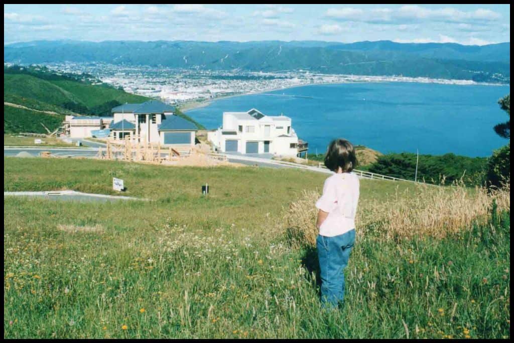
Whether you’re chasing surf, seals, sheltered swimming spots, or dramatic coastal scenery, Wellington has a beach for you. It’s a region where you can go from city waterfront strolls to remote, windswept coastlines in no time — exactly what makes it so special.