Where Are The Best Beaches In Canterbury, New Zealand?

Christchurch has a surprisingly diverse coastline — think long, open surf beaches, in North Canterbury, and all the quiet, sheltered bays tucked around Banks Peninsula. It doesn’t matter whether you’re after an easily accessed city beach, a family-friendly spot, or somewhere a little more scenic and tucked away, Canterbury is rich in choices. Here are the best!
Best Beaches in North Canterbury
Just north of Christchurch city is the Hurunui district, which has three pretty amazing beach destinations all of its own:
⛱ Waikuku Beach
General Location: Waikuku Beach is tucked into Pegasus Bay immediately north of th Canterbury Bight on the South Island’s East Coast. Nearest Civilisation: The settlement of Waikuku Beach is extremely close, but the next hub of any significant size would be the town of Rangiora, 11 minutes drive inland (11 kilometres, or 7 miles).
Immediate Surroundings: Waikuku Beach is at the mouth of the Ashley/Rakahuri River, with Ashley/Rakahuri Estuary behind the shoreline. It is part of the wider Pegasus Bay coastline, and Tuhaitara Coastal Park (which runs the coast from Waikuku Beach, down to Woodend Beach, and beyond, to The Pines Beach).
Beach Name: Waikuku translates to “waters of freshwater mussels”. These would have been in abundance in the river mouth in the past but are nearly extinct now. Rakahuri translates to “turning and entangled” and describes the winding river. Getting There: Waikuku Beach is accessed just off State Highway 1 as it runs the east coast. You need to cross the dunes after parking to access the beach.
Vehicle Parking: There is vehicle parking at the Waikuku Beach Surf Lifesaving Club. Walking Options: Loop the Ashley/Rakahuri Estuary behind Waikuku Beach – a 7 kilometre loop (4.3 miles) that will take you up to two hours. It’s a river bank and pine forest walk, with lots of birdlife to see. Swimming: Swimming is good at Waikuku Beach! Lifeguards patrol during peak season.
Surfing: Surfing is good at Waikuku Beach, too! Dogs: Dogs can be off lead on the southern end of Waikuku Beach, away from the estuary, but need to be on lead on the estuary half of the beach. Amenities: Toilets are available at Waikuku Beach.
Camping: Campers can stay at Waikuku Beach Holiday Park nearby. Go, Because: Waikuku Beach is a safe, patrolled beach, with great surf for swimmers and surfers alike. Something Extra: There’s a lavender farm on Waikuku Beach Road; definitely pay a visit if you are there in season. Last Updated: May, 2026.
⛱ Woodend Beach
General Location: Woodend Beach is tucked into the coastline immediately north of the Canterbury Bight on the South Island’s East Coast. Nearest Civilisation: Despite being just 12 minutes drive from the town of Rangiora, Woodend Beach is closer to the town of Kaiapoi, which is 9 minutes drive south – 8 kilometres, or 5 miles.
Immediate Surroundings: Woodend Beach is along the stretch referred to as Tuhaitara Coastal Park – it runs north to Waikuku Beach and south to The Pines Beach, as well. Woodend Beach is part of Pegasus Bay, like the other two.
Beach Name: Woodend Beach is named for Thomas Woodend, a settler in the area in the 1850’s, although it is also true that the woods ‘end’ at Woodend Beach – like the other two, its backed by amazing pine forest – Woodend Beach Pine Forest. Getting There: Woodend Beach is easily accessed from the end of Woodend Beach Road, which comes off the main highway.
Vehicle Parking: There is a decent carpark at Woodend Beach. Walking Options: Your walking recommendation is the Tūtaepatu Trail. It links the beaches of Waikuku, Woodend and The Pines – so you can go in either direction. It’s 5 kilometres (3 miles) up to Waikuku Beach, and the same back again, which will take you three hours total.
Swimming: Swimming is good at Woodend Beach – and for boogie boarding, too! Lifeguards patrol in peak season. Surfing: Woodend Beach is a great surfing beach.
Dogs: Dogs are welcome on Woodend Beach as long as they are under control. Amenities: Woodend Beach Domain has good amenities – a great playground, toilets and a shower. Camping: Campers can stay at nearby Woodend Beach Holiday Park.
Go, Because: Woodend Beach is another great family friendly beach with enough surf to keep surfers entertained, too. Something Extra: From Woodend Beach you can cycle up to Kaiapoi on the Pegasus Trail – well worth doing, with amazing pine forest and river bank scenery. Last Updated: May, 2026.
⛱ The Pines Beach
General Location: The Pines Beach is immediately north of Christchurch city and the Canterbury Bight, on the South Island’s East Coast. Nearest Civilisation: By road (NB: on foot you take the longer river route), The Pines Beach is just 4 minutes drive from Kaiapoi, which is 4 kilometres (or 2.5 miles).
Immediate Surroundings: The Pines Beach sits within Pegasus Bay. It’s just up from the Waimakariri river mouth, the Brooklands Spit, and the Brooklands Lagoon behind the spit, parallel to the coastline. It’s part of the Tuhaitara Coastal Park which runs north to Waikuku Beach at the other end of Pegasus Bay.
Beach Name: The Pines Beach is named for the adjacent pine forest. Pine Beach is a separate beach in the Far North of New Zealand, and not to be confused. Getting There: The Pines Beach is easily accessed from Kaiapoi township, along Beach Road, until the end. The carpark is right before the sand starts. Vehicle Parking: There is a carpark at the beach end of Beach Road for access to The Pines Beach.
Walking Options: Walk over to the township of Kaiapoi from The Pines Beach – an 11 kilometre loop (7 miles), which will take you up the Waimakariri River and back and be just under three hours. Swimming: Unlike Woodend and Waikuku Beaches, The Pines Beach is not patrolled. It is near the Waimakariri river mouth and therefore the water quality is variable and should be avoided for up to two days after rain.
Surfing: Surfing is good at The Pines Beach. Dogs: Dogs can be off lead at The Pines Beach! It’s a wonderful spot to take them. Amenities: Toilets are available at The Pines Beach, and there is a playground, too.
Camping: Freedom camping for those who are self contained is generally okay in Pegasus Bay (with the exception of areas of Waikuku Beach). Go, Because: Back from The Pines shoreline are more of these wonderful pine trees, so the environment is very pretty and it’s not a long drive from Christchurch city, either.
Something Extra: Go explore nearby Brooklands Lagoon at the Waimakariri river mouth – there’s abundant birdlife and peaceful kayaking opportunities. Last Updated: May, 2026.
Best Beaches in Christchurch
⛱ New Brighton Beach
General Location: New Brighton Beach is contained within the city of Christchurch, halfway down the east coast of New Zealand’s South Island. Nearest Civilisation: New Brighton Beach within the city bounds of Christchurch, just 10 kilometres (6 miles) from the city centre – an 18 minute drive.
Immediate Surroundings: New Brighton Beach is long and straight, and runs down to Southshore Spit, at the South New Brighton Beach end. Beach Name: Maori referred to the area as Te Karoro Karoro, translating to “the chatter of the seagulls”. New Brighton Beach is thought to have gotten its name from England’s Brighton, merely nicknamed at first, whereupon it stuck.
Getting There: New Brighton Beach access points are all along Marine Parade in the suburb of New Brighton. Vehicle Parking: There is abundant vehicle parking in several spots along New Brighton Beach.
Walking Options: The major walking option in the area is the Southern Pegasus Bay Route – a three and a half hour walk (15 kilometres, or 9 miles) all the way fro Southshore Spit, up South New Brighton Beach, up North New Brighton Beach, past the pier and up to Spencer Beach. Swimming: There is good swimming at New Brighton Beach! In summer, it is patrolled by lifeguards.
Surfing: New Brighton Beach is a good one for surfers of all levels. Dogs: Dogs can be off lead on New Brighton Beach but need to be away from the lifeguard patrol areas and on the pier during peak season. Amenities: New Brighton Beach is very suburban so has lots of amenities all close by – shops, eateries, the library, a waterfront restaurant, the splash park and hot pools!
Camping: South Brighton Holiday Park at the southern end of New Brighton Beach is the local campsite. Go, Because: New Brighton Beach is so easy to get to, has great surf, has a paddling pool for toddlers to play in, and a hot pool for adults to soak in with views over the shoreline.
Something Extra: Do walk the length of the pier (300 metres)! It’s the longest on the continent. Last Updated: May, 2026.
Best Beaches on Godley Head
Godley Head is not too far out of Christchurch city in the other direction, and very accessible for half day – or less – excursions. It’s known for its dramatic cliffs, brightly coloured water, wonderful walks – and wonderful beaches.
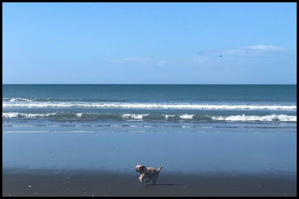
⛱ Sumner Beach
General Location: Sumner Beach is located in the southeast outskirts of Christchurch, halfway down New Zealand’s South Island. Nearest Civilisation: Sumner is a 23 minute drive from the city centre of Christchurch, 14 kilometres, or 9 miles.
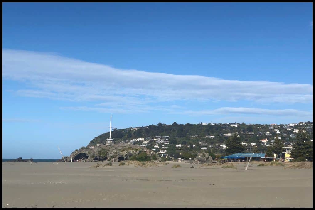
Immediate Surroundings: Sumner Beach is located across the Avon Heathcote Estuary entrance, opposite Southshore Spit (at the end of South New Brighton Beach). Shag Rock / Rapanui sits at the end of the beach, in the entrance to the estuary.
Beach Name: Sumner Beach was named after the Archbishop of Canterbury in the mid 1800’s, who was John Bird Sumner. Getting There: Sumner Beach can be accessed by public transport as well as by private vehicle. From the esplanade, it is an easy walk onto the sand.
Vehicle Parking: Several carparks are available at Sumner Beach. Walking Options: Walk the Sumner Promenade – a 20 minute stroll along the beachfront, just over a kilometre long (half a mile). Swimming: Swimming is great at Sumner Beach. Lifeguards patrol in peak season.
Surfing: Sumner Beach is a really good spot for beginner surfers to go to! Dogs: Dogs are permitted on Sumner Beach but need to stay clear of the surf patrol area and Cave Rock area during summer. Amenities: Cafés, toilets and a fabulous playground (Scarborough Park Playground) can all be found at Sumner Beach.
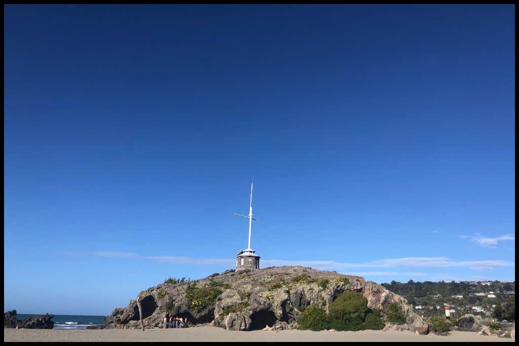
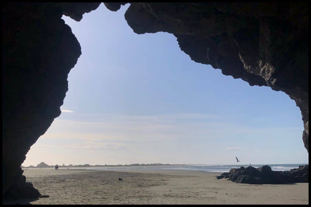
Camping: There are no campsites at Sumner Beach. Go, Because: Sumner Beach is home to Cave Rock, which is just a short little cave on the sand that you can walk through and explore at low tide, with a flagstaff on top.
Something Extra: Stroll down to the north end of Sumner Beach to take a look at Shag Rock. Last Updated: May, 2026.
⛱ Scarborough Beach
General Location: Scarborough Beach is located on the outskirts of Christchurch city, which is halfway down the South Island’s east coast. Nearest Civilisation: Christchurch city centre is a 22 minute drive from Scarborough Beach – 13 kilometres, or 8 miles.
Immediate Surroundings: Scarborough Beach is located just down the esplanade from Sumner Beach and is along the winding coastline that goes out to Godley Head.
Beach Name: Scarborough Beach’s namesake is England’s own Scarborough. Getting There: Scarborough Beach can be reached by public transport – or private vehicle – from Christchurch, and once there, there is no walk between the car parks and sand.
Vehicle Parking: Vehicle parking is available at Scarborough Beach.
Walking Options: The Scarborough Bluffs Track across to Taylor’s Mistake is a goodie! Swimming: Swimming is great at Scarborough Beach.
Surfing: Surfers can enjoy the breaks at Scarborough Beach. Dogs: Dogs are permitted off lead at Scarborough Beach, just not around the surf patrol area in summer. Amenities: A park and splashpad, as well as toilets, are available down the end of Scarborough Beach.
Camping: There is no campsite at Scarborough Beach. Go, Because: Scarborough Beach is a great surf beach and has the promenade that you can walk in this beautiful fringe suburb of Christchurch city.
Something Extra: Head up to Scarborough Farm Park if you have the time to spend! Last Updated: May, 2026.
⛱ Taylors Mistake Beach
General Location: Taylors Mistake Beach is on the South Island’s east coast, halfway down. Nearest Civilisation: Christchurch city centre is a half hour drive from Taylors Mistake Beach – 18 kilometres, or 11 miles.
Immediate Surroundings: Taylors Mistake Beach is located on Godley Head, immediately above Banks Peninsula.
Beach Name: Taylors Mistake Beach is named for an incident in 1858 when a captain by this name beached his ship here. Getting There: Taylors Mistake Beach is accessed from Taylors Mistake Road.
Vehicle Parking: There is vehicle parking at Taylor’s Mistake Beach.
Walking Options: If you have three hours, make the return trip to Godley Head (7 kilometres, or 4.3 miles). The track is the Taylors Mistake to Godley Head Track – and it’s beautiful! Swimming: Lifeguards patrol Taylors Mistake Beach in peak season so that you can swim safely!
Surfing: Taylors Mistake Beach is a great surf beach. Dogs: Dogs are restricted at Taylors Mistake Beach in summer. Amenities: Toilets are available at Taylors Mistake Beach.
Camping: There is no campsite at Taylors Mistake Beach but there is a Department of Conservation operated campsite up on Godley Head. Go, Because: Taylor’s Mistake Beach is one of Canterbury’s top surf spots, the scenery is epic, and there are some coastal tracks up on the cliffs providing wonderful views.
Something Extra: Go check out the remains of the defence battery up on Godley Head. It’s a relic from World War II! Last Updated: May, 2026.
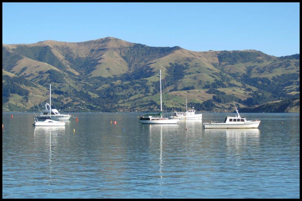
Best Beaches in Lyttelton Harbour
Lyttelton Harbour is tucked just far enough out of Christchurch to entice you to escape the city, but is also so readily accessible to locals and visitors alike. Consider visiting one of the below bays if you are looking for a beautiful spot to spend an afternoon:
⛱ Corsair Bay
General Location: Corsair Bay is located just above Banks Peninsula, halfway down the South Island’s east coast. Nearest Civilisation: The town of Lyttelton is a three minute drive from Corsair Bay, 4 kilometres, or 2.5 miles. Immediate Surroundings: Corsair Bay is tucked into the coastline of Lyttelton Harbour / Whakaraupō, which runs along the top of Banks Peninsula. Corsair Bay is little further within the inlet than Lyttelton Port itself.
Beach Name: Corsair Bay takes its name from the ship that wrecked here in 1861. In Maori, its name, Motu-kauati-iti, means ‘little fire-making tree grove’. Getting There: You can walk to Corsair Bay from Lyttelton within an hour, or drive there – or get there from Christchurch city, which is also very close by. From the carpark to the shoreline there is a steep path.
Vehicle Parking: Vehicle parking is available at Corsair Bay. Walking Options: The Corsair Bay Walk can be walked over to Cass Bay, or Magazine Bay, which is in the other direction. Going one way and returning the other, then returning to Corsair Bay in your initial direction is an hour and a half’s loop, 4 kilometres return, or 2.5 miles.
Swimming: Corsair Bay is sometimes good for swimming, with its calm water and swimming pontoon – but sometimes the water quality makes it unsafe for swimming, so check the council website before you go.
Surfing: There is no surf at Corsair Bay. Dogs: Dogs need to be a on a lead at Corsair Bay. Amenities: Toilets and a playground are available at Corsair Bay.
Camping: There is no campsite at Corsair Bay. Go, Because: Corsair Bay is small, sheltered and safe – a great spot for young families. Something Extra: Spot Quail Island from the shores of Corsair Bay! Last Updated: May, 2026.
⛱ Cass Bay
General Location: Cass Bay sits right above Banks Peninsula, which is halfway down the South Island’s east coast. Nearest Civilisation: Cass Bay is a five minute drive from the town of Lyttelton – 3 kilometres, or 1.8 miles, and not far from Christchurch city, either.
Immediate Surroundings: Cass Bay lies one over from Corsair Bay, a little further into the inlet that is Lyttelton Harbour. Beach Name: Cass Bay takes its name from Thomas Cass, who was a surveyor in the area in the mid 1800s. In Maori, its name, Motu-kauati-rahi, means ‘great fire-making tree grove’ (with Corsair Bay’s Maori name meaning ‘little fire-making tree grove’, by contrast).
Getting There: Cass Bay can be reached on foot from Lyttleton, or driven to from Lyttelton or Christchurch city – or public transport can be taken from Christchurch city. Vehicle Parking: Vehicle parking is available at Cass Bay.
Walking Options: Whether you are walking from Lyttelton, the port, Magazine Bay next to the port, or Corsair Bay one over from that – or just starting at Cass Bay, continue out to Pony Point, which is a fifteen minute ascent from Cass Bay (1 kilometre, or half a mile). Picnic areas and amazing views await you at the summit. Swimming: Swimming is very enjoyable in the sheltered waters of Cass Bay! Surfing: There is no surfing to be had at Cass Bay.
Dogs: Dogs need to be on lead at Cass Bay. Amenities: Toilets and a picnic area are available at Cass Bay.
Camping: There is no campsite at Cass Bay. Go, Because: Like Corsair Bay, Cass Bay is safe and family friendly, with a floating pontoon that can be swum out to and jumped off. Something Extra: The jetty at Cass Bay is perfect for watercraft – consider a kayak or paddleboard session when there, if you have the means. Last Updated: May, 2026.
Best Beaches on Banks Peninsula
There are around 50 bays on the Banks Peninsula alone! It’s a large area with endless choices of where you could spend a beach day. Here are the most loved ones!
⛱ Okains Bay
General Location: Okains Bay is located on Banks Peninsula – a perfectly round peninsula halfway down the east coast of New Zealand’s South Island. Nearest Civilisation: Okains Bay is an hour and a half’s drive from Christchurch city – the nearest civilisation of any significant size is the French settlement of Akaroa, 20 kilometres (12 miles) away, which is a 25 minute drive over the hills.
Immediate Surroundings: Okains Bay is one of the inlets that break into the circular coastline of Banks Peninsula. It faces out in a two-o-clock direction as you come around the peninsula. Opara Stream feeds the Okains Estuary/Lagoon before it flows into the sea here.
Beach Name: The Maori name for Okains Bay is Kawatea. Getting There: Okains Bay can be accessed in a day from Christchurch, Lyttelton, or Akaroa. The drive is predominantly along State Highway 75 (Christchurch to Akaroa). From there, it’s a fifteen minute descent by road from the Summit Road. You access the shore through the campground there.
Vehicle Parking: Parking is limited at Okains Bay – definitely recommend staying at the campground and parking there for a night. There is some vehicle parking for day-stayers, with the cave being quite close to the parking area.
Walking Options: Walk the twenty minutes over to Little Okains Bay (Little Okains Walk) – scenic, quiet, secluded, and with abundant birdlife. Swimming: Swimming is safe in the lagoon nearby.
Surfing: There is no surf at Okains Bay. Dogs: Dogs need to be on a lead at Okains Bay. Amenities: Public toilets are available at Okains Bay, with shower, toilet, playground facilities etc for those staying at the campground. There is a general store in the settlement of Okains Bay itself.
Camping: Campers can stay at Okains Bay Camping Ground. Go, Because: Okains Bay is a fantastic, scenic swimming spot, with a cave at the end of the beach to be explored, and (certainly in previous years) green lipped mussels which can be collected at low tide (collect only those under the surface!). There was a biotoxin present in the fish a few years ago at the time of writing so just check with locals or council guidelines at the time of your visit as to whether these can be consumed.
Something Extra: Not far away is the Okains Bay Maori and Colonial Museum – a tiny little museum with historical relics from the area. Pay a visit before you head back into civilisation! Last Updated: May, 2026.
⛱ Le Bons Bay
General Location: Le Bons Bay is part of the coastline running the perimeter of Banks Peninsula, which is halfway down the east coast of New Zealand’s South Island. Nearest Civilisation: Aside from Christchurch city, an hour and a half away by road, the nearest civilisation – of any significant size – would be the French settlement of Akaroa, a half hour drive away (20 kilometres, or 7.5 miles).
Immediate Surroundings: Le Bons Bay is located further around the coastline of the circular shaped Banks Peninsula than Okains Bay, facing outward in the three-o-clock direction. It’s part of Otepatotu Scenic Reserve.
Beach Name: Generally the understanding behind the name of Le Bons Bay is its French translation of ‘Good Bay’. The other possible origins of the name are from the whalebone collected by the French whalers who settled here in the early 1800s. Getting There: State Highway 75 leads you from Christchurch city out onto Banks Peninsula. From its end in the settlement of Akaroa, you take summit road and descend down into Le Bons Bay via Le Bons Bay Road.
Vehicle Parking: Vehicle parking is available at Le Bons Bay.
Walking Options: Take on the Otepatotu Scenic Reserve loop walk, which is an hour and a half. You’ll summit Lavericks Peak for amazing views. Swimming: Le Bons Bay is a great swimming beach.
Surfing: There is no surfing to be had at Le Bons Bay. Dogs: Dogs are welcome at Le Bons Bay but need to be on a lead. Amenities: Toilets are available at Le Bons Bay.
Camping: There is no campsite at Le Bons Bay. Go, Because: Le Bons Bay is a safe and quiet place for a swim, although quite isolated and lacking the facilities other beaches have.
Something Extra: Consider a luxury night at eco accommodation Lavericks Bay Retreat in the surrounding area! If your’e just here for the day, head into the Old Wharf Road Conservation Area for further walking options. Last Updated: May, 2026.
⛱ Tumbledown Bay
General Location: Tumbledown Bay is another narrow bay tucked into the coastline of the round-shaped Banks Peninsula, halfway down the South Island’s east coast. Nearest Civilisation: Although Christchurch city is only an hour and a quarter’s drive away, the nearest place of any significance is Little River – a settlement on Banks Peninsula. It’s commonly visited enroute to Akaroa, but you can turn off at Little River as Akaroa is further out on the peninsula than you need to go. Little River is 15 kilometres (10 miles) from Tumbledown Bay – a 25 minute drive.
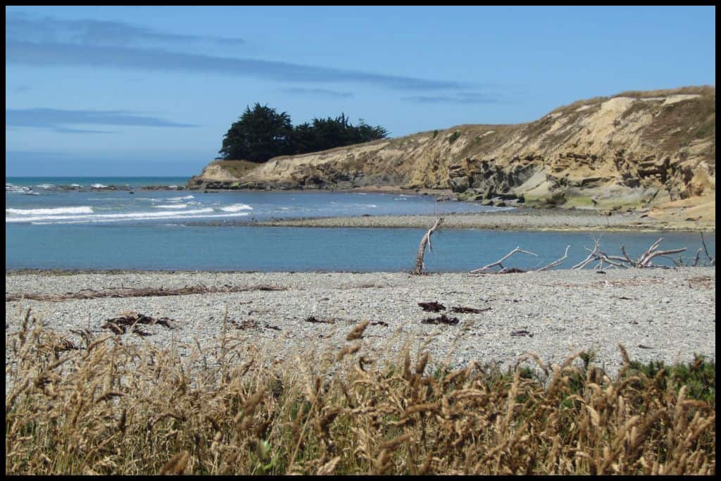
Immediate Surroundings: Tumbledown Bay is on the underside of Banks Peninsula, where it adjoins the mainland and the Canterbury Bight starts.
Beach Name: The Maori name for Tumbledown Bay is Te Kāio. Steep cliffs prone to slips earn Tumbledown Bay its name. Tumbledown Bay is also the name of a bay in the Marlborough Sounds – don’t confuse it! Getting There: A short track leads down the cliffs to the shoreline of Tumbledown Bay. Access is from Te Oka Bay Road, (named after the neighbouring bay).
Vehicle Parking: There is a grassy area off Te Oka Bay Road for parking before accessing Tumbledown Bay. Walking Options: The Tumbledown Te Oka Trail is a beautiful one! From Te Oka Reserve Track Start Point, it is 6 kilometres or 3.7 miles down to the bay (one-way). Allow an hour and a half to walk down.
Swimming: Tumbledown Bay is a much loved bay for swimming. You may even be sharing the water with the odd seal! Surfing: There is some good surf at Tumbledown Bay. Dogs: Dogs are banned from Tumbledown Bay to protect the wildlife there.
Amenities: There is one toilet at Tumbledown Bay. Camping: There is no campsite at Tumbledown Bay – the nearest is Little River Campground. Go, Because: Tumbledown Bay is a location where you can explore the caves and rocks, may find a seal or two, and even spot some of the little Hectors dolphins swimming by!
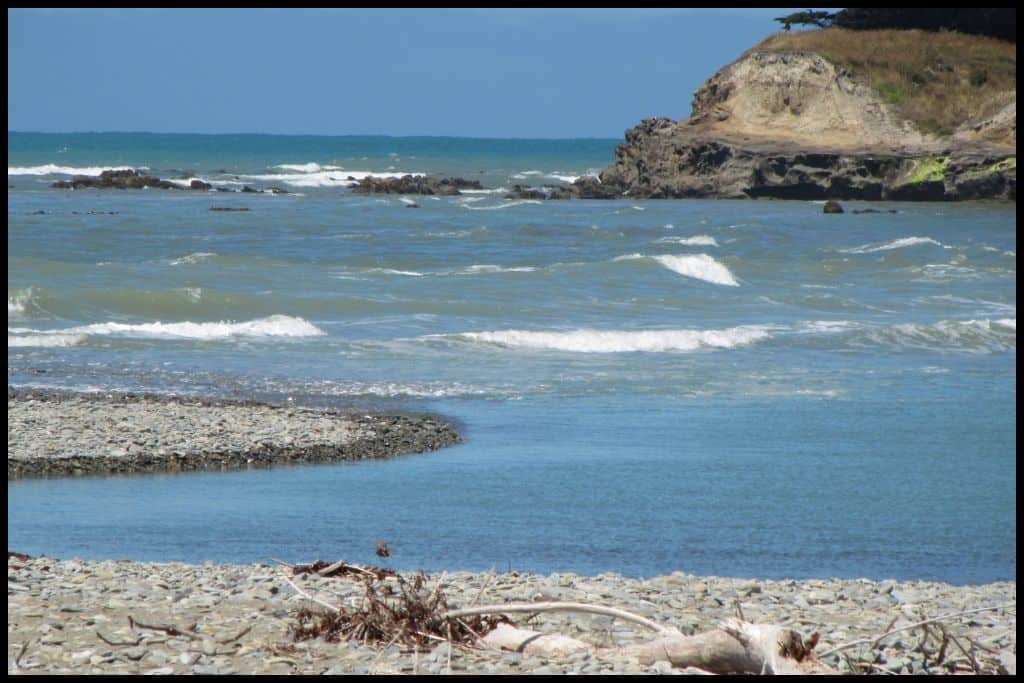
Something Extra: Te Oka Bay is similar but well worth visiting too! Head one bay over – by road or by foot – and enjoy the scenery! These beaches look amazing from above with their grassy farmland clifftops and striking turquoise waters. Last Updated: May, 2026.
Best Beaches in South Canterbury
South of Christchurch we have a long, rather uneventful stretch of coastline, and just before the border into the Otago region we have the town of Timaru, which has its own special spot.
⛱ Caroline Bay Beach
General Location: Caroline Bay Beach is located down in Timaru, down the South Canterbury coastline on the South Island’s east coast. Nearest Civilisation: Caroline Bay Beach is part of the town. of Timaru itself, just a couple of minutes from the town centre. Immediate Surroundings: Caroline Bay Beach sits adjacent to the Timaru Port and Timaru Breakwater, with the Timaru Lighthouse and Benvenue Cliffs at the other end.
Beach Name: It is generally assumed that Caroline Bay Beach takes its name from one the ships that spent lots of time here in the whaling era of the 1800s. The bay has also been known as ‘the riviera of the south’! Getting There: Caroline Bay Beach is easily accessed from Timaru’s town centre by following Caroline Bay signage. The beach is on the other side of the park.
Vehicle Parking: Abundant parking is available at Caroline Bay Beach. Walking Options: Stroll the loop around the Caroline Bay Park, or head down the boardwalk toward the cliffs – neither walk is long, and can be done in less than an hour. Swimming: Caroline Bay Beach is awesome for swimming, but there is a pool nearby (Caroline Bay Pool) with hydroslides, for those who don’t want to brave the cold!
Surfing: There is intermediate/advanced surfing opportunity at Caroline Bay Beach. Dogs: Dogs are banned from the Caroline Bay Beach tidal area between October and March to protect the penguin colony, but can be off lead in parts outside of those months.
Amenities: Caroline Bay has lots of amenities! There’s a park, playground, aviary, a miniature steam train ride, an obstacle course, a flying fox (zipline), a picnic area, skate park, paddling pool, bike park, indoor pool/leisure centre, Trevor Griffiths Rose Garden, Palliser Fountain, sports courts (tennis and basketball), barbecues, gym equipment, and a carnival during the Christmas/New Year period … in fact, this playground is one of the largest in the Southern Hemisphere!!
Camping: Timaru District Council allows paid self-contained camper parks at Caroline Bay Beach. There is also a Top 10 Holiday Park at Caroline Bay. Go, Because: Caroline Bay Beach was ranked 4th Most Popular Beach in the South Island in 2021!
Something Extra: Caroline Bay Beach is a spot you’ll want to visit at sunset in order to see the little blue penguin colony here! They’re best spotted from October until March. Also check out the Memorial Wall marking the sacrifices made in the world wars, the lighthouse, and whatever else you can squeeze into your time here – it is all offered in this precinct! Last Updated: May, 2026.
From the long surf beaches to the quiet peninsula bays and even the odd bit of wildlife – Canterbury’s stretch of coastline has more variety than one might expect. Allow me to encourage you to explore a bit of the coastline when you are next in this hugely diverse, all-rounder of a region!