Where Are The Best Beaches In Otago, New Zealand?
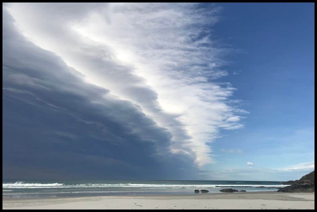
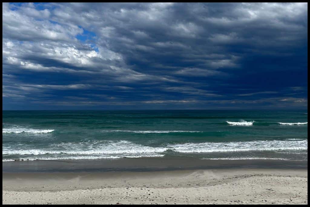
Otago’s coastline is wild and scenic, featuring stop-worthy geological formations, beaches with wildlife, pounding surf, and hidden bays. Whether you’re exploring north of Dunedin, around the Otago Peninsula, or further south, there’s a huge variety of spots to discover. Here are the best of them!
Best Beaches on the North Otago Coast
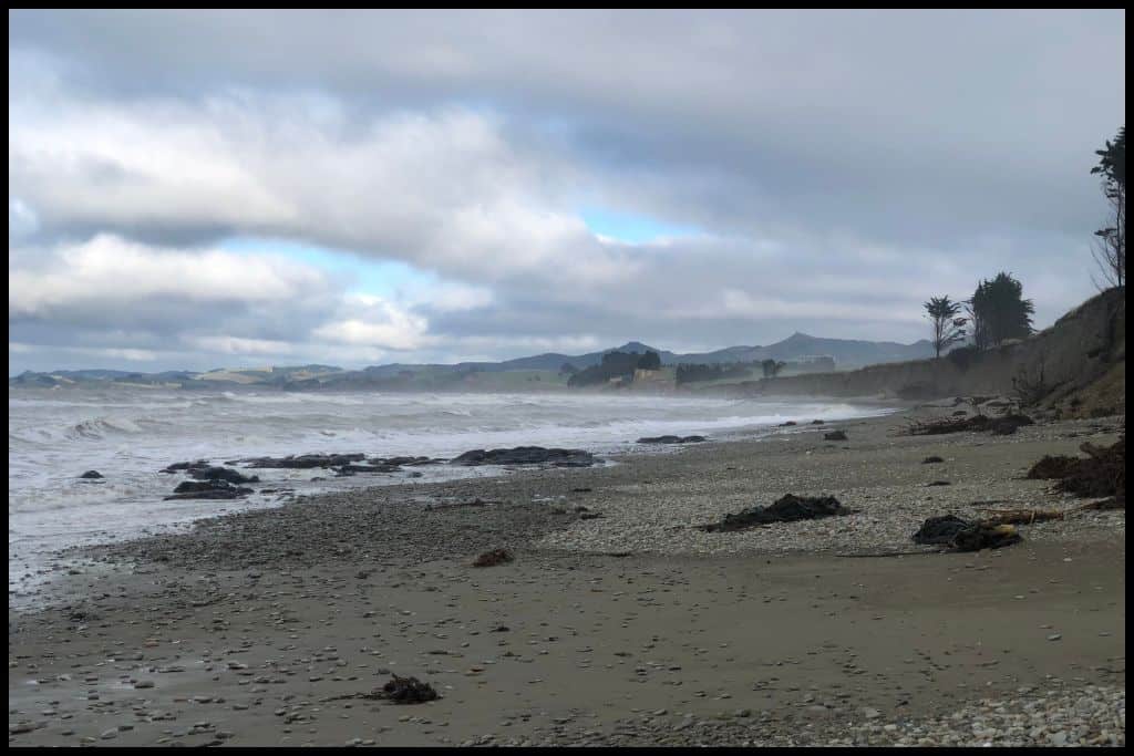
⛱ Koekohe Beach
General Location: Koekohe Beah sits on the eastern coastline of New Zealand’s South Island, below the Canterbury Bight, in the northern part of the Otago region. Nearest Civilisation: The small village of Moeraki is just a kilometre away from Koekohe Beach (0.6 miles) – or a couple of minutes by car.
Immediate Surroundings: Parts of Koekohe Beach are interchangeable with the Moeraki Boulders Scenic Reserve area. It sits just north of the Moeraki Peninsula and Katiki Point.
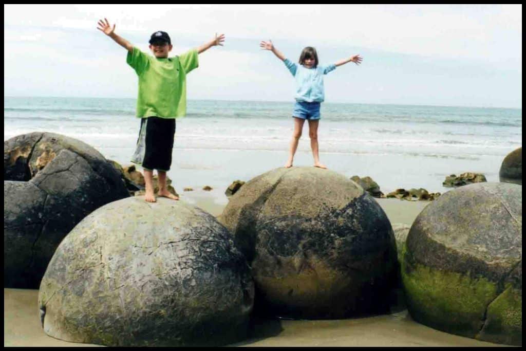
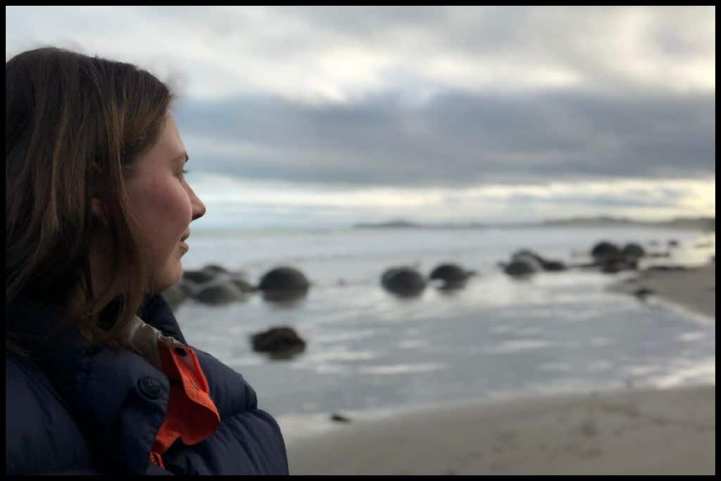
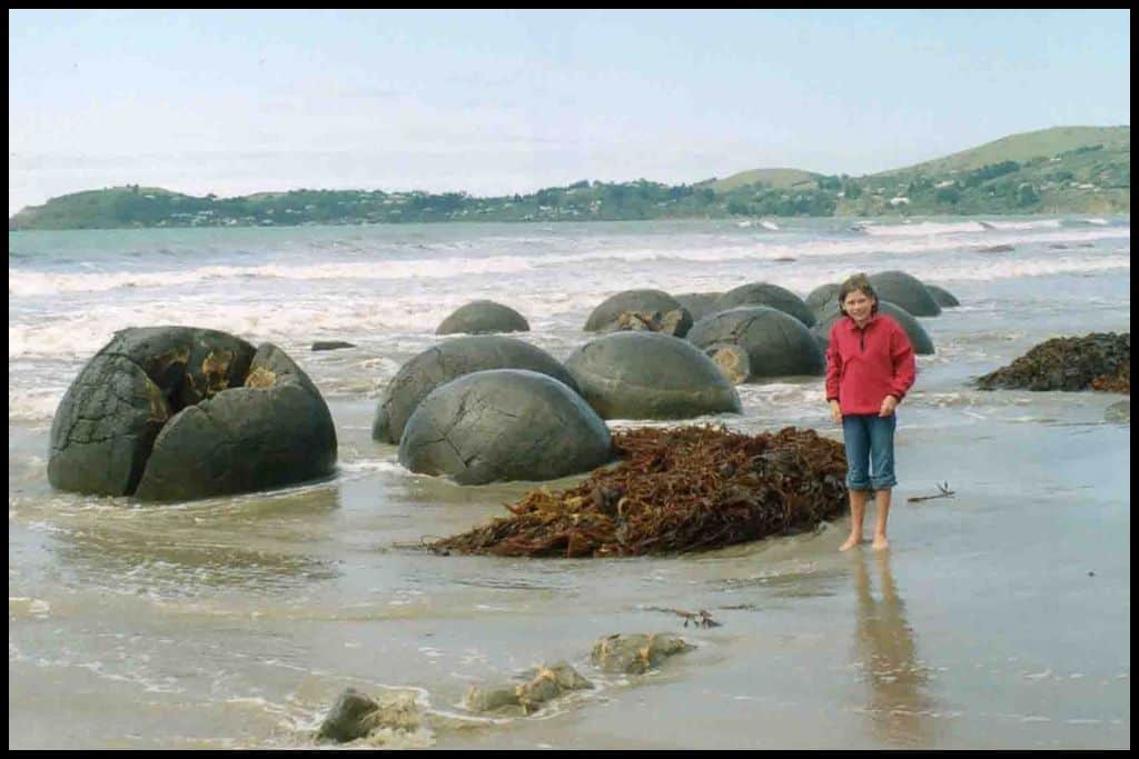
Beach Name: Koekohe Beach is sometimes referred to as Moeraki Boulders Beach because the boulders are what has made it famous – and the reason people go there. Getting There: Koekohe Beach is not far from the main highway so very accessible. Access to Moeraki Boulders is either via the Department of Conservation managed scenic reserve carpark – which is free – or through the Moeraki Boulders Café, which is paid access, but a shorter and more direct walk down to the boulders. The boulders are best seen at low tide as more of them are showing.
Vehicle Parking: There is vehicle parking at the Department of Conservation maintained carpark and also at the Moeraki Boulders Café, for patrons. Their direct access route to the boulders is available 7 days a week. In winter, they close at mid-afternoon, but in summer they run until 1700h.
Walking Options: There are two routes down to the Moeraki Boulders, as mentioned above. Those after a longer walk might like to consider the Moeraki Millennium Walk, which runs between the village and the boulders and is between half an hour and a full hour one-way (1.7 kilometres, or a mile, one-way). Swimming: There are better places to swim than Koekohe Beach, due to all the rocks and lack of a surf life guard patrol.
Surfing: There is a stretch of Koekohe Beach that is considered particularly good for surfing. Dogs: Dogs are okay at Koekohe Beach but need to be on a lead around the boulders. Amenities: There are public toilets and a café at Koekohe Beach, and a tavern and restaurant in the village.
Camping: Campers can stay at Moeraki Boulders Holiday Park nearby. Go, Because: Koekohe Beach is where to see the famous Moeraki Boulders, those spherical boulders scattered along the beach, all over sixty million years old! And the beach made the list of the Top 50 Beaches in the World, in 2019!
Something Extra: After your visit to the boulders, head on down to the Katiki Point Lighthouse, where lives a yellow eyed penguin colony. Spot them a couple of hours before the sun sets when they have returned from a day at sea – or early in the morning. Just remember to keep your distance as you observe these endangered birds. Last Updated: May, 2026.

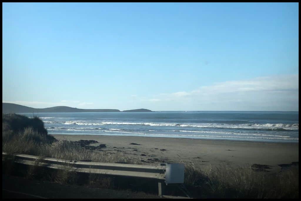
⛱ Waikouaiti Beach
General Location: Waikouaiti Beach sits on the southeastern corner of the South Island, in the stretch of coastline just north of the Otago Peninsula. Nearest Civilisation: The little village of Waikouaiti is adjacent to Waikouaiti Beach.
Immediate Surroundings: Waikouaiti Beach sits just between the Waikouaiti River Mouth (with Karitane Beach on the other side), and the entrance to the Hawksbury Lagoon (with Matanaka Beach on the other side of that). Beach Name: Waikouaiti Beach has a couple of possible translations but both tend to come back to the nearby Waikouaiti River. Getting There: Access to Waikouaiti Beach is via an easy turn off – off the main highway.
Vehicle Parking: Vehicle parking is available at Waikouaiti Beach – there is a small carpark. Walking Options: Those wanting to stretch the legs can complete the Waikouaiti Beach Walk, a 6.3 kilometre (4 mile) return trip up the length of the beach. Allow up to an hour and a half for this.
Swimming: Waikouaiti Beach is generally considered a safe swimming beach, but stick to swimming in-season, when it is patrolled. Surfing: Waikouaiti Beach is actually a good spot for beginner surfers! Dogs: Dogs are allowed off lead at Waikouaiti Beach, as long as they are under control. Amenities: Cafés and toilets are available at Waikouaiti Beach.
Camping: Waikouaiti Beach Motor Camp is the place to stay if you want to camp here. Go, Because: From Waikouaiti Beach, there’s a nearby lagoon with lots of birdlife, so its a great day out from Dunedin to see some local wildlife.
Something Extra: Definitely head down the beach to Hawksbury Lagoon Wildlife Refuge to see some native birdlife! The loop walk is an hour and a half long (6.3 kilometres, or 4 miles). Also consider heading over to Matanaka Historic Site on the other side of the lagoon – there are buildings still there from the mid 1800’s! Last Updated: May, 2026.
⛱ Karitane Beach
General Location: Karitane Beach is located on the North Otago coastline, below the Canterbury Bight on the eastern coast of New Zealand’s South Island, and above the Otago Peninsula. Nearest Civilisation: The nearest civilisation is the small coastal village of Karitane, the site of the beach itself. Immediate Surroundings: Karitane Beach is located at the base of the Karitane Peninsula – also named the Huriawa Peninsula.
Beach Name: There are mixed opinions on the meaning of Karitane, but the name of the peninsula, Huriawa, translates to ‘turning river’. Getting There: Karitane Beach is easily accessed from Coast Road just off the main highway. Vehicle Parking: Roadside parking is available at Karitane Beach.
Walking Options: Embark on the Huriawa Pā Walk, which is 2.5 kilometres (or 1.6 miles). The loop will take you three quarters of an hour to walk. You’ll learn historical tidbits along the way and see the old Waikouaiti Tavern and Whaling Station sites, and blow holes where the sea water rushes through, plus the remains of the Huriawa Pā, obviously.
Swimming: The swimming is good at Karitane Beach! It is often patrolled by lifeguards in peak season so it is a good idea to swim only if they are patrolling and have their flags out. Surfing: Karitane Beach is a fantastic beach for surfers. Dogs: Dogs are welcome at Karitane Beach but need to be on a lead.
Amenities: Toilets and a playground are available for use at Karitane Beach. Camping: Freedom camping for self contained campers is allowed in certain parts at Karitane Beach. Go, Because: Karitane Beach has some fantastic surf breaks.
Something Extra: Don’t miss a roadside pullover stop named Puketeraki Lookout for excellent views across Karitane Beach, the Huriawa Peninsula, and Waikouaiti Beach. Last Updated: May, 2026.
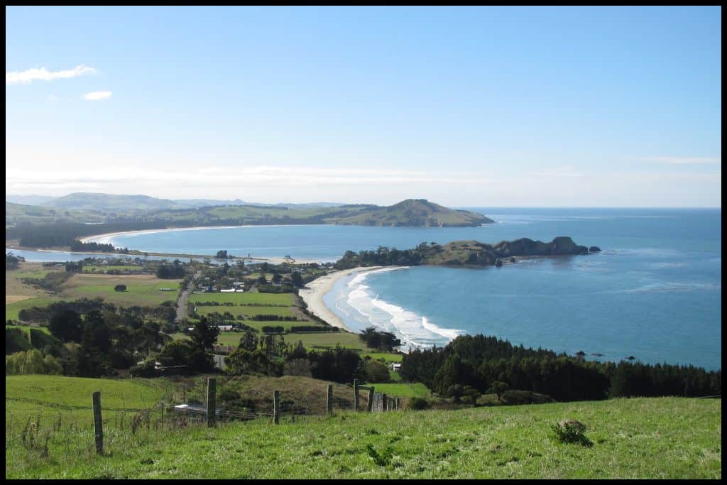
⛱ Blueskin Bay
General Location: Blueskin Bay sits immediately north of the Otago Harbour, on the southeastern coastline of New Zealand’s South Island. Nearest Civilisation: The small village of Waitati is located right on Blueskin Bay. Immediate Surroundings: Blueskin Bay is a largely enclosed bay, enclosed by Warrington Peninsula and Doctor’s Point on the other side. Inside the bay is a little island called Rabbit Island.
Beach Name: Blueskin Bay was named after a Maori chief who had so many tattoos that the European settlers referred to him as ‘Blueskin’. Getting There: The main highway skirts the edges of Blueskin Bay, with the best stopover point being Warrington Beach at the northern end of the bay. Vehicle Parking: At Warrington Beach, contained within Blueskin Bay, there is a large, free vehicle parking area.
Walking Options: Only recently opened, you can be one of the first (at the time of writing) to walk the first part of the Coastal Connection Trail – a trail that will connect up all of these little North Otago coastal settlements. The first section runs between Waitati and Orokonui EcoSanctuary – located just south of the bay. It includes a climb so will reward you with fantastic views down over Blueskin Bay. This section is 4.3 kilometres (2.5 miles) and you should allow a couple of hours.
Swimming: The best swimming in Blueskin Bay is to be had at Warrington Beach, where there is a lifeguard patrol on in summer. Surfing: Yes, there is surfable waves at the Warrington Beach part of Blueskin Bay. Dogs: Dogs are okay at Blueskin Bay if under control but need to have good recall as they pose a danger to wildlife on the Warrington Peninsula.
Amenities: Warrington Domain and Warrington Beach (the northern section of Blueskin Bay) offer a playground and toilets. Camping: Freedom camping is permitted in the Warrington Domain. Go, Because: You can collect your own cockles and clams from Blueskin Bay.
Something Extra: Head on out to Rabbit Island from the Warrington Beach end of the bay. Just remember to go at low tide – and keep an eye out for painted trees and estuary birdlife that you are bound to see! Last Updated: May, 2026.
⛱ Doctor’s Point Beach
General Location: Doctor’s Point Beach is located on the southeastern coastline of the South Island, immediately north of the entrance to Otago Harbour. Nearest Civilisation: The little coastal village of Waitati is the closest civilisation to Doctor’s Point Beach, just a three minute drive away (2 kilometres, or 1.25 miles).
Immediate Surroundings: Doctor’s Point is also, technically, located within Blueskin Bay. It faces out to Rabbit Island and the end of the Warrington Peninsula (or Warrington Spit).
Beach Name: Doctor’s Point Beach – and Doctor’s Point – is named for the group of doctors that purchased this section of land for holiday cottages as a getaway spot in the early 1900’s. Getting There: Doctor’s Point Beach is accessed via Doctor’s Point Road, which comes off the main highway at Waitati and crosses the Okoronui Lagoon. Vehicle Parking: Parking is available at the Doctor’s Point Reserve Carpark, providing easy access to the beach.
Walking Options: The main attraction of Doctor’s Point Beach are Taoka’s Arches and the sea caves, accessed via the Doctor’s point Trail. Allow half an hour for the return trip to the caves (800 metres), and time it for low tide – this is important if you want to walk through the sea arches. Swimming: Swimming is safe and calm at Doctor’s Point Beach.
Surfing: The water at Doctor’s Point Beach does not lend itself to surfing. Dogs: Dogs can be run off lead at Doctor’s Point Beach. Amenities: Toilet facilities are available at Doctor’s Point Reserve.
Camping: Camping is not permitted at Doctor’s Point Beach – head to Warrington Domain at the other end of Blueskin Bay instead. Go, Because: Taoka’s Arches are an example of some of the amazing geology found on the Otago coastline. And, if you walk through to the other side, you’ll find yourself at Canoe Beach!
Something Extra: Head back down the road toward Okoronui EcoSanctuary on your way out – for $26NZD you can walk the tracks and spot up to 20 different kinds of endangered, native birdlife, plus many, many types of native plants – and lizards and frogs, too. Last Updated: May, 2026.
⛱ Canoe / Mapoutahi Beach
General Location: Canoe Beach is located just north of Dunedin city, in the southeastern corner of New Zealand’s South Island. Nearest Civilisation: Canoe Beach is just 6.5 kilometres (4 miles) from Pūrākaunui village, but will take you thirteen minutes to drive because of the route you need to take.
Immediate Surroundings: Canoe Beach is situated right between Pūrākaunui Beach and Doctor’s Point Beach, with the Mapoutahi Headland at one end and Taoka’s Arches at the other. Beach Name: The Maori name for the beach, Mapoutahi, refers to a single, stand alone feature – in Canoe Beach’s case, the interesting rocks here. The European name, Canoe Beach, refers to the beach having been a landing spot in the past.
Getting There: You actually need to access Canoe Beach via Doctor’s Point Beach or Pūrākaunui Beach at low tide – through Taoka’s Arches or around the Mapoutahi Headland; they’re the only ways. Vehicle Parking: There is no parking at Canoe Beach – you need to walk around the coastline to get there.
Walking Options: Canoe Beach is just over a kilometre (half a mile) long – it’ll only take you a few minutes to walk the length of it. (See sections on Pūrākaunui Beach and Doctor’s Point Beach for other nearby walks). Swimming: The swimming is calm at Canoe Beach.
Surfing: There is no surf at Canoe Beach. Dogs: Dogs are not encouraged at Canoe Beach due to the wildlife they are protecting here, although council may shift its bylaws on this according to the season, so keep an eye on the council website. Amenities: There are no amenities at Canoe Beach.
Camping: There are no campsites at Canoe Beach. Go, Because: Canoe Beach is a small, hidden bay that many overlook – a bit of a hidden secret! Something Extra: Awesome rock pools are to be found at the bottom of the Mapoutahi Headland, so check these out before you head out again (and before the tide comes in again). Last Updated: May, 2026.
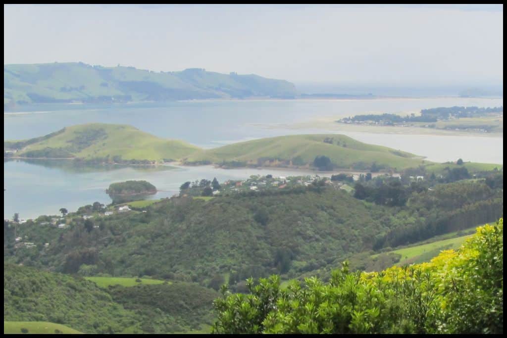
⛱ Pūrākaunui Beach
General Location: Pūrākaunui Beach is located on the Northern Otago coast in the southeastern corner of the South Island. Nearest Civilisation: The coastal village of Pūrākaunui is just a couple of minute away from the beach by car.
Immediate Surroundings: Pūrākaunui Beach is tucked into Pūrākaunui Bay, just north of the entrance into the Otago Harbour and right next to the Pūrākaunui Inlet, and across the inlet from Pūrākaunui Recreation Reserve. The reserve is also referred to as Mouats Bay, a small bay inside the inlet.
Beach Name: Pūrākaunui Beach is not to be mixed up with Purakaunui Bay, in the Catlins Coastal Area. They’re only two hours apart so sometimes they do get confused. Pūrākaunui Beach is Otago, and the Catlins are Southland.
Getting There: There is a fifteen minute walk involved to get the gravel carpark to Pūrākaunui Beach itself. You can also walk through from Canoe Beach at low tide. Vehicle Parking: There is a gravel parking area for those wanting to access Pūrākaunui Beach. It’s on the opposite side of the Pūrākaunui inlet to Pūrākaunui, the village.
Walking Options: Head on up the Mapoutahi Track to the remains of the Mapoutahi Pā for amazing views. It’s three quarters of an hour’s walk return (3 kilometres, or 1.8 miles). Swimming: The swimming is good at Pūrākaunui Beach – the water is really, really clear here.
Surfing: Pūrākaunui Beach is not a surfing spot. Dogs: Dogs need to be on leads at Pūrākaunui Beach. Amenities: In the Pūrākaunui Recreation Reserve there is a playground, toilets and picnic area, but you will not have access to anything once you drive to the other side of the Pūrākaunui inlet and park.
Camping: There are not any campsites at Pūrākaunui Beach specifically (do not confuse the Department of Conservation operated campsite at Purakaunui Bay in the Catlins Coastal Area, two hours to the south). Go, Because: Pūrākaunui Beach is a secluded, peaceful swimming spot, lesser visited than other beaches but still so close to the city!
Something Extra: Go and find the colourful and quirky little boat sheds lined up on the shores of the Pūrākaunui Inlet! Last Updated: May, 2026.
⛱ Aramoana Beach
General Location: Aramoana Beach is down in the southeastern corner of New Zealand’s South Island, immediately north of Dunedin city. Nearest Civilisation: The tiny settlement of Aramoana is right behind the beach. Immediate Surroundings: Aramoana Beach is located right at the entrance to the Otago Harbour, with Heyward Point Scenic Reserve at one end, and the Aramoana Spit at the other.
Beach Name: Aramoana translates to “pathway of the sea”, which is fitting given its location at the harbour’s mouth. Sometimes it is just called “The Spit” and the beach is referred to as “Big Beach”. Getting There: From Dunedin, you would head up toward Port Chalmers and past it, right to the mouth of the Otago Harbour. Vehicle Parking: There are two carparks you can use at Aramoana Beach.
Walking Options: Spare half an hour to walk the Aramoana Salt Marsh Track, which is a kilometre (half a mile) return boardwalk over the area’s salt marshes. Swimming: Swimming is not safe at Aramoana Beach. Surfing: Aramoana Beach is loved by surfers, suited to intermediate levelled surfers.
Dogs: Dogs are permitted on some areas of Aramoana Beach – south of Keyhole Rock, but not anywhere else, due to wildlife. Amenities: Toilets, a playground and a picnic area are available at Aramoana Beach. Camping: Freedom camping is permitted at Aramoana Reserve, right next to the beach.
Go, Because: This is a wildlife reserve and you might get to see some sea lions or a yellow eyed penguin! Sea lions are often seen from the spit and also from the breakwater, whereas the penguins nest on the beach.
Something Extra: Go and find Keyhole Rock partway down the beach, named for the large hole inside it. The hole acts as a heart shaped frame for those wanting to climb up and pose from inside it. It’s ten metres high (approximately) and best seen at low tide.
Last Updated: May, 2026.
⛱ Shelly Beach
General Location: Shelly Beach is at the mouth of the Otago Harbour, north of Dunedin city in the southeastern corner of the South Island. Nearest Civilisation: Shelly Beach is a minute’s drive from the village of Aramoana, just 500 metres.
Immediate Surroundings: Shelly Beach is tucked in between the Aramoana breakwater (“The Mole”) and the spit (“Aramoana Spit”) with all the beach to the west of this being referred to as simply “Big Beach”.
Beach Name: Shelly Beach is a common name for beaches in New Zealand – and an obvious one! Getting There: From Aramoana, head down to the breakwater (“The Mole”) to access Shelly Beach. Vehicle Parking: Muri Street, Moana Street and Mole Road converge next to Shelly Beach, where there is an area to park.
Walking Options: Head up the Heyward Point Track if you have a spare two hours and the necessary fitness for this clifftop track (5 kilometres, 3 miles). The views are quite the reward! In spring there is some restricted access due to lambing season so check the Department of Conservation website.
Swimming: Swimming is calm and safe at Shelly Beach – a good alternative to Aramoana Beach on the other side of the breakwater. Surfing: Surfing is no good at Shelly Beach. Head west to the “Big Beach” part of Aramoana. Dogs: Dogs are not permitted in the nearby salt marsh area at Shelly Beach or on the breakwater. Penguins and other native birdlife nest here.
Amenities: Toilets, a picnic area and a playground are available for use at the Aramoana Domain, right across the road from Shelly Beach. Camping: Freedom camping is permitted in the Aramoana Domain across the road.
Go, Because: A main attraction of a visit to Shelly Beach is the chance to walk the length of ‘The Mole’, which is the name for the breakwater that extends out to sea from the harbour side of Aramoana Beach. It’s over a kilometre long and extends out to keep the shipping channel clear for passing watercraft. From the end you’ll get some great views across to the Taiaroa Head – the end of the Otago Peninsula – and you might get to see some seals, and albatrosses, coming and going from the colony up at the Head.
Something Extra: Do go and have a look at the nearby Aramoana Memorial, a memorial to the victims of the 1990 gun violence siege. Last Updated: May, 2026.
Best Beaches in Dunedin
Who doesn’t love a city beach? Dunedin is blessed with two particularly great ones, with all the city side comforts not far away.
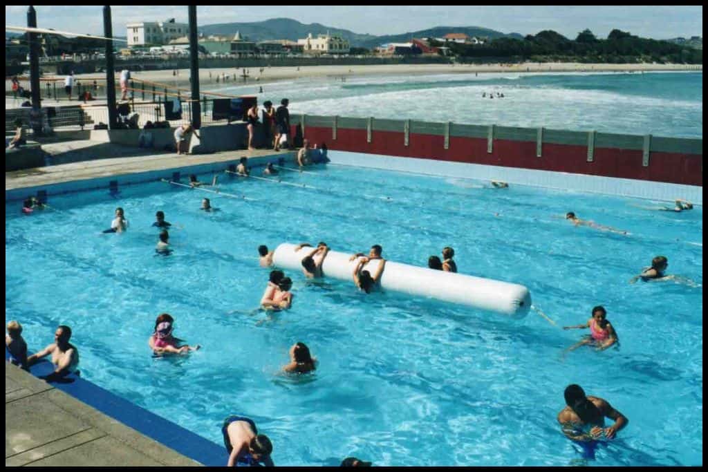
⛱ St Clair Beach
General Location: St Clair Beach is situated right at the base of the Otago Peninsula, on the southern facing side. Nearest Civilisation: The city centre of Dunedin is just a seven minute drive from St Clair Beach (4.3 kilometres, or 2.5 miles).
Immediate Surroundings: St Clair Beach is the western end of Ocean Beach (with the eastern end going by the name St Kilda Beach). It’s actually one stretch of coastline. Beach Name: St Clair Beach is named for the Chapel of Saint Clair – a location in Scotland. Getting There: Public transport is available to get to St Clair Beach, as it is very much a city beach, so is very accessible.
Vehicle Parking: Time restricted roadside parking is available near the foreshore of St Clair Beach. Walking Options: Walkers may like to continue past the saltwater pool at the end of St Clair Beach and around to Second Beach, where there is a pathway.
Swimming: St Clair Beach is great for swimming; lifeguards patrol in summer. St Clair is also famous for its saltwater pool at the end of the beach overlooking the sea; this is an awesome place to swim! Surfing: St Clair Beach is great for surfing, too. Dogs: At St Clair Beach, dogs need to be off the beach between 0800h-2000h (but are alright to be on the Esplanade).
Amenities: St Clair is one of Dunedin’s city suburbs, so all the amenities you could want are right there. There are public toilets and showers, a playground, and shops all the way up the Esplanade.
Camping: Being a city beach, there is no camping at St Clair Beach. Go, Because: There’s a saltwater pool just up from the shoreline of St Clair Beach and this is the perfect way to swim in warm water while still enjoying the views of the surf.
Something Extra: Wander on down to the Sir James Barnes Lookout for a viewpoint out across the sea. Last Updated: May, 2026.
⛱ St Kilda Beach
General Location: St Kilda Beach is located at the base of the Otago Peninsula, within the city boundaries of Dunedin. Nearest Civilisation: Dunedin’s city centre is just a fifteen minute drive from St Kilda Beach (5 kilometres, or 3 miles).
Immediate Surroundings: St Kilda Beach is the eastern end of Ocean Beach – the other half is St Clair Beach. Beach Name: Our St Kilda is actually named after Melbourne’s St Kilda. The Maori name for the beach is Whakahekerau.
Getting There: Access to St Kilda Beach is easy, and there is public transport if you don’t have a vehicle. Vehicle Parking: There is vehicle parking on John Wilson drive in the middle of the day, weekdays only (and pedestrian only the rest of the time) and there is roadside parking along the beachfront of St Kilda Beach.
Walking Options: If you have two hours and can handle 8 kilometres (5 miles) and an ascent, head up to Lawyers Head and back (a loop track) for fabulous views from above over St Kilda Beach. Swimming: In summer, St Kilda Beach is patrolled by lifeguards. It’s best to swim when they are on.
Surfing: St Kilda is a beloved surfing spot. Dogs: Dogs can be off lead at St Kilda Beach but summer time brings sea lions onto the beach and dogs need to be kept on lead around these. Amenities: Another city beach, St Kilda has all the amenities you could need. Cafés and shops, a playground and toilets are all nearby.
Camping: The location of St Kilda Beach in the city means there are no camping options here. Go, Because: St Kilda is a sea lion beach! Where else can you be just a few minutes from a city CBD and see sea lions on a city beach?! Keep an eye out – but keep a wide berth from them, also (20 metres).
Something Extra: Pop on up to the Sir Leonard Wright Lookout at the eastern end of St Kilda Beach. Last Updated: May, 2026.
Best Beaches on the Otago Peninsula
The Otago Peninsula is full of lots of little beaches and bays so it’s hard to pick the best – but these next eight would probably be the pick of the bunch.
⛱ Macandrew / Te Rotopāteke Bay
General Location: Macandrew Bay is on the outskirts of Dunedin city, in the southeast corner of New Zealand’s South Island. Nearest Civilisation: Macandrew Bay is a fifteen minute drive from Dunedin’s city centre, 10 kilometres, or 6 miles out. Immediate Surroundings: Macandrew Bay is tucked into the Otago Peninsula, on the harbour side.
Beach Name: Macandrew Bay is named for James Macandrew, Superintendent in the province back in the 1800’s. Te Rotopāteke translates to “bay of the brown duck”. Getting There: Macandrew Bay is accessed by Portobello Road as you leave Dunedin city and head out onto the Otago Peninsula.
Vehicle Parking: Vehicle parking is available in front of the playground at Macandrew Bay. Walking Options: If you’ve a spare hour, head up the Greenacres Track (3 kilometres, or 1.8 miles return) for views over Macandrew Bay and the Otago Harbour from above. Swimming: Swimming is safe and calm at Macandrew Bay.
Surfing: There is no surf at Macandrew Bay due to its position on the harbour side of the peninsula. Dogs: Dogs are not permitted at Macandrew Bay.
Amenities: Toilets and a playground are available at Macandrew Bay.
Camping: Freedom camping is allowed at Macandrew Bay if you are self contained. Go, Because: Macandrew Bay is on the sheltered side of the Otago Peninsula, making it very safe, shallow, and great for young ones.
Something Extra: Jump on the Otago Harbour Cycleway – it runs the length of Macandrew Bay. Last Updated: May, 2026.
⛱ Broad Bay
General Location: Broad Bay is situated down on the Otago Peninsula in the southeastern corner of the South Island. Nearest Civilisation: Dunedin city is a 20 minute drive from Broad Bay, 15 kilometres, or 9 miles. Immediate Surroundings: Broad Bay is contained within the Otago Harbour, opposite Port Chalmers.
Beach Name: Broad Bay is named for its length and open span. Getting There: Access to Broad Bay is via the coastal road, Portobello Road. Vehicle Parking: There is some vehicle parking available near Broad Bay Beach Reserve.
Walking Options: A popular side trip is to take the Camp Road Track up from Broad Bay to Larnach Castle. Some do it in an hour, some do it in two: the track is 6 kilometres one way, or 3.8 miles, with ascents. Swimming: There is great swimming at Broad Bay.
Surfing: There is no surf at Broad Bay. Dogs: Dogs are banned from Broad Bay. Amenities: Toilets are available at Broad Bay Beach Reserve.
Camping: There are no campsites at Broad Bay. Go, Because: This little settlement along the peninsula offers a safe and sheltered paddling spot for families with small children. Something Extra: If you do up the track to Larnach Castle, consider spending some time at New Zealand’s only castle, gaining admission to explore the building interior and surrounding gardens. Last Updated: May, 2026.
⛱ Tomahawk Beach
General Location: Tomahawk Beach is directly south of Dunedin city in the southeastern corner of New Zealand’s South Island. Nearest Civilisation: Dunedin’s city centre is just a ten minute drive from Tomahawk Beach, 5 kilometres, or 3 miles. Immediate Surroundings: Tomahawk Beach is on the underside of the Otago Peninsula, just next door to Smails Beach. Behind Tomahawk Beach is the Tomahawk Lagoon.
Beach Name: It is understood that the name Tomahawk has come from a misspelling of a Maori phrase that translates to “place of bones”. Getting There: Tomahawk Beach is easily accessed off Tomahawk Road. Vehicle Parking: There is a carpark at Tomahawk Beach, from where beach access is just a short walk away over the sand.
Walking Options: An enjoyable walk close by is the 41-Peg Track by the lagoon – a 2.8 mile (1.7 mile) two hour walk.
Swimming: Swim cautiously, due to strong currents. Surfing: There is some good surfing to be had at Tomahawk Beach. Dogs: Dogs can be walked off lead at Tomahawk Beach.
Amenities: Tomahawk Beach does not have any toilets. Camping: Freedom camping is sometimes done at Tomahawk Beach but there are no toilet facilities so you need to be self contained. Go, Because: Tomahawk Beach is nice and close to Dunedin city, and you may just spot a sea lion or yellow eyed penguin!
Something Extra: Head on up the hill if you have an hour to the Soldier’s Monument to the soldiers of World War One. The views from the top are pretty amazing. Last Updated: May, 2026.
⛱ Smails Beach
General Location: Smails Beach is one of the beaches tucked into the base of the Otago Peninsula, in the southeastern corner of New Zealand’s South Island. Nearest Civilisation: Dunedin’s city centre is a twelve minute drive away from Smails Beach – 7.3 kilometres, or 4.5 miles. Immediate Surroundings: Smails Beach is on the underside of the Otago Peninsula, next door to Tomahawk Beach.
Beach Name: Smails Beach – also spelled “Smaills Beach” is named after the Smaills family, who were settled in the area in the 1800’s. Getting There: Smails Beach can be accessed via public transport if you factor in a twenty minute walk, or is easily reached by vehicle from Dunedin city. Vehicle Parking: A gravel carpark is available at Smails Beach, which is accessed off Tomahawk Road.
Walking Options: Nearby Smails Beach is the Karetai Track, which runs between the beach and Karetai Road. It’s 4 kilometres (2.5 miles) return and will take you an hour and a half. It’s a farmland walk up into the hills behind the beach and offers great views down to the sea.
Swimming: My friend and I really enjoyed swimming at Smails Beach in December 2021, although it can be quite cold! Surfing: There is some good surfing to be had at Smails Beach. Dogs: Dogs are permitted at Smails Beach, although on some parts of the beach they need to be on a lead.
Amenities: There are no facilities at Smails Beach. Camping: There is no designated campsite at Smails Beach. People do freedom camp there but it is not really allowed.
Go, Because: Smails Beach is close to Dunedin city, beautiful with its white sand and glittering surf, and pretty quiet, too! Something Extra: Spot Bird Island out in the surf, or a seal and/or sea lion, if you’re lucky! Last Updated: May, 2026.
⛱ Sandfly Bay
General Location: Sandfly Bay is on the Otago Peninsula in the southeastern corner of the South Island of New Zealand. Nearest Civilisation: The city centre of Dunedin is half an hour away, 15 kilometres (or 9 miles). Immediate Surroundings: Sandfly Bay sits on the underside of the Otago Peninsula, further along the peninsula from Tomahawk Beach and Smails Beach.
Beach Name: Sandfly Bay gets its name from the sand that flies off the huge sand dunes here. Getting There: The track down to Sandfly Bay (Sandfly Bay Track) will take you fifteen minutes each way and is just over 500 metres long. Vehicle Parking: Vehicle parking is available at Sandfly Bay.
Walking Options: A longer walking option is through the giant sand dunes at Sandfly Bay, which links Sandymount Recreation Reserve carpark (behind Sandfly Bay) with Sandfly Bay via those huge dunes. It’s 4.5 kilometres (2.7 miles) and will take an hour and a half.
Swimming: Sandfly Bay, like adjacent beaches, has strong currents, but moreover, the abundant wildlife (prey) seen at Sandfly Bay means that the waters are known to have great white sharks .. don’t swim! Surfing: If it wasn’t already obvious .. don’t surf – or do, at risk of becoming a snack. Dogs: Being a wildlife refuge, dogs are banned from Sandfly Bay.
Amenities: There are no toilets or other facilities at Sandfly Bay. Camping: Self contained campers are permitted at Sandfly Bay Wildlife Refuge Carpark. Go, Because: Sandfly Bay is backed by ginormous sand dunes – well worth a wander! It’s also a really good beach for seeing penguins and sea lions. You can’t visit in summer, as the native, endangered yellow eyed penguins nest on the beach.
Something Extra: Stop at the viewing platforms for a photo on your way down to the beach. Last Updated: May, 2026.
⛱ Allans Beach
General Location: Allans Beach is our next beach in this list that is on the underside of the Otago Peninsula, in the southeastern corner of the South Island. Nearest Civilisation: Allans Beach is a 35 minute drive from the city centre of Dunedin, 25 kilometres, or 15 miles.
Immediate Surroundings: Allans Beach is on the other side of Hoopers Inlet from the previously named beaches – further still along Otago Peninsula. Allans Beach Wildlife Reserve runs the length of most of the beach. It’s separated from Sandfly Bay by Sandymount Recreation Reserve – those giant sand dunes.
Beach Name: Allans Beach is named for one of the settlers in the history of this area. Getting There: Allans Beach Walking Track is a five minute walk leading down to the beach. Vehicle Parking: A small, gravel carpark is found at Allans Beach.
Walking Options: A three hour walking option from Allans Beach is to head up Mt Charles (named Poatiri in Maori), which is a steep climb up to the highpoint of the Otago Peninsula. You cross private farmland so need to ring the landowner, whose phone number appears upon a quick search, for permission to cross. Views from Mt Charles are unrivalled.
Swimming: There is no lifeguard patrol at Allans Beach but still good swimming to be had. As is the case of the neighbouring beaches, currents can be strong. Surfing: There is good surf at Allans Beach.
Dogs: Dogs are permitted on some parts of Allans Beach but need to be kept away from the wildlife – check local council information before you go, for specifics. Amenities: There are no facilities out at remote Allans Beach. Camping: There are no camping options at Allans Beach.
Go, Because: At sunset, Allans Beach is home to sea lions and yellow eyed penguins, and you’ll see them too, if you hang around! Other possible sightings include seals, orcas, dolphins and our little native blue penguins. Keep a good distance from all wildlife but do enjoy the variety to be found here!!
Something Extra: Enjoy rock pools at Allans Beach at low tide, yellow lupins on the cliffs during early summer, or go kayaking in Hoopers Inlet. Last Updated: May, 2026.
⛱ Victory Beach
General Location: Victory Beach is eastern facing near the end of the Otago Peninsula in the southeastern corner of New Zealand’s South Island. Nearest Civilisation: Dunedin’s city centre is a 35 minute drive from Victory Beach – 25 kilometres, or 15 miles.
Immediate Surroundings: Victory Beach is positioned at the end of the Ōkia Flat / Ōkia Reserve and is home to some pyramids formed by volcanic activity millions of years ago. It’s tucked into Wickliffe Bay towards the end of the Otago Peninsula. At one end is Papanui Inlet.
Beach Name: Victory Beach is named for the shipwreck of SS Victory that ran aground in 1861. Wreckage is still visible from the beach! Getting There: It’s three quarters of an hour’s walk through the Ōkia Reserve down to Victory Beach – the direct route is 2 kilometres, or 1.2 miles, approximately. You’ll pass the pyramids on the way. Vehicle Parking: There is a carpark at Victory Beach.
Walking Options: The longer walk option at Victory Beach is to take the loop track after walking down the beach and re-entering the Ōkia Flat. You can also climb the Little Pyramid to lengthen your walk (also named Te Matai o Kia), and some people climb the bigger of the two pyramids, too. Give yourself a couple of hours for this loop.
Swimming: Strong currents make Victory Beach not the best spot for swimming. Surfing: There is good surf at Victory Beach. Dogs: Dogs are forbidden at Victory Beach.
Amenities: There are no facilities at Victory Beach. Camping: You cannot go camping at Victory Beach. Go, Because: There’s natural pyramids at Victory Beach – it’s worth going just to see these pyramid formations!
Something Extra: Collect cockles at low tide from Victory Beach, stay until sunset for penguin sightings, or later still (on a clear night) for incredible star gazing! Last Updated: May, 2026.
⛱ Pilots Beach / Takiharuru
General Location: Pilots Beach is at the tip of the Otago Peninsula, in the southeastern corner of the South Island. Nearest Civilisation: While, as the row flies, the nearest civilisation to Pilots Beach is Aramoana, across the harbour, Dunedin city is an hour’s drive (30 kilometres, or 18 miles).
Immediate Surroundings: Pilots Beach is right at the end of the peninsula, just before Taiaroa Head, the albatross colony. It’s a tiny beach on the harbour side of Harington Point – just across the harbour mouth from Aramoana – and very sheltered, because of the breakwater at Aramoana.
Beach Name: Takiharuru translates to reflect the roaring sound of the sea, and the European name, Pilots Beach, takes its name from the pilot station that operates in the 1860’s, housing ‘harbour pilots’ who would guide the ships safely in.
Getting There: The coastal road, Portobello Road, takes you from Dunedin, up the Otago Peninsula. Vehicle Parking: There is a little bit of free parking at Pilots Beach.
Walking Options: 100 metres across the peninsula is the Waiwhakaheke Seabird Lookout, where there is a 200 metre long loop pathway, a great spot to see the albatross colony – the only breeding colony of albatross on the mainland in the world.
Swimming: Swimming is safe and sheltered at Pilots Beach. Surfing: There is no surf at Pilots Beach. Dogs: Dogs are not allowed at Pilots Beach as it is home to a colony of our native Little Blue Penguins.
Amenities: A basic public toilet is available at Pilots Beach. Alternatively, visitors to the Royal Albatross Centre can use their facilities. Camping: No camping is permitted at Pilots Beach.
Go, Because: Pilots Beach is home to a little colony of little blue penguins (a slightly smaller variety of penguin than our yellow eyed penguins) – so this is a beach to visit at dusk for your chance to see them. It does close to the public at sunset, to ensure visitors pay for one of the penguin spotting tours that are operated by Blue Penguins Pukekura.
Something Extra: Do get on one of these penguin spotting tours for your chance to see all the penguins parade up the beach to their nests after a day fishing at sea. And do pay a visit to the Royal Albatross Centre whilst there. Last Updated: May, 2026.
Best Beaches South of Dunedin
Continue on down past the Otago Peninsula and you’ll encounter these next three beaches…
⛱ Blackhead Beach
General Location: Blackhead Beach is located south of Dunedin city, just on its outskirts, beyond St Kilda and St Clair. Nearest Civilisation: The city centre of Dunedin is a fifteen minute drive away, 10 kilometres, or 6 miles.
Immediate Surroundings: Blackhead Beach has the quarry and some interesting basalt columns at the eastern end. The headland is volcanic rock, dark basalt rock, formed ten million years ago! Tunnel Beach is not far up the coast.
Beach Name: The black basalt headland is the namesake of Blackhead Beach. There’s another Blackhead Beach in the North Island’s Hawkes Bay, but this one is quite distinct. Getting There: Access to Blackhead Beach is via Blackhead Road. A track leads down from the quarry to the shore.
Vehicle Parking: Vehicle parking for Blackhead Beach is just next to the quarry. Walking Options: Walk out to the famous hexagonally shaped basalt columns on the headland at the end of Blackhead Beach, but only go as far as you are confident doing so. People do go all the way around but pounding surf and slippery rock can make the trip quite perilous.
Swimming: Currents are strong, so swim with caution at Blackhead Beach. Surfing: There is good surf at Blackhead Beach. Dogs: Dogs can be off lead at Blackhead Beach.
Amenities: There are no amenities at Blackhead Beach specifically. Camping: Blackhead Beach does not have any campsites. Go, Because: The patterns in the basalt columns look similar to the Giant’s Causeway in Northern Ireland!
Something Extra: The geology up on the headland has also formed natural little pools you can swim in, called the Roman Baths; again, take all environmental factorsand confidence levels into consideration before you embark on this adventure. Last Updated: May, 2026.
⛱ Tunnel Beach
General Location: Tunnel Beach is located on the southern facing outskirts of Dunedin city, inland from the Otago Peninsula. Nearest Civilisation: Dunedin’s city centre is an eleven minute drive from Tunnel Beach – 7 kilometres, or 4.3 miles. Immediate Surroundings: Tunnel Beach is located between Blackhead and the suburbs of St Clair and St Kilda.
Beach Name: Tunnel Beach is named for the natural tunnel carved out by the sea. Not to be confused with Tunnel Beach in Marokopa or on the Coromandel Peninsula – or tunnel Point in the Waitakere Ranges. Getting There: Tunnel Beach is accessed from the end of Tunnel Beach Road – which is off Blackhead Road – the route to neighbouring Blackhead Beach. From the carpark, it’s an hour (return) on foot (2.6 kilometres, or 1.2 miles, return). Vehicle Parking: Vehicle parking is available at the end of Tunnel Beach Road.
Walking Options: The Tunnel Beach Walkway is the walk from the carpark to Tunnel Beach, via a tunnel that was dug by hand in the 1870’s. It’s a farmland track with a staircase leading down into this little, hidden cove. Swimming: Tunnel Beach is too dangerous for swimming. Surfing: Waves pounding the cliffs here make Tunnel Beach unsuitable for surfing, as well.
Dogs: Dogs are not permitted at Tunnel Beach. Amenities: Toilets are available at the Tunnel Beach carpark. Camping: There is no campsite at Tunnel Beach.
Go, Because: Access to the beach is through a secret tunnel and down a staircase – how cool! NB: However, access was closed a year ago (October 2024) and we are yet to see if Tunnel Beach will reopen in the near future. Something Extra: Have a look for fossils in the cliffs when down there – oh, and seals! Last Updated: May, 2026.
⛱ Brighton Beach
General Location: Brighton Beach is on the outskirts of Dunedin city, just east of Blackhead Beach. Nearest Civilisation: Brighton Beach and Dunedin’s city centre are a fifteen minute drive apart (14 kilometres, or 8.5 miles).
Immediate Surroundings: Brighton Beach is situated between Brighton Recreation Reserve and Ocean View Recreation Reserve, with Rock View Point at its southern end. Beach Name: Brighton Beach is the namesake of England’s Brighton Beach. Don’t confuse it for New Brighton Beach, in Christchurch! Getting There: Brighton Beach is accessed along Brighton Road, coming from the city. From the carpark, it is an easy stroll onto the beach.
Vehicle Parking: Vehicle parking is available at Brighton Beach. Walking Options: It is possible to walk from Brighton Bridge, which crosses the Kaikorai Estuary, to Brighton Beach – a fifteen minute walk through the estuary and sand dunes. Swimming: Brighton Beach is patrolled by lifeguards in peak season so is a good swimming beach.
Surfing: Brighton Beach is great for intermediate level surfers. Dogs: Dogs are banned from Brighton Beach. Amenities: Toilets and a playground are available at Brighton Beach.
Camping: Self contained campers can stay in the Brighton Domain at Brighton Beach. Go, Because: Brighton Beach is a real playground! Little ones can enjoy getting their feet wet in the adjacent stream (Otokia Creek), but the surf is also great here – and at low tide, you can access Barney’s Island at the end of the beach.
Something Extra: You can rent rowboats to paddle up the nearby Otokia Creek! Last Updated: May, 2026.
From penguins and sea lions to rock formations and sweeping surf beaches, Otago offers some of the most unique coastal experiences in New Zealand! This is a region where the wildlife, scenery, and little hidden spots will leave you planning a return visit.