Where Are The Best Beaches In Tasman, New Zealand?
Tasman region is most definitely home to some of the most beautiful beaches in New Zealand — from the golden sands of Golden Bay to the crystal clear waters of Abel Tasman National Park. It’s calm, sheltered bays and signature warm, clear water makes it a region that can feel almost tropical.
Best Beaches in Nelson
Nelson locals are very lucky to have Abel Tasman National Park at their doorstep, with its plethora of beautiful beaches, but closer to home, and equally amazing, they have these two…
⛱️ Rotokura / Cable Bay
General Location: Rotokura / Cable Bay is located at the top of the South Island, west of all the Marlborough Sounds, and north of the town of Nelson. Nearest Civilisation: The closest place of significance to Rotokura / Cable Bay is the town of Nelson, which is a half hour drive away (28 kilometres, 17 miles).
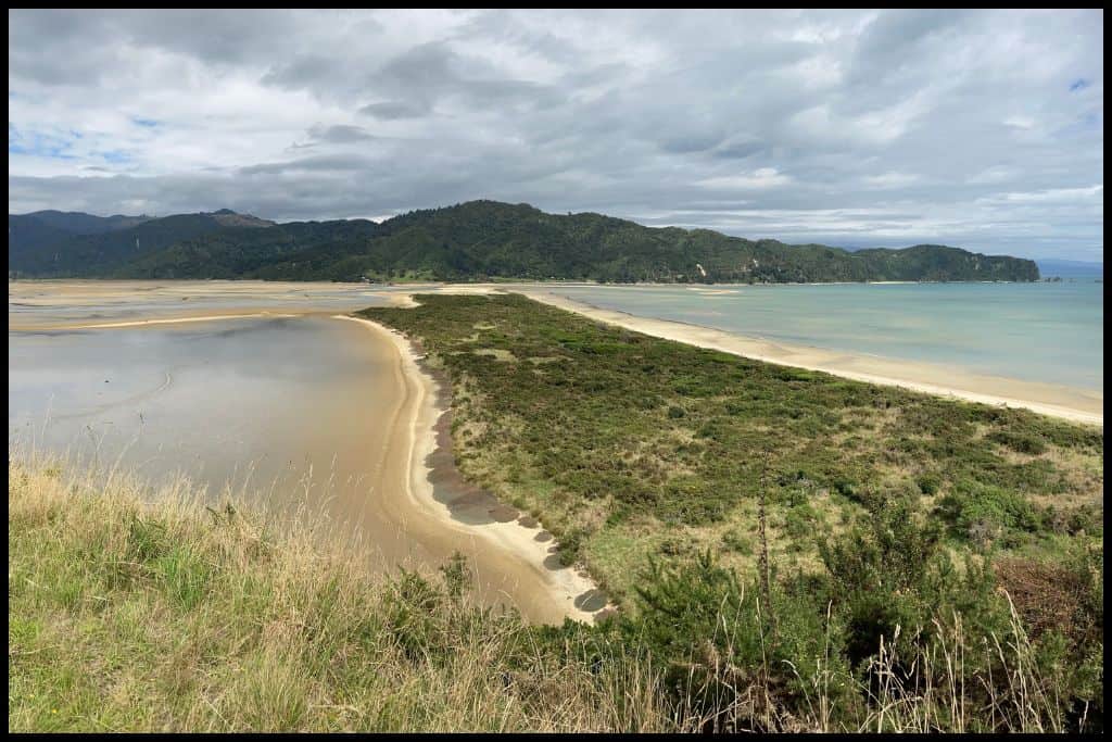
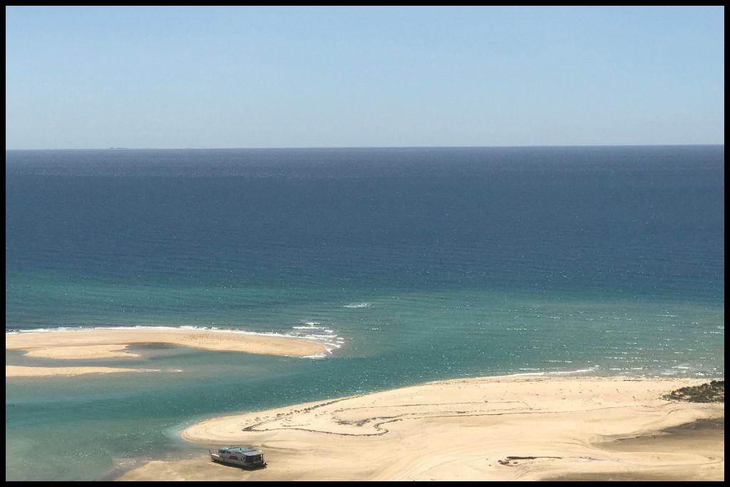
Immediate Surroundings: Rotokura / Cable Bay is tucked into the wider Delaware Bay, and is found right along the causeway which links Pepin Island with the mainland. The location, being on a causeway, gives Cable Bay its unique feature – you may have seen photos with what can look like two beaches facing opposite directions, virtually back to back! The causeway is not wide – and on the other side is the Wakapuaka Estuary.
Beach Name: Rotokura / Cable Bay got its name from being the site of a telegraph cable station; a cable was installed in 1876 that ran under the water from New Zealand to Australia, enabling communication by telegraph. There are Cable Bays in Northland (Urupukapuka Island, Bay of Islands) and Auckland (Waiheke Island) regions as well – they are separate.
Getting There: From Nelson, you would come off the main highway and drive Cable Bay Road until you reach Rotokura / Cable Bay. Vehicle Parking: There is some vehicle parking available for free at Rotokura / Cable Bay.
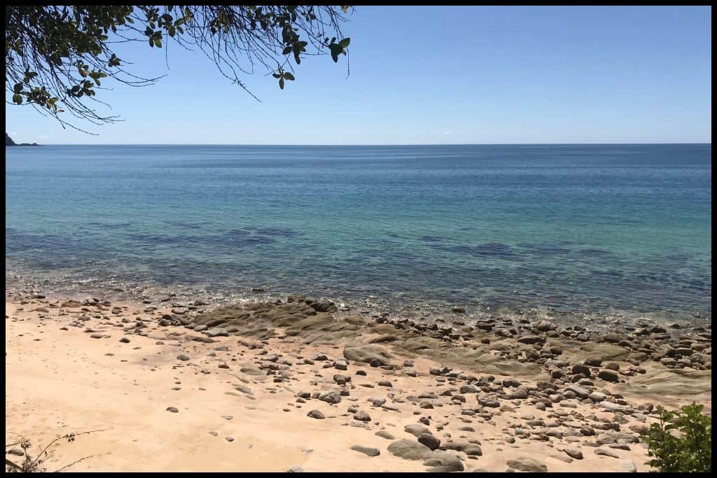
Walking Options: The Cable Bay Walkway is one option for those with three and a half hours to spare – but if you only have an hour, why not climb up the 250 metre high Sentinel Hill and back? The views are worth it. Swimming: Swimming is great at Rotokura / Cable Bay – the water is very clear and there is abundant marine life in the marine reserve adjacent.
Surfing: There is no surfing at Rotokura / Cable Bay. Dogs: Dogs are not permitted at Rotokura / Cable Bay. Amenities: Toilets and picnic tables are available at Rotokura / Cable Bay – and a café, which operates in summer.
Camping: Cable Bay Holiday Park is nearby and offers accommodation to those visiting. Go, Because: Rotokura / Cable Bay shares its location with the Horoirangi Marine Reserve – it’s a wonderful spot for snorkelling and diving. Something Extra: While in the area, stop in at Cable Bay Adventure Park – there’s a zipline (flying fox), mountain bikes, ebikes and quad bikes, paintball and more.
Last Updated: April, 2026.
⛱️ Tāhunanui Beach
General Location: Tāhunanui Beach is located within the city of Nelson, right at the top of the South Island. Nearest Civilisation: Tāhunanui Beach is the local favourite for residents of Nelson, what with it being within the bounds of the city itself.
Immediate Surroundings: Tāhunanui Beach is a big sandbar that juts out into the Waimea Inlet, which is the bottom of the V shaped dip separating the Tasman and Marlborough regions. Beach Length: Tāhunanui Beach is 1.75 kilometres long (1 mile). Beach Name: The name Tāhunanui means ‘big sandbank’ / ‘big sandy beach’.
Getting There: Tāhunanui Beach is very easy to get to as it is within Nelson itself – public transport can take you there from the Nelson CBD if you do not have vehicle access yourself. Vehicle Parking: There is lots of parking along the beachfront of Tāhunanui Beach and in nearby off streets.
Walking Options: There’s a good walk which will take you an hour and a quarter and take you down the lengths of Tāhunanui Beach and Back Beach (behind the sand bar) – but it’s tidal, so go at low or mid tide.
Swimming: Tāhunanui Beach is loved for good swimming and calm water that lends itself to paddleboarding, also. Surfing: There is no good surfing at Tāhunanui Beach. Dogs: Dogs can be on Back Beach behind Tāhunanui Beach, but not on Tāhunanui Beach itself.
Amenities: Tāhunanui Beach has a playground, toilets, and all the comforts of the city nearby. Camping: Tāhuna Beach Holiday Park offers accommodation to visitors in the area. Go, Because: Go, because Tahunanui Beach is a city beach, a fantastic ocean playground for swimmers and paddleboarders, with all the ease of access and facilities you get at popular city beaches.
Something Extra: Natureland Zoo is located in Tāhunanui Recreation Reserve, which runs along the beachfront. They have birds, farm animals, monkeys, meerkats and porcupines. Last Updated: April, 2026.
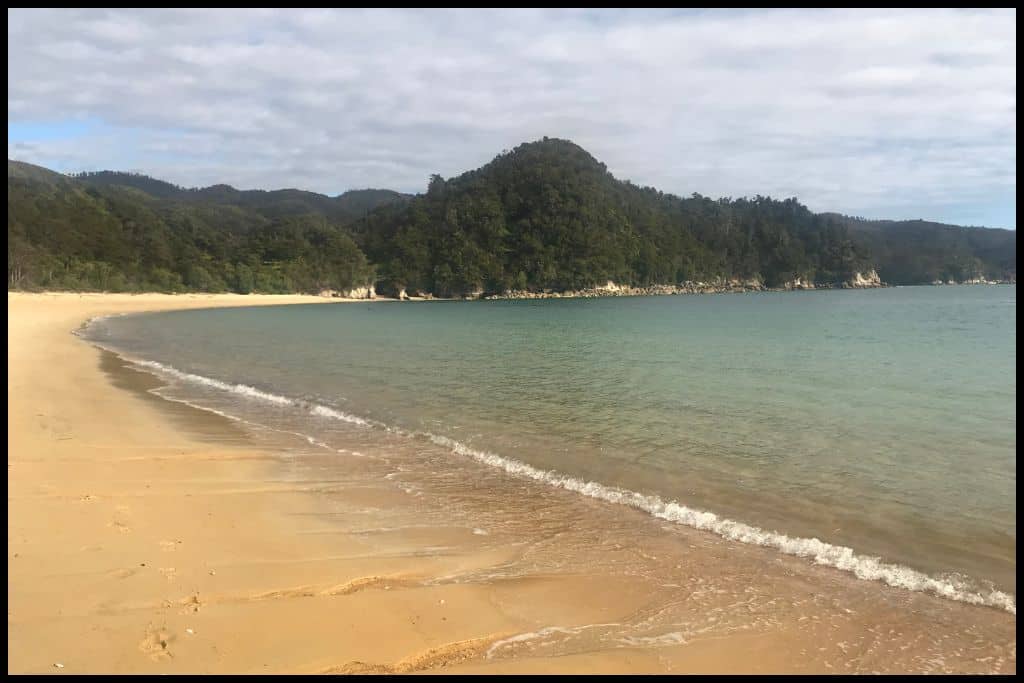
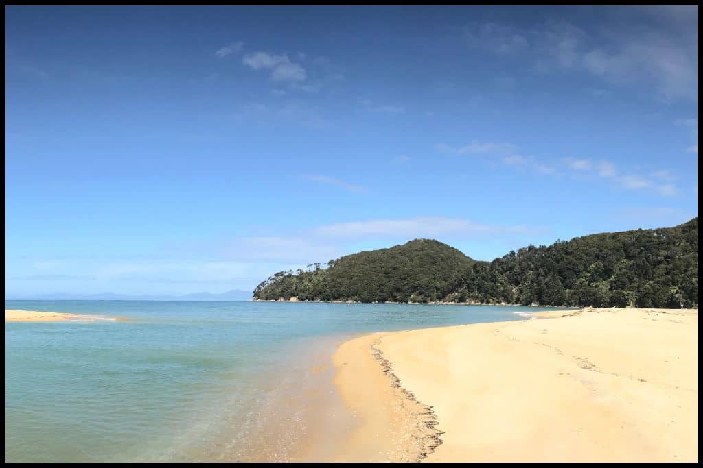
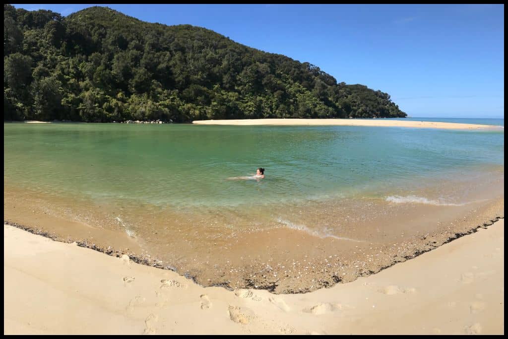
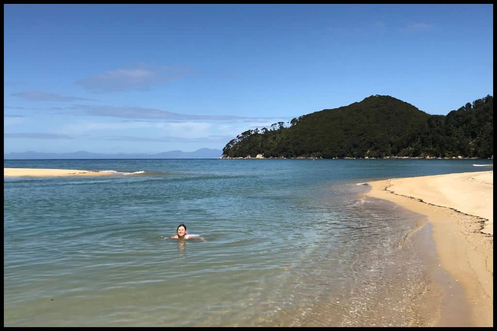
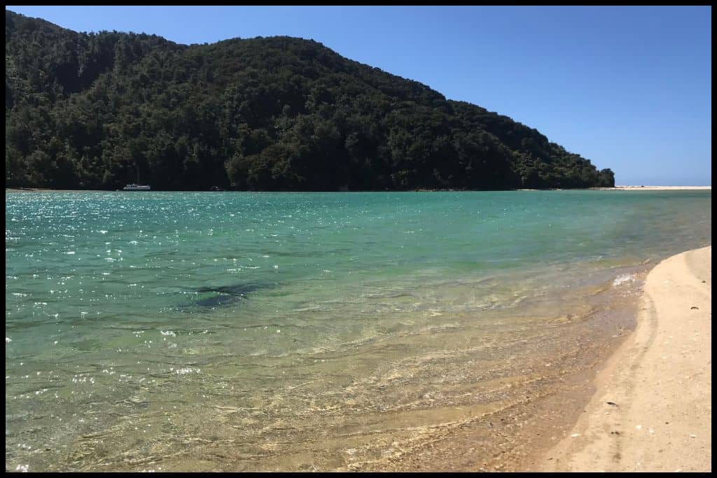
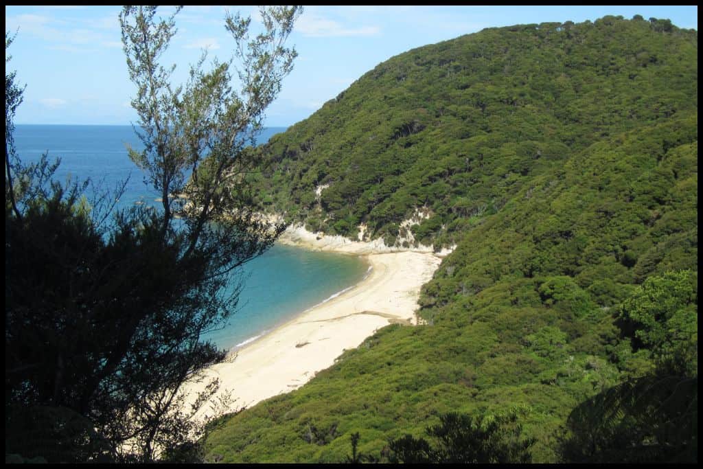
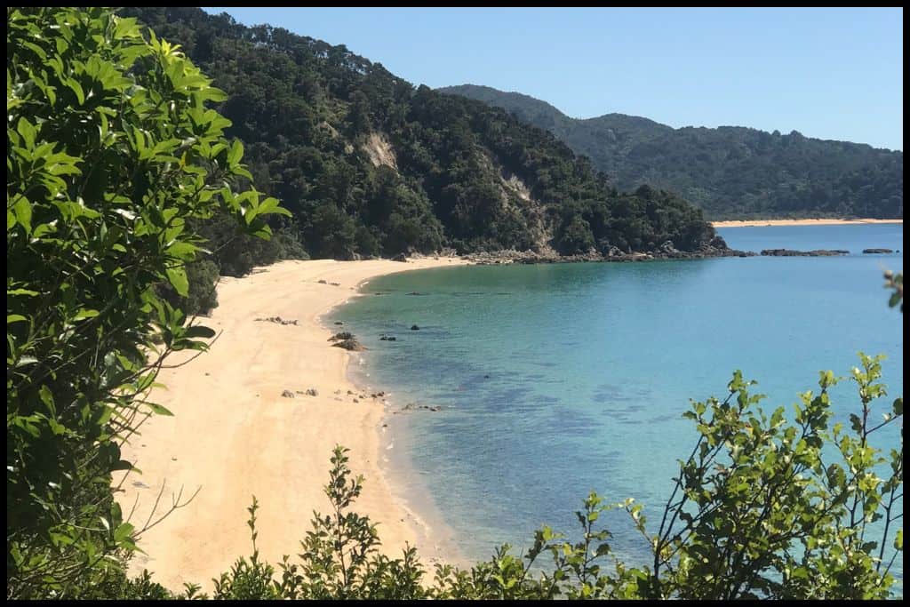
Best Beaches in Abel Tasman National Park
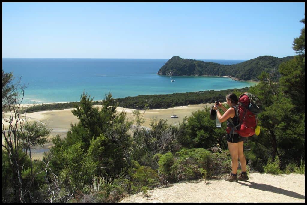
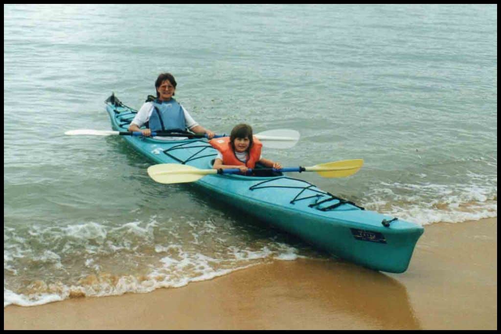
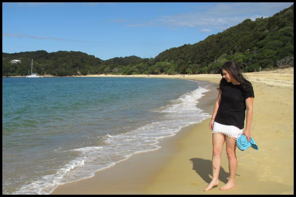
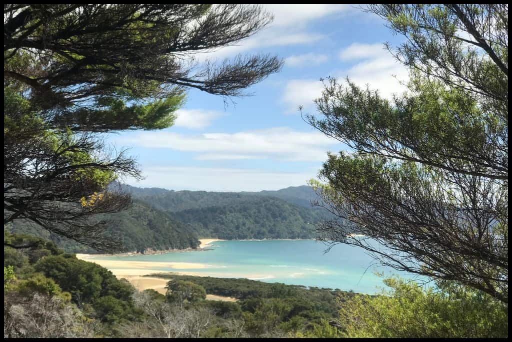
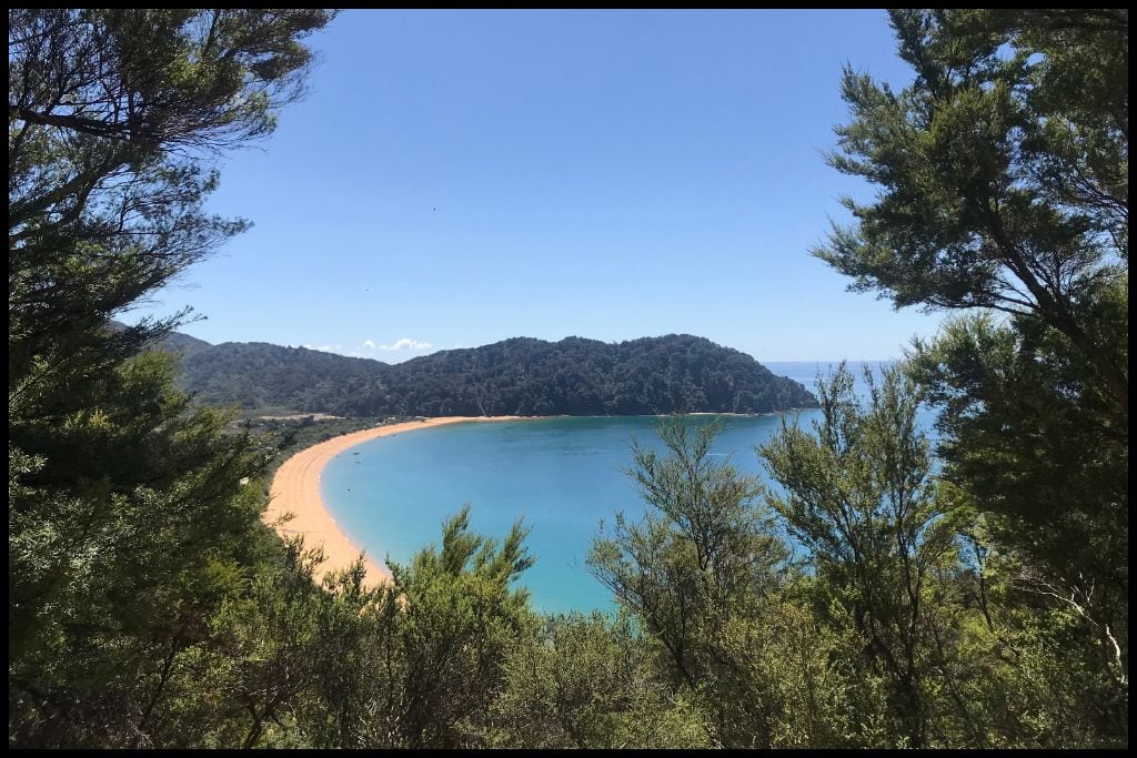
Abel Tasman has got to be one of our premier beach destinations in the country: I was absolutely floored by the beauty of the beaches when I walked the coastal track in 2022. The water is so clear at the park’s beaches, and such an incredible shade of turquoise. You really will feel like you were in the tropics when you look back on the hundreds of photos you took…
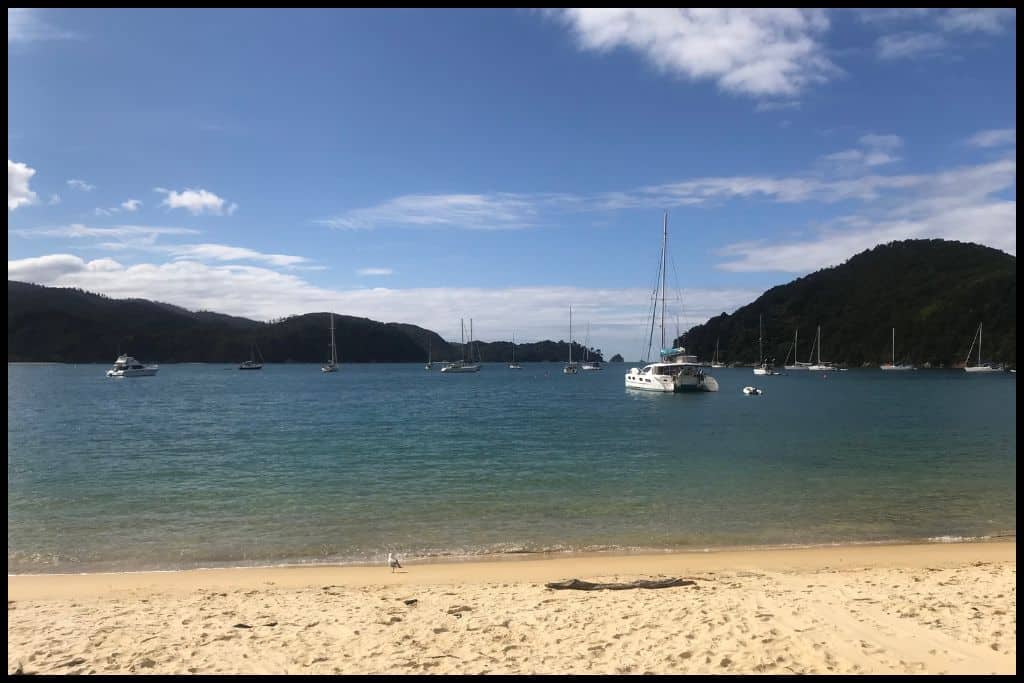
⛱️ Kaiteriteri Beach
General Location: Kaiteriteri Beach is on the western side of Tasman Bay (Te Tai o Aorere), a V shaped bay at the top of the South Island. Nearest Civilisation: The small town of Kaiteriteri is the gateway to Abel Tasman National Park, and adjacent to the beach – just a couple of minutes walk away.
Immediate Surroundings: Kaiteriteri Beach is along the stretch of coastline of Tasman Bay (Te Tai o Aorere) – part of the network of beautiful beaches in the Abel Tasman National Park. Beach Length: Kaiteriteri Beach is half a kilometre (a third of a mile) long. Beach Name: Kaiteriteri translates to ‘hurried meal’. Legend states Māori hurried to finish their meal and return to the beach one day when rocks were heard falling at the beach.
Getting There: Access to Kaiteriteri Beach is via State Highway 60 from Nelson, or from several other beaches in Abel Tasman National Park that are part of the water taxi network. Vehicle Parking: There’s a carpark at Kaiteriteri Beach – it’s free 9 months of the year but paid over summer – and there are roadside parks, too.
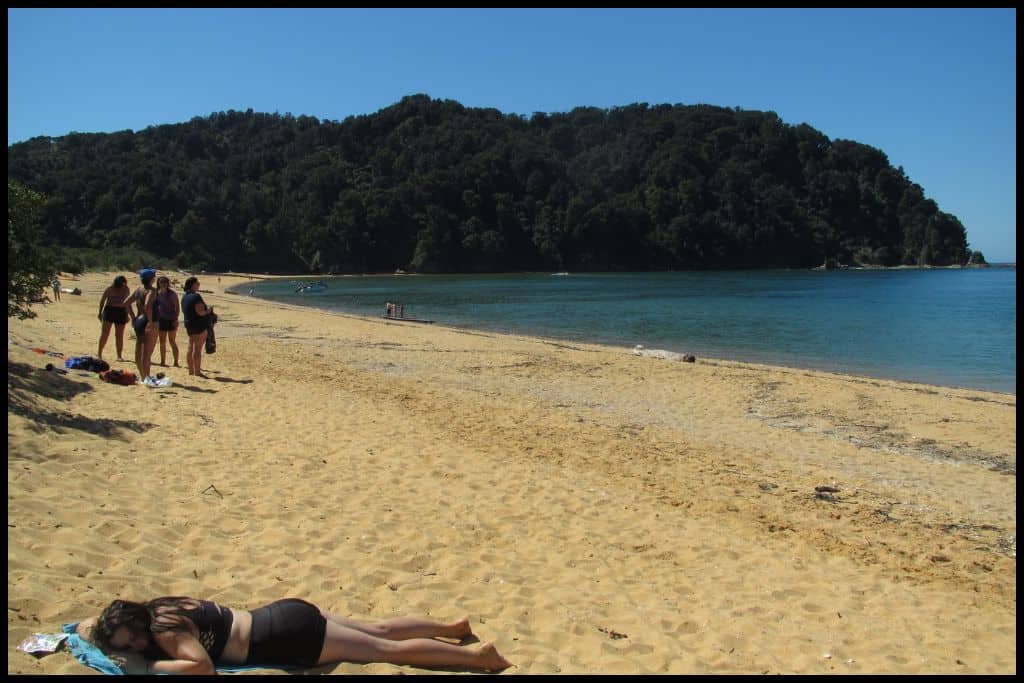
Walking Options: From Kaiteriteri Beach there are lots of short walks. Withell’s Walk will take you up to a lookout and takes three quarters of an hour. Kaka Pah Point is another viewpoint at the end of the beach that you can walk to, as is the lookout over Honeymoon Bay. Swimming: Swimming is amazing at Kaiteriteri Beach.
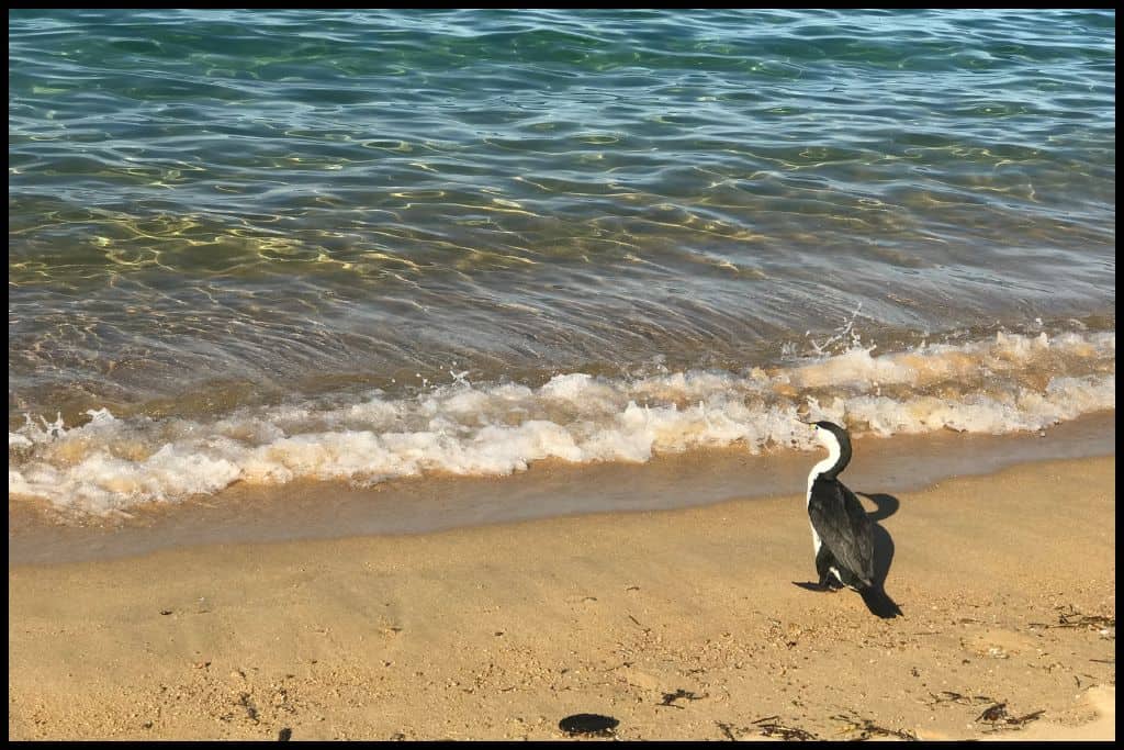
Surfing: There is no surf at Kaiteriteri Beach. Dogs: Dogs are not permitted on Kaiteriteri Beach, in order to protect the wildlife. You can take them to Little Kaiteriteri Beach at certain times – mornings over the summer, and evenings over the remainder of the year (check the specific times that align with the dates of your visit). The rules have been instated to protect the little blue penguins on the beach.
Amenities: Kaiteriteri Beach has changing rooms, toilets, showers, a boat washing facility, and nearby restaurants and cafés. Camping: Kaiteriteri Recreation Reserve allows camping. Go, Because: Visitors to Kaiteriteri Beach will also enjoy Little Kaiteriteri Beach next door – equally beautiful, but smaller, and also Kaiteriteri Lagoon, which offers great swimming as well.
Something Extra: If you paddle in the direction of Marahau Beach, when you are about halfway there, you will see the famous Split Apple Rock – a boulder cleaved in half naturally, which sits out in the water. Last Updated: April, 2026.
⛱️ Anchorage Bay
General Location: Anchorage Bay is located at the top of the South Island, part of the Abel Tasman National Park. Nearest Civilisation: The town of Marahau, which is, like Kaiteriteri, considered a gateway into the national park, is closest to Anchorage Bay – water taxis can take you to and from – and they take three quarters of an hour. Immediate Surroundings: Anchorage Bay is on the western side of the large, V shaped Tasman Bay (Te Tai o Aorere).
Beach Name: Anchorage Bay is named for the boats that use it as an anchoring point. Getting There: There is no road access to Anchorage Bay. Walking from Marahau along the Abel Tasman Coastal Track takes four hours (12 kilometres, 7.5 miles), and arriving by water will take you three quarters of an hour from Marahau. You can also arrive by boat from Kaiteriteri Beach or Torrent Bay, Totaranui or Awaroa – different operators offer different routes and shuttles.
Vehicle Parking: There is no road access to Anchorage Bay. Walking Options: Anchorage Bay is right on the Abel Tasman Coastal Track – a track with 3 day or 5 day options. There’s also the Pitt Head Loop Walk starting from the bay that will take you an hour and a half.
Swimming: Anchorage Bay is beautiful for swimming. Surfing: There is no surf at Anchorage Bay. Dogs: Dogs are allowed at the eastern end of Anchorage Bay only, and need to be on a lead.
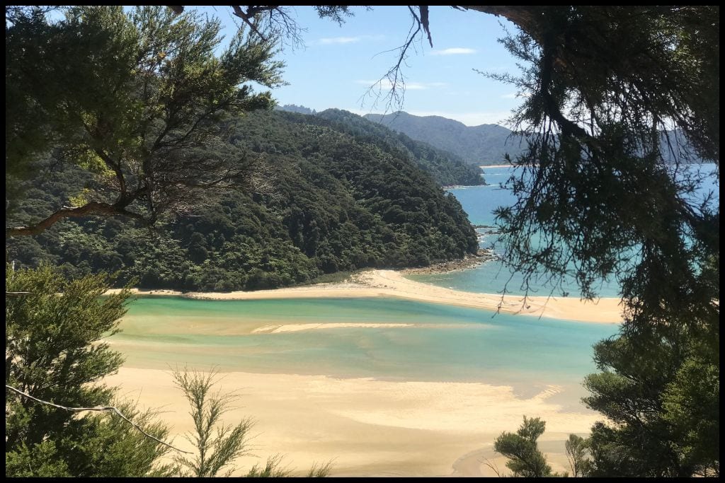
Amenities: Toilets (flushing ones!) and showers are at Anchorage Bay. Camping: The Department of Conservation Anchorage Bay campsite is the main one used by walkers of the Abel Tasman Coastal Track. Go, Because: Go, because, true of all beaches in the park, the waters here are clear, the sand is golden, the bay is sheltered – a lovely mooring or swimming spot – with the Department of Conservation hut right on the shoreline, too – and a glowworm cave!
Something Extra: Do pay a visit to Cleopatra’s Pool – a two hour return walk. It’s a crystal clear swimming hole with a natural waterslide! Last Updated: April, 2026.
⛱️ Te Pukatea Bay
General Location: Te Pukatea Bay is located at the top of the South Island, tucked away into the top left corner. Nearest Civilisation: The town of Marahau is considered to be the gateway to Abel Tasman National Park, where Te Pukatea Bay lies. On foot, Marahau is five hours walk away (14 kilometres, 8.5 miles), or a short boat ride away (three quarters of an hour) plus an hour’s walk.
Immediate Surroundings: Te Pukatea Bay is located within Abel Tasman National Park, and accessed via Anchorage Bay, mentioned above.
Beach Name: Te Pukatea Bay is named for the Pukatea tree which grew prolifically beyond the shore.
Getting There: Te Pukatea Bay is normally accessed through Anchorage Bay. You can get to Anchorage Bay by boat or on foot, and then from Anchorage Bay, you do need to walk to Te Pukatea Bay via the Pitt Head Loop Track, which will take you between an hour and an hour and a half to walk. It’s 2 kilometres (1 mile) return to and from Anchorage Bay. Some operators will do boats directly to Te Pukatea Bay.
Vehicle Parking: There is no road access or vehicle parking at Te Pukatea Bay. Walking Options: The track between Anchorage Bay and Te Pukatea Bay is the Pitt Head Loop Track, and is the main walking option for the bay. Swimming: The water at Te Pukatea Bay is clear and beautiful for swimming.
Surfing: You cannot surf at Te Pukatea Bay. Dogs: Dogs are banned from Abel Tasman National Park. Amenities: Te Pukatea Bay and campsite has toilets, a tap, and a picnic area.
Camping: The Department of Conservation operates the Te Pukatea Bay Campsite. Go, Because: What with being a short walk from Anchorage Bay, Te Puketea Bay is more of a secret, lesser visited, just as beautiful, and more secluded. Something Extra: Along the Pitt Head Loop Track is the Pitt Head Lookout – snap a photo before you descend into the bay. Last Updated: April, 2026.
⛱️ Bark Bay
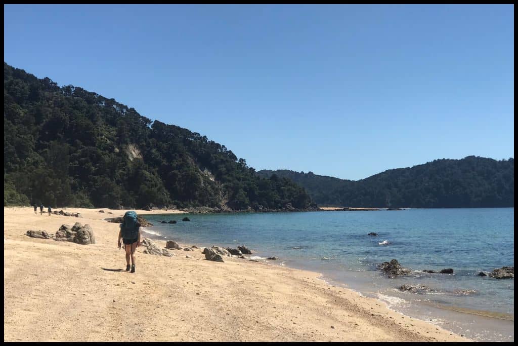
General Location: Bark Bay is located at the top of the South Island, contained within the massive Tasman Bay (Te Tai O Aorere), which is next to Golden Bay. Nearest Civilisation: The nearest civilisation for those coming and going from the Abel Tasman National Park is Marahau, the gateway town. It’s an hour by boat from Marahau to Bark Bay – or, on foot, along the Abel Tasman Coastal Track, its an eight hour journey (25 kilometres, 15.5 miles).
Immediate Surroundings: Bark Bay is part of the Abel Tasman National Park and was our second night of four nights when we did the trail from east to west. Beach Name: The bay used to be a site for harvesting bark from the native trees, which is how it was named Bark Bay. They milled the bark and used the powder to tan fish nets in the past.
Getting There: You can access Bark Bay by boat or on foot – it lies along the Abel Tasman Coastal Track. From Marahau, the walk is 25 kilometres (15.5 miles) and will take eight hours – doable in a day, but we did it in two and stayed at Anchorage Bay in between.
Vehicle Parking: There is no road access to or vehicle parking at Bark Bay. Walking Options: The obvious one, if you have taken a boat to Bark Bay, is to walk a little of the Abel Tasman Coastal Track in either direction. Alternatively, take the Bark Bay Falls Track up to Bark Bay Falls (4 kilometres, 2.5 miles, or an hour’s walk return). Swimming: Swimming is fantastic at Bark Bay.
Surfing: There is nowhere to surf at Bark Bay. Dogs: Dogs are not permitted at Bark Bay. Amenities: Flushing toilets and a cooking shelter are available at Bark Bay.
Camping: The Department of Conservation has a campsite at Bark Bay. Go, Because: Bark Bay is located right on the Bark Bay Estuary, so you can enjoy the swimming in both the sea and the estuary (take to the estuary waters when the tide is going in, not out, for your own safety). We swam here in February 2022 and the water was just so warm, clear and inviting.
Something Extra: Check out Bark Bay Falls, a 12 metre high cascade. Last Updated: April, 2026.
⛱️ Awaroa Bay
General Location: Awaroa Bay is at the top of the South Island, located within Tasman Bay (Te Tai O Aorere).
Nearest Civilisation: The nearest town to Awaroa Bay is Marahau – the gateway to the Abel Tasman National Park. It’s a 35-40 kilometre (22-25 mile) walk (the discrepancy in distance is because there is a shorter route at low tide and a longer route at high tide), which takes 11 hours, give or take.
Road access to Tōtaranui Beach means you can also go via Tōtaranui Beach to access Awaroa Bay via water or trail. Water taxis cover the distance between Tōtaranui and Awaroa in just fifteen minutes! On foot, it’ll take you two hours (5.5 kilometres, or 3.4 miles), or up to three hours (7 kilometres, or 4.3 miles) if you go at high tide, forcing you to go around the Awaroa Inlet instead of straight across it.
Immediate Surroundings: Awaroa Bay is located within Abel Tasman National Park, next to the Awaroa Inlet. Beach Name: Awaroa means ‘long river’ and refers to the Awaroa Inlet, which is tidal. Getting There: You cannot drive to Awaroa Bay, but you can walk there, along the Abel Tasman Coastal Track, or take a boat there – or a helicopter scenic flight!
Vehicle Parking: There is no vehicle parking available at Awaroa Bay – you cannot access it by road. Walking Options: The main walking option from Awaroa Bay is to head in either direction along the Abel Tasman Coastal Track. Consider walking up to Awaroa Lodge if a pizza or a drink is in order!
Swimming: Awaroa Inlet is a much enjoyed swimming spot at high tide on the incoming tide. Surfing: You cannot surf at Awaroa Bay. Dogs: Dogs are forbidden at Awaroa Bay – and the entirety of Abel Tasman National Park, for that matter.
Amenities: Awaroa Bay has more amenities than neighbouring bays because it is home to the luxurious Awaroa Lodge. The lodge has a restaurant that anyone can visit, so its worth stopping if you are midway through a long day walk! Camping: The Department of Conservation operates the Awaroa Bay Campsite.
Go, Because: Like Bark Bay, Awaroa Bay is located on an estuary, too, and when the tide is coming in, that estuary is full of the most clear, turquoise water. Lapping upon the white sand I could not believe we were not in the tropics. Go, and enjoy the water!
Something Extra: Awaroa Bay is a real playground! Consider staying at Awaroa Lodge – a highly luxury stay, where guests can enjoy the restaurant, the day spa, the kayaks and get the scoop on where best to find the glow worms. Last Updated: April, 2026.
⛱️ Tōtaranui Beach
General Location: Tōtaranui Beach is located up the top of the South Island, on the western half of Tasman Bay.
Nearest Civilisation: Tōtaranui Beach is closest to the town of Marahau, which acts as the gateway into Abel Tasman National Park. The time between Tōtaranui Beach and Marahau is nearly two hours by boat, and on foot, its approximately 50 kilometres (31 miles) and can take 15 hours, give or take. It’s typically the middle day of the 3-5 day Abel Tasman Coastal Track.
Immediate Surroundings: Tōtaranui Beach is part of the Abel Tasman National Park, which is a section of the coastline of Tasman Bay (Te Tai O Aorere). Beach Name: Tōtaranui translates to large Tōtara (one of our native trees).
Getting There: Access to Tōtaranui Beach is via Wainui, the endpoint of the Abel Tasman Coastal Track (15.5 kilometres, 9.5 miles – a five hour walk), or the other end of the Abel Tasman Coastal Track, which is Marahau.
You can also get to Tōtaranui Beach via boat – it is one of the more popular beaches in the park so there are abundant water taxi options between Tōtaranui Beach and Marahau Bay, Kaiteriteri Beach, Anchorage Bay, Onetahuti Beach, Bark Bay and Awaroa Bay.
Vehicle Parking: Tōtaranui Beach is the only beach in Abel Tasman National Park with road access. There is parking for day use, and parking for campers. It’s a large carpark! Walking Options: A walking option that differs from the beaches dotted along the main Abel Tasman Coastal Track is the Gibbs Hill Track. Gibbs Hill is 405 metres above sea level and the track goes from Tōtaranui Beach, inland, and should take you a couple of hours return (9 kilometres, or 5.5. miles back down to Tōtaranui).
Swimming: Swimming is so enjoyable in the clear waters of Tōtaranui Beach. Surfing: You cannot surf at Tōtaranui Beach. Dogs: Dogs are not allowed at Tōtaranui Beach or anywhere in Abel Tasman National Park.
Amenities: There’s a campsite and visitor centre at Tōtaranui Beach. Camping: The Department of Conservation campsite at Tōtaranui Beach is huge and can accommodate up to 850 people!
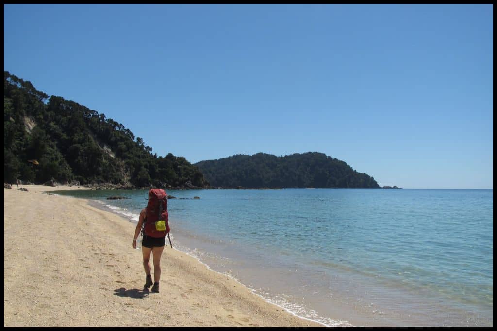
Go, Because: Tōtaranui Beach is the longest beach in the park and the sand is the deepest hue of gold. It’s absolutely stunning – but popular – and a huge campground runs the length of it. It’s the last stop for the water taxis so go, because it’s so accessible and you can boat in and boat out if you are not undertaking any big walks.
Something Extra: Don’t leave Tōtaranui Beach without engaging in a bit of snorkelling, fishing or kayaking. The water is amazing. Last Updated: April, 2026.
⛱️ Anapai Bay
General Location: Anapai Bay is at the top of New Zealand’s South Island, in the left hand corner, part of the wider Tasman Bay (Te Tai O Aorere). Nearest Civilisation: The closest place of any significance to Anapai Bay is the town of Pōhara (an hour’s drive from Tōtaranui Beach, with the distance between Tōtaranui Beach and Anapai Bay being an hour’s walk on top of that (3 kilometres, 1.8 miles).
Immediate Surroundings: Anapai Bay is one of many beautiful, clear-watered beaches in the Abel Tasman National Park – which is a section of the western shoreline of the wider Tasman Bay (Te Tai O Aorere).
Beach Name: To my knowledge, ‘pai’ translates to bay or cove, and ‘ana’ means pleasant. Getting There: Access to Anapai Bay is through Tōtaranui Beach – you can get to Tōtaranui Beach by road, foot (the Abel Tasman Coastal Track) or by water taxi (from any of the six main beaches that offer water taxi shuttles) and from Tōtaranui Beach you still must walk another hour (3 kilometres, 1.8 miles).
Vehicle Parking: There is no vehicle parking at Anapai Bay. Walking Options: Aside from the main Abel Tasman Coastal Track, which you can walk in either direction from Anapai Bay, you can also tackle the Separation Point Loop Track, which will take you from Anapai Bay to Mutton Cove, and you can go on to Separation Point and return via the Whariwharangi Saddle. This whole loop should be allocated 5-7 hours (but you can also turn back at either Mutton Cove or Separation Point and just do it as an out-and-back walk) – 15 kilometres, or 9 miles, for the full thing.
Swimming: Definitely allocate swimming time at Anapai Bay! The water is stunning. Surfing: There is no surfing at Anapai Bay. Dogs: Dogs are not allowed at Anapai Bay.
Amenities: There are toilets and a water tap at Anapai Bay. Camping: There is a Department of Conservation campsite at Anapai Bay. Go, Because: The sand is golden, the sea is clear, and, being an hour’s walk from Tōtaranui, you can boat in and boat out for the day but still enjoy the lack of crowds as most people don’t bother with the walk when they have docked at Tōtaranui. We did Anapai Bay on our fourth day of the Abel Tasman Coastal Track, which was much, much quieter than the previous three days, as many people walk Marahau to Tōtaranui Beach only, and call it.
Something Extra: When headed up to Separation Point, have a look at the Separation Point Lighthouse – not the most aesthetic lighthouse, but an interesting landmark all the same. If you prefer to stay on the beach, wander down to the Anapai Bay Sea Stacks – naturally stacked boulders that really look quite epic. Last Updated: April, 2026.
Best Beaches in Golden Bay
Golden Bay is a large bay in the Tasman region, with a series of little beaches and bays within that are all of outstanding beauty, renowned for their truly beautiful, truly golden sand. Make the trip out here; you’ll have no regrets.
⛱️ Tata Beach
General Location: Tata Beach is located in the top left hand corner of the South Island, under the curve of Farewell Spit. Nearest Civilisation: Tata Beach is just a seven minute drive out of the small beach settlement of Pōhara – 5.5 kilometres, or 3.5 miles.
Immediate Surroundings: Tata Beach is one of several that form the arc of Golden Bay (Mohua).
Beach Name: Tata translates to ‘nearby’. Getting There: Tata Beach is an easy short drive up the road from the coastal settlement of nearby Pōhara.
Vehicle Parking: Tata Beach has lots of free, beachfront vehicle parking. Walking Options: There is a coastal track that connects Tata Beach with Ligar Bay – if you’re up for it! It is not far, as the beaches neighbour each other.
Swimming: The calm, turquoise waters of Tata Beach have made it quite the destination for swimming. Surfing: There is no surfing to be had in any of Golden Bay. Dogs: Dogs have restricted access to Tata Beach – predominantly over the summer holidays, when they are only allowed on the beach in the early morning and at sunset. Check local rules before you go, for the time of year you are planning on going.
Amenities: There are toilets at Tata Beach – and a pizzeria! Camping: There are a few options for self contained campers at Tata Beach. Go, Because: The colour of the water (turquoise!) and the colour of the sand (gold!) at Tata Beach make it so dearly beloved for its scenery and calm swimming conditions.
Something Extra: Tata Beach looks out onto the Tata Islands, which can be accessed by kayak and are actually home to spotted shags and many other marine birdlife. Taking a kayak tour out here is definitely a good way to explore the bay! Last Updated: April, 2026.
⛱️ Ligar Bay
General Location: Ligar Bay is located in the top left hand corner of the South Island – under Farewell Spit, part of Golden Bay’s coastline. Nearest Civilisation: The settlement of Pōhara is the closest to Ligar Bay – a six minute drive up the road (3.8 kilometres, or 2.3 miles).
Immediate Surroundings: Ligar Bay is part of Golden Bay (Mohua), which is next to Tasman Bay. The two bays make up the Tasman region of New Zealand.
Beach Name: Ligar Bay is the namesake of Charles Ligar, one of New Zealand’s Surveyor-Generals in the mid 1800’s. Getting There: From Pōhara, Ligar Bay is a short drive up the road.
Vehicle Parking: There is free beachfront parking at Ligar Bay. Walking Options: Head west along the beach until you reach the Abel Tasman Monument – commemorating the site and date of the first recorded encounter between the Dutch explorers that named New Zealand and the native Maori that were living here.
Swimming: The water at Ligar Bay is an incredible colour for swimming in! Surfing: There is no surf at Ligar Bay. Dogs: Dogs are sometimes permitted on Ligar Bay – the council bylaws are seasonally based, so check the local council site for details before you take your pooch.
Amenities: There are toilets and a picnic area at Ligar Bay. Camping: There is no camping at Ligar Bay specifically. Go, Because: Ligar Bay is known for its rock pools and shell fish – there are cockles, tuatua and pipi to be gathered here.
Something Extra: Your something extra is to stop and gather some shellfish at low tide, or perhaps make use of the BBQ area and stay for dinner. Last Updated: April, 2026.
⛱️ Pōhara Beach
General Location: Pōhara Beach is situated in the top left hand corner of New Zealand’s South Island, under Farewell Spit, part of Golden Bay (Mohua). Nearest Civilisation: The namesake of Pōhara Beach is the small coastal settlement of Pōhara which is right there. The next place of any significance is the town of Takaka, which is an eight minute drive away (8 kilometres, or 5 miles).
Immediate Surroundings: Pōhara Beach is one of the beaches along the coastline of Golden Bay, named for its stunning golden sands, and known for its amazing, turquoise -coloured water.
Beach Name: I believe that Pōhara translates to ‘impoverished’, but as to the story, your guess is as good as mine. Getting There: Pōhara Beach can be accessed from Takaka along Abel Tasman Drive.
Vehicle Parking: There is free, roadside parking for beachgoers at Pōhara Beach. Walking Options: Stroll out to Port Tarakohe (2.5 kilometres, or 1.5 miles, one-way), if you have a spare hour.
Swimming: Pōhara Beach is loved for calm waters that lend themselves to safe swimming. Surfing: There is no surfing at Pōhara Beach. Dogs: Dogs are required to be on a leash and kept to the designated end of Pōhara Beach during the summer months but can enjoy the rest of the beach off-peak and off-leash.
Amenities: Amenities are available to the public at one end of the holiday park there – in a designated day-stay area – where there toilets (free) and showers (paid). Camping: The main campground at Pōhara Beach is the Pōhara Beach Top 10 Holiday Park (a chain of much loved holiday parks all around New Zealand, now exceeding 10: there are 49!) Go, Because: Expect stunning scenery at Pōhara Beach; the beach is also a fantastic spot for water sports and blokarting, and the campground here is pretty amazing, too.
Something Extra: Why not look into doing a bit of blokarting (a go kart with a sail for the wind) on the beach? The holiday park staff are the ones to talk to about this and will gladly point you in the right direction! Last Updated: April, 2026.
Best Beaches on Farewell Spit
Farewell Spit, right up in the top left hand corner of the South Island, has a famous beach that people venture all the way up there to see .. and its Wharariki Beach!
⛱️ Wharariki Beach
General Location: Wharariki Beach is located on the outward facing coastline of the Tasman region of the South Island of New Zealand. Nearest Civilisation: The last town before Wharariki Beach is Collingwood, a half hour drive away (28 kilometres, or 17 miles).
Immediate Surroundings: Wharariki Beach lies on Cape Farewell, the northernmost point of the South Island, that leads out to the long sandbar of Farewell Spit. It’s located within the Farewell Spit Nature Reserve, and Pūponga Farm Park.
Beach Name: Wharariki is the name for the coastal flax that grows well here. Getting There: Walking 1 kilometre (0.6 miles) from the Wharariki Beach Carpark at Pūponga (in the Pūponga Farm Park) is the only way to access Wharariki Beach. It’s a farmland track (Wharariki Beach Track) that will take you 20-30 minutes to walk, one-way.
Vehicle Parking: Vehicle parking is available at the Wharariki Beach Carpark, a half hour walk from Wharariki Bach itself. Walking Options: Aside from the farmland track down to Wharariki Beach (Wharariki Beach Track), visitors can also consider the Pillar Point Lighthouse Track, which is 3 kilometres (1.8 miles) return, and will take you an hour and a half, return.
Swimming: Strong currents make Wharariki Beach unsafe for swimming. Surfing: Wharariki Beach is enjoyed by surfers. Dogs: Dogs are not permitted at Wharariki Beach.
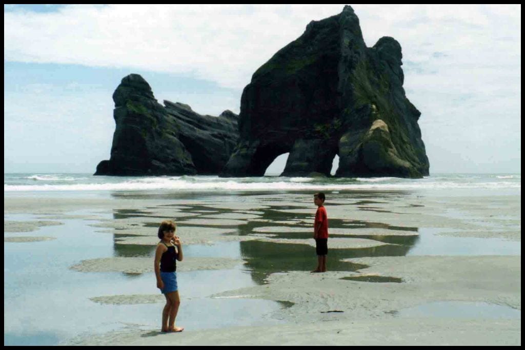
Amenities: Archway Café operates in the Wharariki Beach Carpark for those seeking a last minute snack before some seal spotting! There are composting toilets there to use, too. Camping: Wharariki Beach Holiday Park is the main spot for campers to stay. Go, Because: Go to Wharariki Beach to see The Archway Islands – ie, that famous hole in the rock. It is really beautiful at sunset – although you will have already seen it: it’s the screensaver for Microsoft Windows 10 and 11.
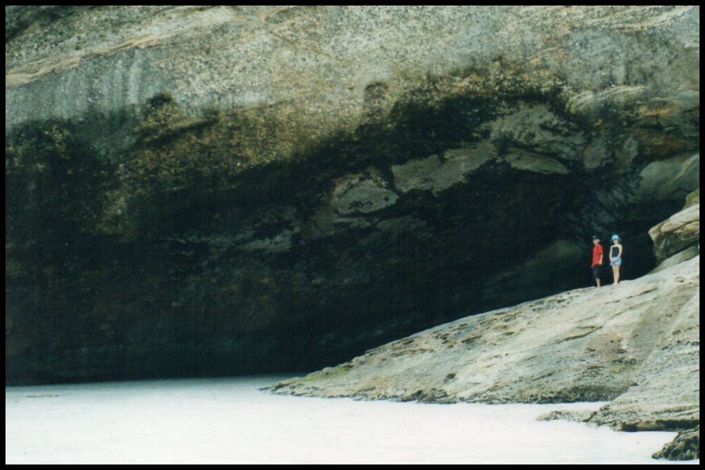
Something Extra: Baby seal pups can be seen in the tidal pools at Wharariki Beach over the spring and summer months. Enjoy them at a distance – 20 metres is the rule. Venture into the Wharariki Beach Sea Cave for an epic, outward facing shot of the Archway Islands framed by the mouth of the cave – but don’t venture in too far; we did, in 2003, and were chased out by an angry mama seal! Last Updated: April, 2026.
Whether you’re exploring Abel Tasman National Park’s famous coastline, making the trip right out to Golden Bay, or stopping for a splash closer in to Nelson, the beaches of the Tasman region are hard to beat. Every bay will seem more beautiful than the last, so prepare to be likely already planning your next visit before you even leave!