
Where Are The Best Beaches In Northland, New Zealand?
Northland is where New Zealand really shows off when it comes to beaches — think white silica sand, turquoise water, huge dunes, and stretches of coastline you may have almost entirely to yourself. From the tippy top of the country, down to the Bay of Islands and even beyond, these are the best beaches in Northland. I’ve grouped them by area so that you can pick where you’re going with ease, and then try and see multiple beaches in one hit, if time is your friend.
Best Beaches on the Aupōuri Peninsula
Starting at the tippy top of the Northland region – the northernmost region of the North Island of New Zealand – we have the Aupōuri Peninsula – and on the eastern side of it, the Pārengarenga Harbour, a massive estuary home to a lot of birdlife.
⛱️ Great Exhibition Bay
General Location: Great Exhibition Bay is located right at the top of New Zealand’s north island – and of the Aupōuri Peninsula, specifically. It’s eastern facing, out into the Pacific Ocean. Nearest Civilisation: Great Exhibition Bay – accessed on foot from Rarawa Beach – it’s an hour south of Cape Reinga, and (nearly) an hour north of the town of Kaitaia (our northernmost town) – 58 kilometres or 36 miles.
Immediate Surroundings: Great Exhibition Bay lies immediately south of the Parengarenga Harbour and the Kotoka Spit, which is a bird sanctuary. Paxton Point, at its southern end, separates Rarawa Beach, which is a southern section of the greater bay.
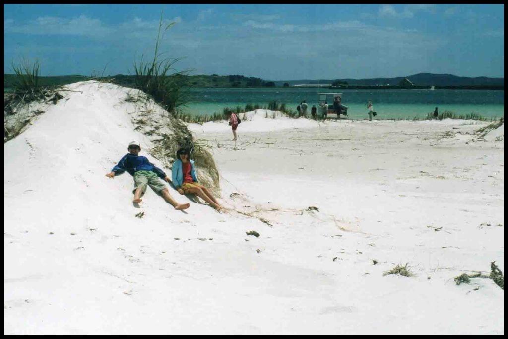
Beach Name: Great Exhibition Bay takes its name from the London event in 1851 – the Great Exhibition. Truly, the sparkling white silica sand in the bay is quite the exhibition to behold and it really does squeak underfoot! Getting There: There is no road access to Great Exhibition Bay. You must access it via the water or on foot from neighbouring Rarawa Beach.
Vehicle Parking: There is no vehicle parking – or road access – to Great Exhibition Bay. Walking Options: The access track to Great Exhibition Bay – and back – from Rarawa Beach is an hour and a half’s walk return (5 kilometres, or 3 miles). Swimming: The water is incredible at Great Exhibition Bay – so, so clear, but can be cold and quite dangerous with strong currents, plus the beach is practically deserted and there are no lifeguards patrolling there – so perhaps just stick to a shallow swim and be mindful of your abilities.
Surfing: Surfing is possible at Great Exhibition Bay but best, really, at Rarawa Beach – where you don’t have to walk over for three quarters of an hour carrying a board. Dogs: Dogs are welcome at Great Exhibition Bay but need to be kept away from the bird sanctuary on Kotoka Spit at the northern end of the bay. Amenities: There are no facilities of any kind at Great Exhibition Bay itself, with the closest amenities being at the southern end, at Rarawa Beach.
Camping: The nearest campsite is at the southern end of Great Exhibition Bay – at Rarawa Beach.
Go, Because: Great Exhibition Bay is something really special – it’s 20 km (12.5 mi) long, and it’s a long, frequently near-deserted stretch of sparkling white sand, with no crowds because of it only being able to be accessed from Rarawa Beach below, or the harbour itself by kayak (or some guided overland tours will take you over private farmland to the bay). The sand is the whitest sand you will ever see, the blue water so incredibly blue.
Something Extra: You can also see Great Exhibition Bay by air – options abound as to how you can get there. Last Updated: July, 2026.
⛱️ Rarawa Beach
General Location: Rarawa Beach is located on the Aupōuri Peninsula – the skinniest part of the far north of the North Island that extends upward. It’s on the eastern coastline of the peninsula. Nearest Civilisation: Kaitaia is the northernmost town of New Zealand and is the best part of an hour’s drive south of Rarawa Beach – it’s 58 kilometres (36 miles) from there.
Immediate Surroundings: Rarawa Beach is part of Great Exhibition Bay (but both are destinations in their own right). It’s south of the Parengarenga Harbour and immediately south of Paxton Point. It opens into the Pacific Ocean and the surrounding area is referred to as the Paxton Point Conservation Area. The Rarawa Stream winds up on the beach and forms a small estuary and lagoon.
Beach Name: Rarawa translates to “the coming together of people”. Getting There: Rarawa Beach is accessed from the very end of Rarawa Beach Road, which comes off the main State Highway 1. Vehicle Parking: There is a carpark at the end of Rarawa Beach, near the campsite.
Walking Options: From Rarawa Beach, you can walk for twenty minutes (500 metres) to reach the tidal lagoon in the estuary. Swimming: Swimming at Rarawa Beach can be a bit dangerous because of rips and currents, so, no matter how amazed you are with the crystal clear water, rather swim in the estuary at high tide instead, where it is safer. Surfing: Surfers will manage okay with the surf at Rarawa Beach! Dogs: Dogs are not permitted at Rarawa Beach due to the birdlife around.
Amenities: Toilets, showers and a tap are available at Rarawa Beach – through the campsite. Camping: The Department of Conservation operates the Rarawa Beach Campsite.
Go, Because: You can expect more of the white silica sand at Rarawa Beach that makes this stretch of coastline so stunning and magical. It’s properties and makeup mean it is a striking colour and even squeaks underfoot! Rarawa Beach is more easily accessed than Great Exhibition Bay and boasts a beautifully located campsite, too.
Something Extra: Why not collect your own tuatua shellfish for dinner (by digging into the sand), take a 4WD onto the beach for a drive, explore the rock pools at the northern end of Rarawa Beach, or stay the night at the campsite? Last Updated: July, 2026.
⛱️ Te Werahi Beach
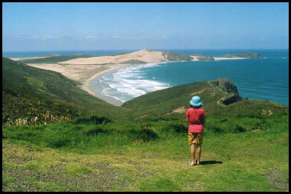
Te Werahi Beach is the beach that divides Cape Reinga and Cape Maria van Diemen – and it’s situated on the Te Paki Coastal Track, which is a five day tramp (hike) and a segment in and of itself of the great Te Araroa Track that spans the country’s length.
General Location: Te Werahi Beach is located at the northwestern tip of the Aupōuri Peninsula – that’s the skinny, northernmost tip of New Zealand’s North Island. Nearest Civilisation: Kaitaia, our northernmost town, is still an hour and a half south of Te Werahi Beach – 109 kilometres (or 68 miles).
Immediate Surroundings: Te Werahi Beach is actually located on the North Cape, which is the northwesternmost corner of the tip of the North Island. It’s part of the Te Paki Recreation Reserve – quite nearby to the famous Te Paki Sand dunes and is along the multi-day Te Paki Coastal Track. Beach Name: The translation for Te Werahi is “the place of the burnt one”.
Getting There: Te Werahi Beach cannot be accessed by road. You can walk down from Cape Reinga (less than an hour’s walk) or via the Twilight-Te Werahi Loop which comes off State Highway 1 (a five hour walk). Vehicle Parking: There is no vehicle access to Te Werahi Beach, so no vehicle parking, either. Walking Options: Access from Cape Reinga to Te Werahi Beach is 2 kilometres (1 mile) one-way and will take you three quarters of an hour – and the same back again.
Swimming: Te Werahi Beach is beautiful but simply not safe for swimming – it’s such an isolated spot with strong currents and dangerous rips. Surfing: Confident surfers will be able to handle the surf at Te Werahi Beach. Dogs: Dogs need to be on a lead at Te Werahi Beach.
Amenities: There are no facilities at Te Werahi Beach. Camping: There is no campsite at Te Werahi Beach. Twilight Beach campsite is 7 kilometres away (three hours on foot).
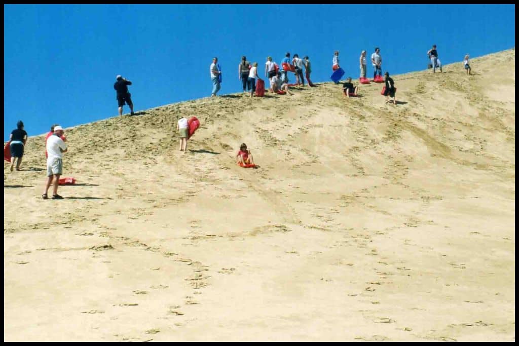
Go, Because: The North Cape is the patch of coastline boasting beautiful coastal stretches like Te Werahi Beach (and the more famous Ninety Mile Beach), excellent spots for adventurous activities. This area is famous for it’s massive sanddunes – also known as the Te Paki sanddunes, and they are a playground for sand tobogganers and sand boarders (or sand surfing) alike.
Something Extra: More likely you will be in the area primarily to see Cape Reinga, not Te Werahi Beach in isolation! But, in case not, simply do not miss Cape Reinga, its lighthouse, and the chance to see the change in the water where the Tasman Sea meets the Pacific Ocean. Last Updated: July, 2026.
⛱️ Ninety Mile Beach
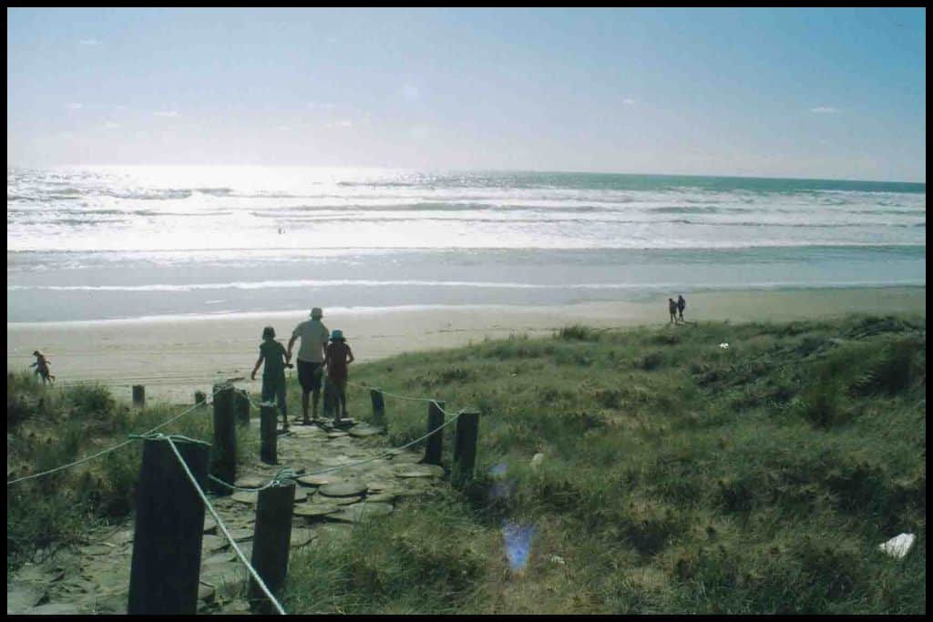
General Location: Ninety Mile Beach is located on the straight, long, western edge of the Aupouri Peninsula – the northernmost tip of the North Island. Nearest Civilisation: Kaitaia, New Zealand’s northernmost town, is fifteen minutes drive away from Ninety Mile Beach – about 10 kilometres, or 6 miles. (It’s frequently accessed via Ahipara, the settlement at the southern end of this crazy long beach).
Immediate Surroundings: Ninety Mile Beach lies south of the North Cape, Cape Maria van Diemen and Cape Reinga and forms the long, straight coastline along the western side of the peninsula. It looks out into the Tasman Sea. Te Paki Recreation Reserve occupies the area at the northern end.
Beach Name: The Maori name for Ninety Mile Beach is Te-Oneroa-a-Tōhē. The European name for Ninety Mile Beach also has a story: it’s not 90 miles long, but 55 miles long (88 km) but it is widely believed that the early Europeans who named it estimated its length from the three days it took to travel it on their horses (the horses would typically would do 30 miles in a day).
Getting There: Ninety Mile Beach can be accessed from the north (Te Paki), from the south (Ahipara), from halfway down (Hukatere) or from three quarters of the way down (Waipapakauri). Just one main highway runs up the Aupouri Peninsula – and it’s State Highway 1.
Vehicle Parking: You can park on Ninety Mile Beach – it’s an official highway! Only do this if you have a 4WD, otherwise, park near the ramp entrances to Ninety Mile Beach. You can access it via Te Paki in the north, Ahipara in the south, the Hukatere Entrance halfway down, or the Waipapakauri Ramp which is three quarters of the way down!
Walking Options: The nearby Te Paki Coastal Track is on my bucket list – it’s 3-5 days, spanning 48 kilometres (or 30 miles) with campsites along the way. Swimming: Swimming is dangerous at Ninety Mile Beach, due to sudden drop offs, strong currents, and the isolation factor. Surfing: Ninety Mile Beach surf caters to all levels.
Dogs: Dogs need to be on a lead at Ninety Mile Beach. Amenities: Ninety Mile Beach has toilets and changing rooms at the northern end where the Te Paki carpark is, but any other facilities further down are generally those of the Ngapae and Ahipara Holiday Parks – eg toilets, showers, shops, pools and barbecues. Camping: Ngapae Holiday Park and the Ahipara Top 10 Holiday Park are great options for campers in the nearby vicinity.
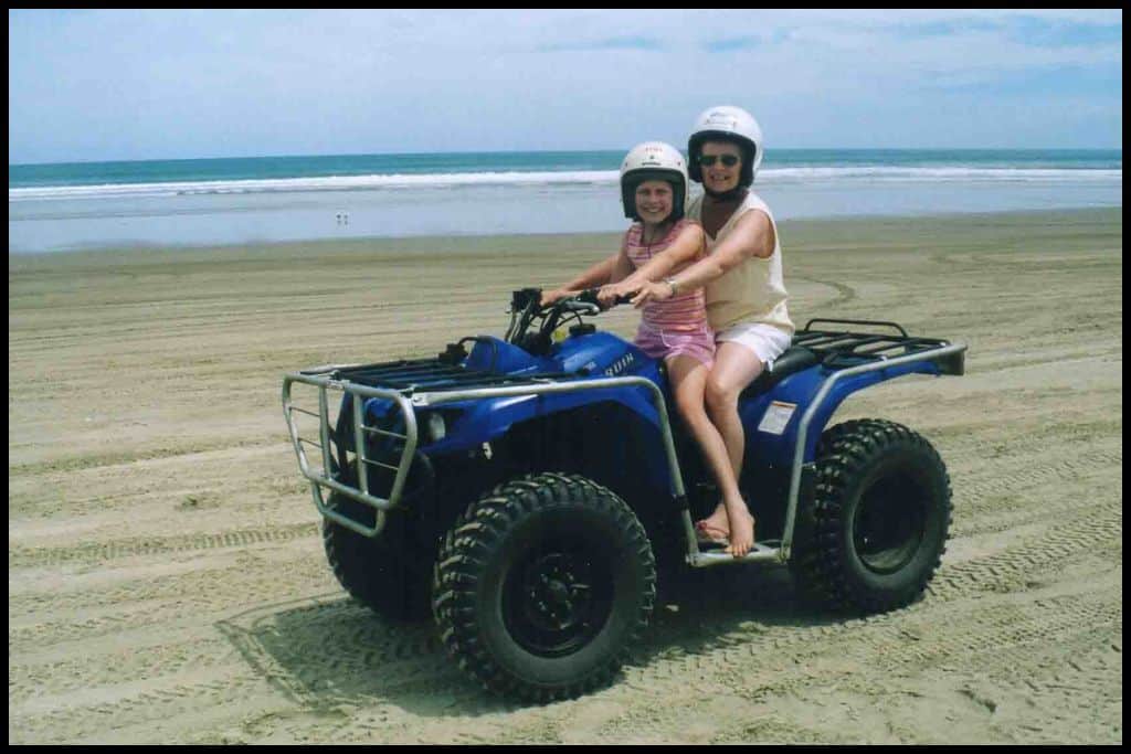
Go, Because: Ninety Mile Beach boasts the Te Paki sanddunes, wicked west coast sunsets, and the chance to offroad (it’s officially an actual highway!). It’s the perfect beach for offroading, but many people get stuck so ensure you know what you are doing, where to drive, time it with the tides .. or go on a tour! Our tour bus drove right down the beach when I was on holiday there with my family in 2006!
Something Extra: Te Paki Sanddunes, hands down. And take something to slide down! Those dunes are massive! Last Updated: July, 2026.
Best Beaches on the Karikari Peninsula
Back to the eastern side of the Far North: Karikari Peninsula, shaped like a lower case ‘r’, juts up and out to the east, its shape creating many a beautiful beach spot, so the peninsula as a whole is my third beach destination recommendation for this list.
⛱️ Rangiputa Beach
General Location: Rangiputa Beach sits in the far north of New Zealand’s North Island, where the island thickens again, on the eastern coastline. Nearest Civilisation: Rangiputa Beach is virtually equidistant from towns Kataia and Mangōnui, but technically it is just a couple of minutes quicker to Mangōnui – 38 kilometres, or 24 miles.
Immediate Surroundings: Rangiputa Beach is located on the Karikari Peninsula, in Kohanga Bay, and the shape of it means that the beach faces back into Rangaunu Harbour, away from Rangaunu Bay. Lake Rotokawau sits not far back from its shoreline. Beach Name: Rangiputa translates to “to cross the sky”.
Getting There: Rangiputa Beach is easily accessed from the end of Rangiputa Road, which comes off Inland Road as it turns up the peninsula off the main State Highway 1. Vehicle Parking: A grass and gravel carpark is available at Rangiputa Beach.
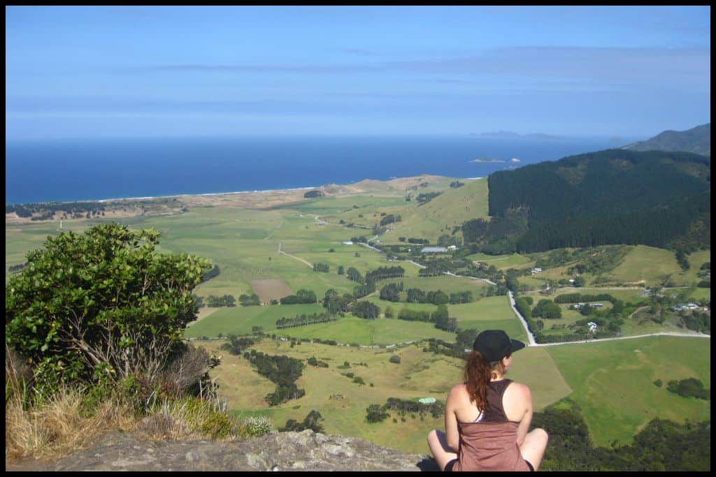
Walking Options: Head ten minutes drive over (down Puheke Road) to Puheke Beach and/or climb Puheke Hill/Mt Puwheke. It’s a 20 minute ascent (just over a kilometre, or half a mile, each way) but the views at the top over the bay and the rest of the peninsula are spectacular.
Swimming: Swimming at Rangiputa Beach is just idyllic. The Karikari Peninsula beaches are famous for their clear, turquoise waters and dazzling white sands, and Rangiputa Beach’s harbour facing position makes it quite sheltered. Surfing: There is no good surfing at Rangiputa Beach but it’s a bit of a world class destination for windsurfing and kitesurfing!
Dogs: Dogs are allowed off lead at Rangiputa Beach nine months of the year but over the summer months can only run off lead outside peak hours – and are prohibited entirely during peak times. Amenities: Toilets, changing rooms and a boat ramp are available at Rangiputa Beach. Camping: Self contained campers can stay at the Reef Lodge Motel nearby Rangiputa Beach in their designated spots.
Go, Because: The colour of the water and the sand draw visitors and locals alike to Rangiputa Beach! It must be seen to be believed, although even satellite images on Maps show the most incredible colours down there.
Something Extra: Rangiputa Beach is known as a kitesurfing beach, and its the perfect place to start if you’ve never tried it! The shallow depth (waist deep), position of the sand bar and westerly winds all contribute to it being an amazing spot for this sport. Last Updated: July, 2026.
⛱️ Maitai Bay / Matai Bay
General Location: Maitai Bay is located on the North Island’s eastern coastline, on the Karikari Peninsula. Nearest Civilisation: Maitai Bay is equidistant from the towns of Kaitaia and Mangonui – and is a forty minute drive from both – 40 kilometres, or 25 miles thereabouts.
Immediate Surroundings: Maitai Bay is part of a twin set of horseshoe shaped bays – Waikato Bay is one over. The Maitai Bay Scenic Reserve sits between the bays.
Beach Name: Maitai Bay is also spelled Matai Bay. The translation refers to pieces of shining metal assumed to be from ship parts that washed up after a shipreck. Getting There: Maitai Bay is accessed from the end of Matai Bay Road (NB it’s spelled Matai on road signage).
Vehicle Parking: There is vehicle parking at the campsite end of Maitai Bay. Walking Options: Walk the Maitai Bay Headland Track up to the lookout point back over the bays – it’s nearly 4 kilometres (2.5 miles) return and can be a little challenging but should only take an hour and a half, return. The view is worth it! Swimming: The water is crystal clear at Maitai Bay and a much loved spot for swimming.
Surfing: Better surf is had elsewhere, not at Maitai Bay. Dogs: Dogs are not permitted at Maitai Bay. Amenities: Maitai Bay has toilets, showers, a tap and a boat ramp for visitors to use.
Camping: The Department of Conservation operates the Maitai Bay Campground which is right on the beach. Go, Because: Maitai Bay is ranked a lot by New Zealanders as one of the top beaches in the country – in 2021 it was voted top beach by readers of the Herald newspaper and made the top three quickly in the Automobile Association’s poll in 2014. Something Extra: Bring a snorkel to Maitai Bay; the water is so clear that it would be a crime not to! Last Updated: July, 2026.
Best Beaches in Doubtless Bay
⛱️ Cable Bay Beach
General Location: Cable Bay Beach is located on the Karikari Peninsula on the eastern coastline of the far north North Island. Nearest Civilisation: Cable Bay Beach is a ten minute drive from the town of Mangōnui, no more than 10 kilometres (6 miles). Immediate Surroundings: Cable Bay Beach is contained within Cable Bay (inside Doubtless Bay), just across the Taipa River Mouth from the rest of the Doubtless Bay coastline and Karikari Peninsula.
Beach Name: Cable Bay is named after the cable station that was built in association with the Pacific Cable installed there in 1902. Quite a popular Cable Bay (named for the same reason) exists just out of Nelson in the Tasman region so don’t confuse them when planning your trip! Getting There: Cable Bay Beach is accessed off the Twin Coast Discovery Highway.
Vehicle Parking: Vehicle parking is available at Cable Bay Beach. Walking Options: The Cable Bay Walk takes you from Cable Bay Beach over to Taipa on the other side of the river mouth and is 3 kilometres (1.8 miles) and an hour’s walk each way. Swimming: Swimming at Cable Bay Beach is quite safe and with beautiful water and sand, is a real kiwi favourite.
Surfing: Yes! There are some good surfing breaks at Cable Bay Beach. Dogs: Dogs need to be on a lead at Cable Bay Beach and are not always permitted there in summer. Amenities: Cable Bay Beach has toilets and changing rooms, and a general store with icecreams, takeaways and some groceries.
Camping: Be careful when researching! Cable Bay Holiday Park is not located in Doubtless Bay, but down in Nelson, in the South Island, and Cable Bay Campsite is located on Urupukapuka Island’s Cable Bay (which is in the Bay of Islands). I am unaware of any camping options at Cable Bay Beach, specifically.
Go, Because: Cable Bay has the most unreal clear waters and golden sands and is well worth a stop. It is named after the cable station that used to be located there. It features prominently on tourist ‘must-visit’ lists for its sheer beauty.
Something Extra: Enjoy fish and chips from the Cable Bay Store on the beach – a quintessentially kiwi core memory. Last Updated: July, 2026.
⛱️ Coopers Beach
General Location: Coopers Beach is located in Doubtless Bay on the eastern coastline of the far North Island. Nearest Civilisation: The town of Mangōnui is just five minutes drive from Coopers Beach! It’s 7.5 kilometres away (or 4.6 miles).
Immediate Surroundings: Coopers Beach is separated from Cable Bay by Taumarumaru Scenic Reserve and the Otanenui Stream. At the other end, the eastern end, lies the Rangikapiti Pā and Rangikapiti Pā Historic Reserve, and the Mangōnui Harbour on the other side of that. Beach Name: Coopers Beach is named for the tradies (the coopers) who were making wooden barrels here in the 19th Century that were for trading and whaling storage.
Getting There: Coopers Beach lies along the Twin Coast Discovery Highway (that’s State Highway 10). Vehicle Parking: Timed parking spots are available at Coopers Beach. Walking Options: The Rangikapiti Pā Walk is an hour’s walk up and down again (2 kilometres, r 1.2 miles) with impressive views over the Mangōnui Harbour from the top.
Swimming: Swimming at Coopers Beach is sheltered and quite safe. Surfing: Surfing at Coopers Beach lends itself to beginner surfers the best. Dogs: Dogs need to be on a lead at Coopers Beach except in the first part of the morning and in the evening.
Amenities: There are toilets and changing rooms at Coopers Beach, with a Four Square supermarket, a café, deli and a couple of retail shops a short walk away. Camping: Freedom campers in self contained vehicles may pay to stay at Coopers Beach Bowling & Social Club on the beachfront. Go, Because: Coopers Beach, another white sand beach of the Far North not to be missed!
Something Extra: Close by is the small town of Mangōnui, famous for its fish and chips – the perfect epilogue to a day spent on the sand. Last Updated: July, 2026.
Best Beaches in the Bay of Islands
⛱️ Mātauri Bay
General Location: Mātauri Bay Beach is actually just north of the Bay of Islands, and sits south of the Mangōnui Harbour on the North Island’s far north eastern coastline. Nearest Civilisation: Mātauri Bay Beach is located south of Mangōnui and north of Kerikeri, but is a bit closer to the town of Kerikeri, what with being only a forty minute drive away (35 kilometres, or 22 miles).
Immediate Surroundings: Mātauri Bay Beach is located within Mātauri Bay, with Motukawaiti Island – part of the Cavalli Islands – 3 kilometres (1.8 miles) offshore. That one’s privately owned but Motukawanui Island (and Motukawanui Island Scenic Reserve), the bigger of the Cavalli Islands, and also 3 kilometres (1.8 miles) offshore, is accessible by boat and managed by the Department of Conservation. At the northern end of Mātauri Bay Beach is the Rainbow Warrior memorial site – a ship that the French bombed in 1985.
Beach Name: Mātauri translates to “white cords” and refers to all the fishing nets that were used here in historic times. Getting There: Mātauri Bay Beach is easily accessed from the end of Mātauri Beach Road.
Vehicle Parking: There is lots of parking at the end of Mātauri Beach Road for access to Mātauri Bay Beach.
Walking Options: Head up the Rainbow Warrior Memorial Track (1.6 kilometres, or 1 mile), which should take you an hour return. It will take you up to a good vantage point at the end of Matauri Bay and marks the site where the Rainbow Warrior ship, bombed in Auckland in 1985, was moved to, to create an artificial reef for marine life here. Swimming: Swimmers love the sheltered and clear – so clear! – waters of Mātauri Bay Beach.
Surfing: Beginner surfers will enjoy the breaks at the southern end of Mātauri Bay Beach. Dogs: Dogs are welcome at Mātauri Bay Beach but need to be on lead during the day when it is is busiest. Amenities: A toilet is available at Mātauri Bay Beach, and, for guests of the campground, there are toilets, showers, a kitchen, a place to get fish and chips, a tractor to launch boats, a place to refill diving bottles for SCUBA divers, a petrol station and a general store.
Camping: Mātauari Bay Holiday Park is right on the beachfront. Go, Because: Mātauri Bay Beach is worth adding to your itinerary if you are interested in shipwrecks: the shipwreck of the Rainbow Warrior, which was bombed in 1985, is located just off Mātauri Bay Beach.
Something Extra: When you visit Mātauri Bay Beach you can go out and see the shipwreck by boat – or even dive under the surface for a proper look, if you are certified to dive the 27 metres underwater! Last Updated: July, 2026.
⛱️ Te Tī Bay
General Location: Te Tī Bay is located on the North Island’s north eastern coastline, contained within the Bay of Islands. Nearest Civilisation: From Paihia, you only need to travel 2 kilometres (1.2 miles) to Te Ti Bay, which is only a minute in the car.
Immediate Surroundings: Te Tī Bay is located just south of the Waitangi Treaty Grounds and just north of the town of Paihia. Motu Maire / Motumaire Island sits just three hundred metres offshore. Behind the bay is the Waitangi Estuary, formed by the Waitangi River Mouth. Te Karuwha Parade crosses the harbour to link the two areas of land by road. Horotutu Scenic Reserve sits back from the bay also. Waitangi Wharf is located to the north and Paihia Wharf is located to the south.
Beach Name: Te Tī Bay translates to mean “the cabbage tree”. Sometimes it is written as Te Tii Bay. Getting There: Te Tī Bay has roadside access all along it.
Vehicle Parking: Roadside parking is available at Te Tī Bay. Walking Options: A great walking option is to head up to Haruru Falls from the Waitangi Treaty Grounds. The return walk to and from Te Tī Bay is a three to five hour walk covering 12 kilometres (7.5 miles) total.
Swimming: Te Tī Bay is known for gentle, safe swimming. Surfing: Te Tī Bay Bay does not lend itself to surfing so much as kitesurfing. Dogs: Dogs are prohibited from Te Tī Bay.
Amenities: Te Tī Bay has toilets, changing rooms, showers, a playground, kayak hire, bicycle hire, barbecues, a boat ramp, a takeaways shop, and nearby amenities in Paihia township. Camping: Campers can stay at Waitangi Holiday Park, which is super close to Te Tī Bay, and freedom campers in self contained vehicles have designated spots they can camp at Te Tī Bay itself, too.
Go, Because: Te Tī Bay, a golden sand beach, is another of Northland’s gems, and a good spot to visit if you have the Waitangi Treaty Grounds on your itinerary. It’s located between Waitangi and Paihia and is a great family friendly spot with barbecues to use. Something Extra: Definitely treat yourself to the hire of a kayak and head on through the estuary and across to Waitangi! Last Updated: July, 2026.
⛱️ Paihia Beach
General Location: Paihia Beach is located on the North Island’s far north eastern coastline, contained within the Bay of Islands. Nearest Civilisation: Paihia Beach runs the length of Paihia town, itself.
Immediate Surroundings: Paihia Beach is tucked into the Bay of Islands, and home to the Paihia Wharf, which ferries visitors between Paihia and Russell and serves day-cruise boats as well. Motumaire Island / Motu Maire – a couple of small islands, actually – are visible offshore.
Beach Name: Paihia Beach is actually named after one of the early Europeans in the 1820’s said that it was “pai” here (pai, translating to “good”) and that the name stuck as “Paihia”. Getting There: Paihia Beach is directly accessed off State Highway 11 (Marsden Road) as it runs through the town. Vehicle Parking: Roadside parking is available for visitors to Paihia Beach.
Walking Options: Spare an hour to head up to the Bay of Islands Lookout – a 3 kilometre (1.8 mile) return trip from Paihia Beach (heading down to the southern end), with amazing views from the top (135 metres high) of the Bay of Islands harbour. Swimming: There is calm, safe swimming at Paihia Beach. Surfing: There is no surf at Paihia Beach.
Dogs: Dogs are prohibited from Paihia Beach. Amenities: Paihia Beach is right in town so enjoys all the amenities close by, like waterfront restaurants and cafés. It also has toilets, changing rooms, showers, playground, barbecues, picnic areas, the wharf and ferry terminal, retail stores and souvenir shops, a visitor information centre (Bay of Islands iSite) and places where you can hire water and boating gear.
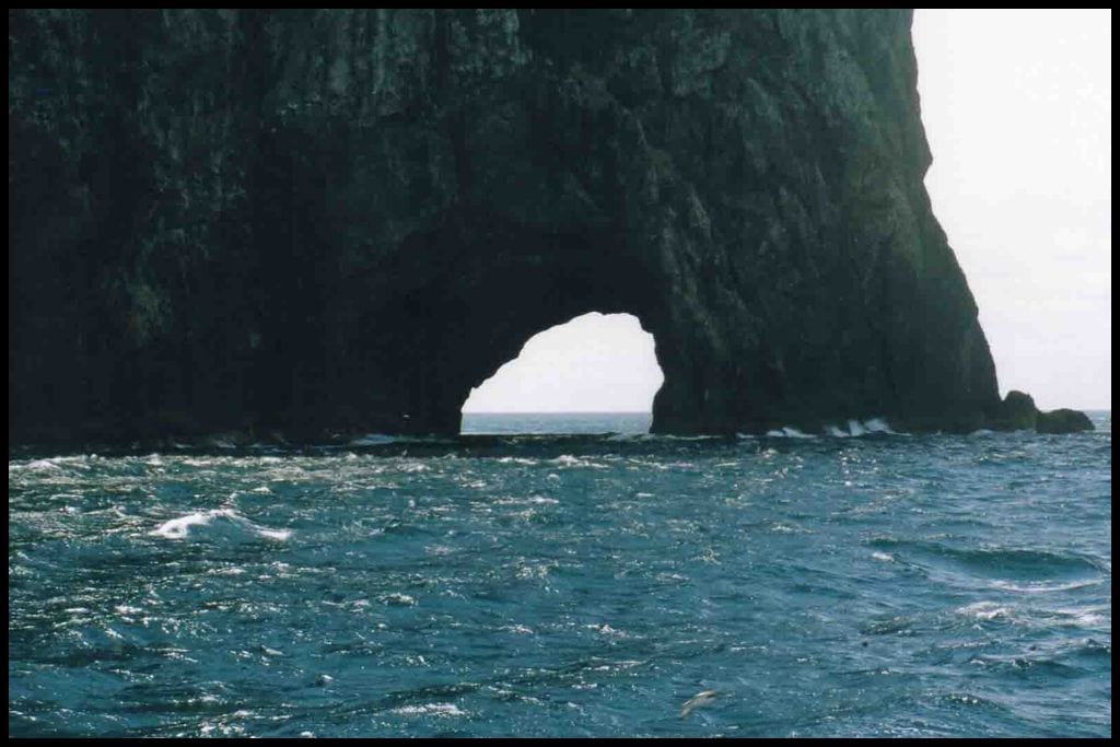
Camping: Campers can stay at nearby Paihia Top 10 Holiday Park and still be very close to Paihia Beach. Go, Because: Go to Paihia Beach for access to boat tours running to and from the Hole in the Rock – a spectacular boat outing during which you are bound to see dolphins! The Hole in the Rock (Piercy Island/Motukokako Island) is on the outskirts of the bay at the tip of the Cape Brett Peninsula. It’s a full day return boat trip out there although there are fast boat options that can get out to the edge of the Bay in an hour and a half.
Something Extra: The Bay of Islands is an excellent place to try a bit of parasailing – give it a go for the best views of the bay! Last Updated: July, 2026.
⛱️ Oke Bay
General Location: Oke Bay is tucked into the Bay of Islands on the North Island’s far north eastern coastline. Nearest Civilisation: Russell is a forty minute drive from Oke Bay (31 kilometres, or 19 miles).
Immediate Surroundings: Oke Bay is located on the Cape Brett Peninsula and is the start point for the Cape Brett Walkway – a rather long trek, and a good one to do as an overnighter! Beach Name: Oke Bay has another name, and it’s Ōpourua, which translates to the “place of two winds”. Getting There: Oke Bay is accessed off Rawhiti Road and requires descending via a steep staircase to reach the sand. Water taxis do operate between Paihia, Russell and Oke Bay, so you can catch a boat there if you do not have the means to drive.
Vehicle Parking: Some roadside parking is available for visitors to Oke Bay, although most people coming through are likely planning to do the Cape Brett Walkway and can pay to park securely at the Oke Bay Lodge.
Walking Options: The Cape Brett Walkway is 33 kilometres return and is an eight hour return trip. The option to stay in the hut at the Cape allows walkers to do it across two days if they wish. You can also just do the first three hours walking in, stay at the hut, and take a ferry out (Deep Water Cove departure point).
Swimming: Oke Bay is shallow, calm, safe and crystal clear – the perfect combination for swimming. Surfing: Breaks at Oke Bay lend themselves to intermediate level surfers. Dogs: Dogs are not allowed at Oke Bay unless they have a permit.
Amenities: Oke Bay has a compositing toilet for public use and a guest lodge with further amenities (Oke Bay Lodge) for paying guests. Camping: Oke Bay Lodge permits campers to pitch a tent on their grounds. Go, Because: Crystal clear water, sparkling white sand .. dolphins! Need I say more?
Something Extra: Sometimes you really can see dolphins from the shores of Oke Bay! If you are not so lucky, jump on a dolphin watching cruise that goes through the Bay of Islands as the likelihood of you seeing them tends to bump up to 90%! Last Updated: July, 2026.
Best Beaches in Hokianga Harbour
Right, back over to the western side of the North Island again! The Hokianga Harbour is home to these next two wonderful beaches, Opononi Beach and Ōmāpere Beach.
⛱️ Ōpononi Beach
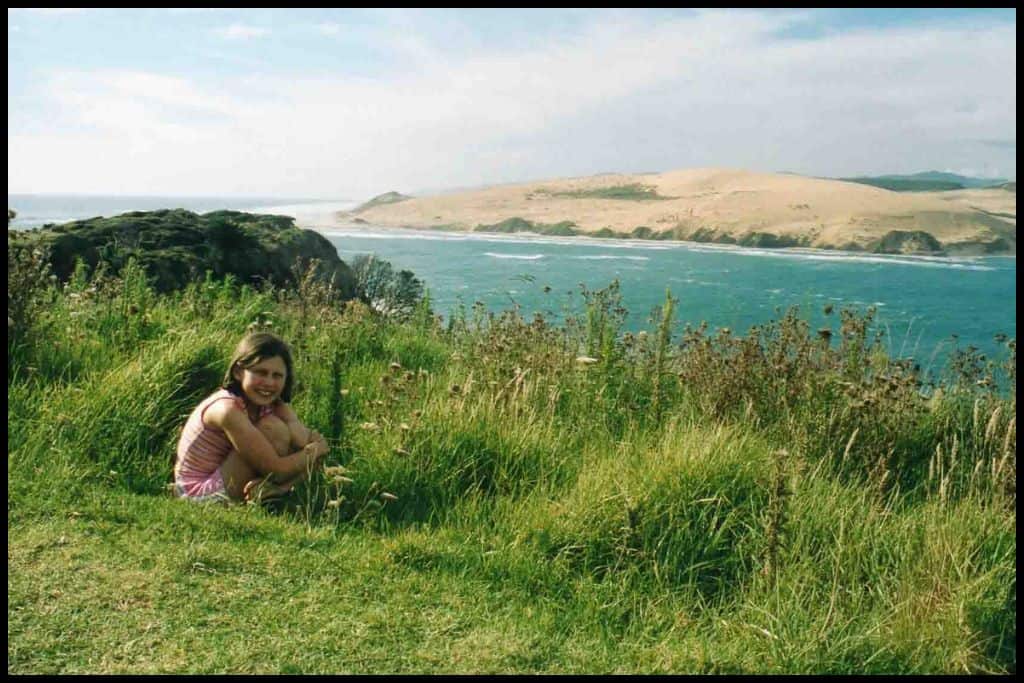
General Location: Ōpononi Beach sits on the western coastline of the top of the North Island. Nearest Civilisation: The town of Ōpononi is just a seven minute drive from Ōpononi Beach, 7 kilometres, or 4.3 miles. Immediate Surroundings: Ōpononi Beach is located at the entrance to the Hokianga Harbour, and faces into the harbour and looks across to the Ōpononi Sand Dunes on the other side.
Beach Name: Ōpononi translates to the “place of the crooked fishing post” and is a nod to the fishing in the harbour area. Getting There: Ōpononi Beach is accessed right off State Highway 12. Vehicle Parking: Yes, vehicle parking is available at Ōpononi Beach.
Walking Options: Just a quarter of an hour’s drive north is the North Island’s answer to the world famous Moeraki Boulders (located in the South Island). These spherical boulders – the Koutu Boulders – can be accessed via the Koutu Boulders Walk (2.5 kilometres, or 1.5 miles), which will take you forty minutes to walk. Swimming: The swimming is very enjoyable at Ōpononi Beach, but it’s not patrolled, so just know your own abilities before you get in.
Surfing: There is no surf at Ōpononi Beach because of its harbourside position. Surf the giant sanddunes across the harbour, instead! Dogs: Dogs need to be on a lead at Ōpononi Beach.
Amenities: Ōpononi Beach has a boat ramp, a wharf, a couple of shops and eateries, toilets, changing rooms, showers and a tap – all right there on or opposite the beach! Camping: Campers are welcome at nearby Ōpononi Beach Holiday Park.
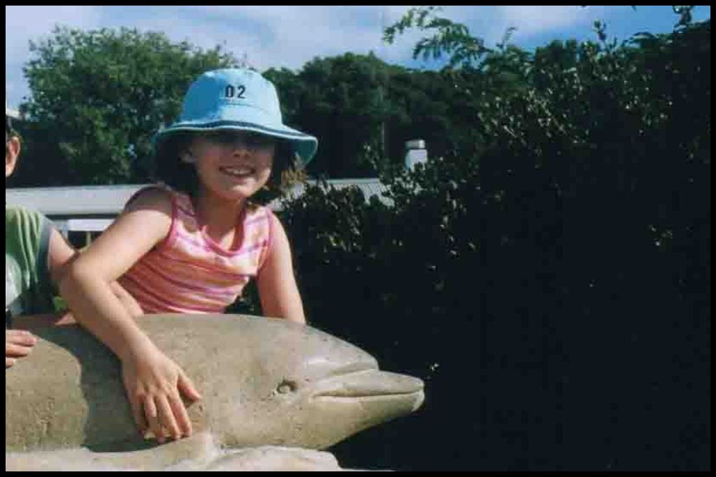
Go, Because: Ōpononi Beach became quite famous in the mid 1950’s when Opo the Dolphin frequented the shores to play with swimmers for two consecutive summers! Ōpononi Beach is also your gateway if you are looking to take a boat trip across the harbour to the giant white sand dunes at North Head – well worth a visit for a spot of sandboarding or dune sliding! Something Extra: Have a look at the statue of Opo the Dolphin, memorialising her and the fun she brought to the summers of 1955 and 1956. Last Updated: July, 2026.
⛱️ Ōmāpere Beach
General Location: Ōmāpere Beach is located a little closer to the Hokianga Harbour mouth than Ōpononi Beach. It’s located on the North Island’s western coast, right up in the Far North. Nearest Civilisation: It’s 4 kilometres (2.5 miles) between Ōmāpere Beach and Ōpononi, the town, just a few minutes drive.
Immediate Surroundings: Ōmāpere Beach is a harbour facing beach and across from the giant sand dunes of the Hokianga Harbour. Offshore is the Mapuna Reef and at the end of the beach is the Signal Station Scenic Outlook. The Arai Te Uru Nature Reserve is close by. Beach Name: Ōmāpere translates to “the place of cutty grass” (māpere).
Getting There: Ōmāpere Beach is also easily accessed from State Highway 12 – that’s the Twin Coast Discovery Highway. Vehicle Parking: Roadside parking is available at Ōmāpere Beach. Walking Options: Walk the fifteen minute loop – Arai Te Uru Heritage Walk – just a six hundred meter loop at the end of Ōmāpere Beach.
Swimming: Ōmāpere Beach is a good swimming beach, but not patrolled so you need to be confident in your own abilities. Surfing: The breaks at Ōmāpere Beach itself are not really strong enough to surf. Dogs: Dogs are welcome at Ōmāpere Beach but need to be on a lead.
Amenities: Ōmāpere Beach has a beachside reserve (Freese Park), toilets, a nearby boat ramp, a wharf, a drinking tap, a playground and picnic areas. Camping: There are no camping options at Ōmāpere Beach specifically. Go, Because: Ōmāpere Beach, the sister settlement to Opononi, namesake to an equally lovely beach is the other gem in the area you simply must visit for more of those views across the harbour to the sanddunes – and more of those West Coast sunsets!
Something Extra: Stop at the roadside Pakia Hill Lookout for expansive views over the townships and harbour! Last Updated: July, 2026.
Best Beaches on the Tūtūkākā Coast
The Tūtūkākā Coast, lying just out from the small city of Whangārei, is a beach destination not to be missed.
⛱️ Sandy Bay
General Location: Sandy Bay lies along the Northland East Coast – thats at the northern end of the North Island, beneath the skinnier part at the top. Nearest Civilisation: The city of Whangārei is a three quarters of an hour drive from Sandy Bay – 34 kilometres, or 21 miles.
Immediate Surroundings: Sandy Bay is tucked away in a whole string of beautiful beaches – from Whananaki Beach, Grahams Bay and Daisy Bay above it, and Woolleys Bay and Whale Bay below it. They face out into the Pacific Ocean. Te Wairahi Stream ends its journey on the beach. This beautiful beach is one of the favourites along the Tūtūkākā Coast.
Beach Name: Sandy Bay shares its name with those on Waiheke Island, on the Coromandel Peninsula, in Auckland city, and in the Abel Tasman National Park – a common name, understandably! Getting There: Sandy Bay is accessed right off State Highway 12 – the Twin Coast Discovery Highway (also known as (Matapōuri Road).
Vehicle Parking: Yes, there is a gravel carpark at Sandy Bay. Walking Options: If you fancy a four hour jaunt, head up from the northern end of Sandy Bay onto the Whananaki Walkway – a four hour return walk up to Whananaki Beach and back that is 12 kilometres (or 7.5 miles). Part of it is along the cliffs so bring a camera for those amazing views!
Swimming: Sandy Bay currents are strong – swim at the southern end, and cautiously, if at all, as there are no lifeguards here. Surfing: The surf is really good at Sandy Bay! World-class. Dogs: Dogs need to be under control at Sandy Bay and are banned during peak hours in summer.
Amenities: There is a toilet, a changing room, and picnic areas at Sandy Bay. Camping: Sandy Bay Glamping is just a couple of minutes walk from the beachfront – treat yourself to a more luxury night! And freedom camping is available at the northern end of neighbouring Woolleys Bay – head south.
Go, Because: First bay not to miss on the Tūtūkākā Coast is Sandy Bay – a favourite spot for surfers! Beautiful sand and water and waves suitable for varying abilities (a world class surfing beach) makes Sandy Bay a fantastic holiday spot.
Something Extra: On the coastal track north you’ll pass it anyway but do have a look at the Bougainville Memorial. Lives were lost in a ship fire and sinking in 1975 and the memorial honours those lost. Last Updated: July, 2026.
⛱️ Whale Bay
General Location: Whale Bay is located on the Northland East Coast – specifically the Tūtūkākā Coastline, beneath the Bay of Islands and above the Auckland regional boundary. Nearest Civilisation: Whangārei is the closest city to Whale Bay – a three quarters of an hour drive – 37 kilometres, or 23 miles.
Immediate Surroundings: Whale Bay faces out into the Pacific Ocean and is tucked into the southern corner of the bigger Woolleys Bay. Whale Bay Headland sits right behind it, separating it from Matapōuri Bay.
Beach Name: Whale Bay was named as historically it was a good, sheltered location to set off whaling – although there is also the story that a telescope was borrowed to identify a mysterious floating object offshore, which turned out to be a deceased whale which was pulled ashore.. Getting There: Whale Bay is accessed on foot! It’s a 15 minute walk from the carpark on the Twin Discovery Highway (Matapōuri Road) – just 500 metres in and 500 metres out.
Vehicle Parking: There is a carpark for Whale Bay, with a fifteen minute walk connecting the carpark to the shoreline. Walking Options: The best one around is the Whale Bay/Matapōuri Loop – also known ass the Matapōuri Headland Loop Track, which connects Whale Bay and Matapōuri Bay. It’s a 5 kilometre (2.5 mile) loop and you’ll need an hour and a half for it.
Swimming: Whale Bay is a secluded little cove with sheltered swimming that drops off gradually. This is a renowned snorkelling beach because it’s so calm and clear. Surfing: There is no decent surf at Whale Bay.
Dogs: Dogs are not permitted at Whale Bay. Amenities: There is a toilet at Whale Bay but little else. Camping: There is no camping at Whale Bay specifically, although you do have options just a little way up the coast each way because of the area’s popularity as a holiday destination.
Go, Because: Whale Bay is a primo spot for snorkelling because of the rocky outcrops at each end. Something Extra: Even if you do not walk the full headland loop, at least pop up to the lookout at the top of the headland! Last Updated: July, 2026.
⛱️ Matapouri Bay Beach
General Location: Matapōuri Bay Beach sits along the Northland East Coast – and, to be more specific, the Tūtūkākā Coastline, which is part of that, and a popular spot for holiday makers. Nearest Civilisation: Aside from the settlement of Matapōuri itself, Whangārei is three quarters of an hour away by car – 37 kilometres, or 23 miles from Matapōuri Bay Beach. (Tūtūkākā is close – but still very small, not even big enough to be considered a village).
Immediate Surroundings: Matapōuri Bay Beach has a couple of access points at the end of the small streets that run between Matapōuri Road and the foreshore. Matapōuri Estuary sits at the southern end of the bay and is a great spot for paddling and swimming. Beach Name: Matapōuri translates to “dark” or “gloomy”, the conditions upon its discovery by Maori.
Getting There: Matapōuri Bay Beach can be accessed on foot from Whale Bay or easily driven up to, by heading along the Twin Coast Discovery Highway (Matapōuri Road). Vehicle Parking: Yes, there is a carpark at Matapōuri Bay Beach.
Walking Options: An alternative to the very recommended headland walk at the northern end of Matapōuri Bay Beach is to drive south a short way (15 minutes, 12 kilometres, 7.5 miles) to the Tūtūkākā Lighthouse for the Tūtūkākā Lighthouse Walkway – there’s a steep staircase down and a low tide crossing over a causeway to Kukutauwhao Island (that is not walkable if you get the tides wrong.) It’s a 2 kilometre (1.2 mile) return wander over to the lighthouse and back, even though the island is only 20 metres off shore (it’s just a bit of a rock hop).
Swimming: The clear water, the colour, the sheltered cove, the gentle gradient, the calm … everything about swimming at Matapōuri Bay Beach is just.. *chefs kiss*! And swimming in the Matapōuri Estuary at the southern end is great, too!
Surfing: It’s too sheltered at Matapōuri Bay Beach for any decent surf to be found. Find world class surf at nearby Sandy Bay, instead! Dogs: Dogs are generally welcome at Matapōuri Bay Beach – and often off lead, but banned entirely during peak hours in summer.
Amenities: Matapōuri Bay Beach has basic toilets, a single shop, and a small playground.
Camping: Freedom campers in self contained vehicles can stay at the end of Wehiwehi Road at Matapōuri Bay Beach. Go, Because: Matapōuri Bay Beach, the third of three of the best beaches on the Tūtūkākā Coast (ranked a world class coastline in the National Geographic Traveller in 2010, is perhaps the most popular of the three. It’s a perfect curve of sand and glistening sea, a favourite holiday spot for many New Zealanders, and has been for generations.
Matapōuri Bay Beach was also the access point to reach the Matapōuri Mermaid Pool. The Mermaid Pool has become quite famous in recent years due to its emerald colour and beauty – strictly a low tide activity, as the sea rushes into the pool at high tide, drawing out the water with considerable pull – but in the last several years the pool has been closed to swimmers anyhow, the reason predominantly being (in my understanding) to protect the ecosystem in the pool from the copious amounts of sunscreen leaching into the water from mermaid wannabes. This is for the foreseeable future at the time of writing.
Something Extra: Matapōuri Bay Beach is another amazing snorkelling destination – pop on a mask, some fins, and enjoy those crystal-clear waters! Tūtūkākā is also the gateway to Poor Knights Islands (and the Poor Knights Islands Marine Reserve) – a world class diving destination, so consider a boat trip out (from Tūtūkākā, which is ten minutes drive south) or to even get certified here! Couldn’t pick a better place in the country for completing your PADI. Last Updated: July, 2026.
Best Beaches in Whangārei Heads
⛱️ Ocean Beach
General Location: Ocean Beach is located on the North Island’s upper eastern coastline, out on the Whangārei Heads Peninsula. Nearest Civilisation: The small city of Whangārei is a three quarters of an hour’s drive (max) and is 35 kilometres (or 22 miles).
Immediate Surroundings: Ocean Beach sits on the Whangārei Heads Peninsula, near the end of it, at the bottom. The peninsula helps to form the inlet that is the Whangārei Harbour (although Ocean Beach is on the outer, ocean-facing coastline. The Ocean Beach Stream makes its way down to Ocean Beach and ends there. At the southern end of Ocean Beach sits Moturaka Island (connected to the mainland) and Tarakanahi Island (immediately behind it). The Bream Head Scenic Reserve sits just south again.
Beach Name: Ocean Beach is named for it’s ocean facing location and shares its name with the ones in Hawkes Bay, Dunedin, Stewart Island, Horowhenua District, Mount Maunganui and Raglan’s main beach. So it’s important to specify with ‘Whangārei Heads’ or ‘Whangārei’ when researching! Getting There: Ocean Beach is accessed off Ocean Beach Road. Vehicle Parking: Yes, there is vehicle parking at Ocean Beach!
Walking Options: The Te Whara Track is a big one, starting at Ocean Beach, and is not for the faint of heart! It’s 7.5 kilometres one-way (4.6 miles) and you’ll need anywhere from four and a half hours to six hours to walk the one way track to Bream Head (it’s best to organise a pick up else you’ll be doubling that for the return walk).
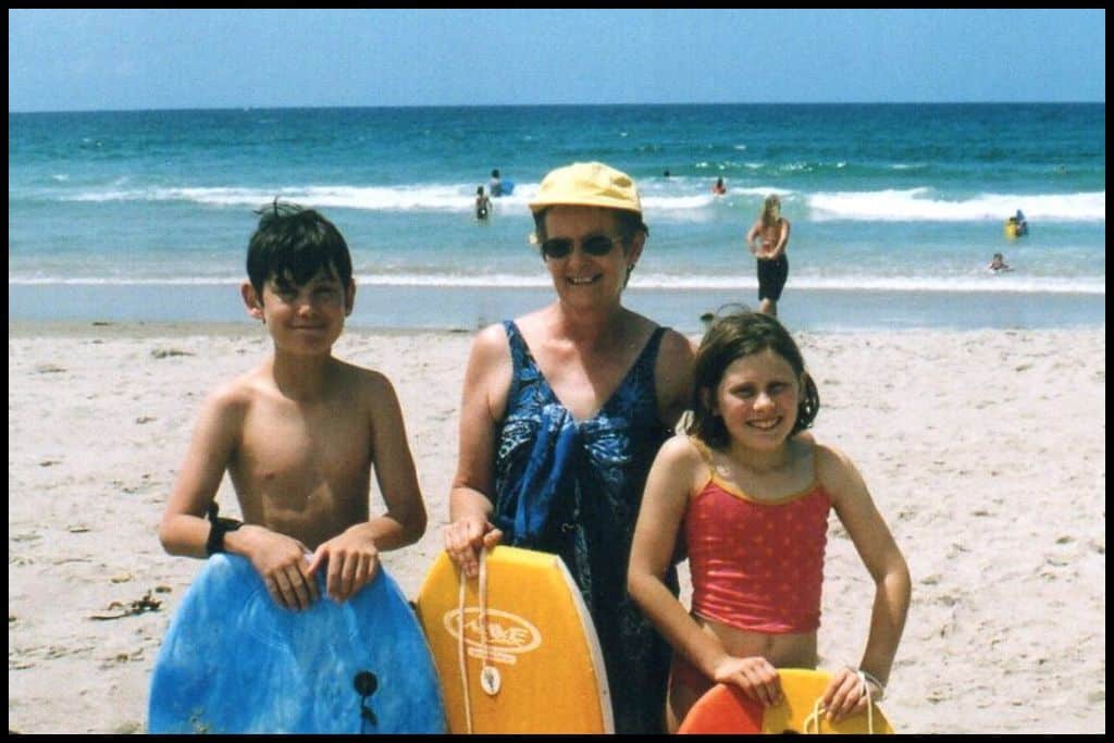
Swimming: Swimming at Ocean Beach is safest when lifeguards patrol during summer – swim, or boogie-board, between their flags and be aware of strong rips. And enjoy! The boogie boarding is so good here. Surfing: Ocean Beach surf caters to surfers of all levels.
Dogs: Dogs are permitted at Ocean Beach – on lead – but keep them away during peak times in summer, away from lifeguard patrol areas, birdlife and the sand dunes. Amenities: Ocean Beach has changing rooms, toilets and a shower but is pretty limited otherwise. Camping: Self contained campers can freedom camp at the Ocean Beach overnight carpark.
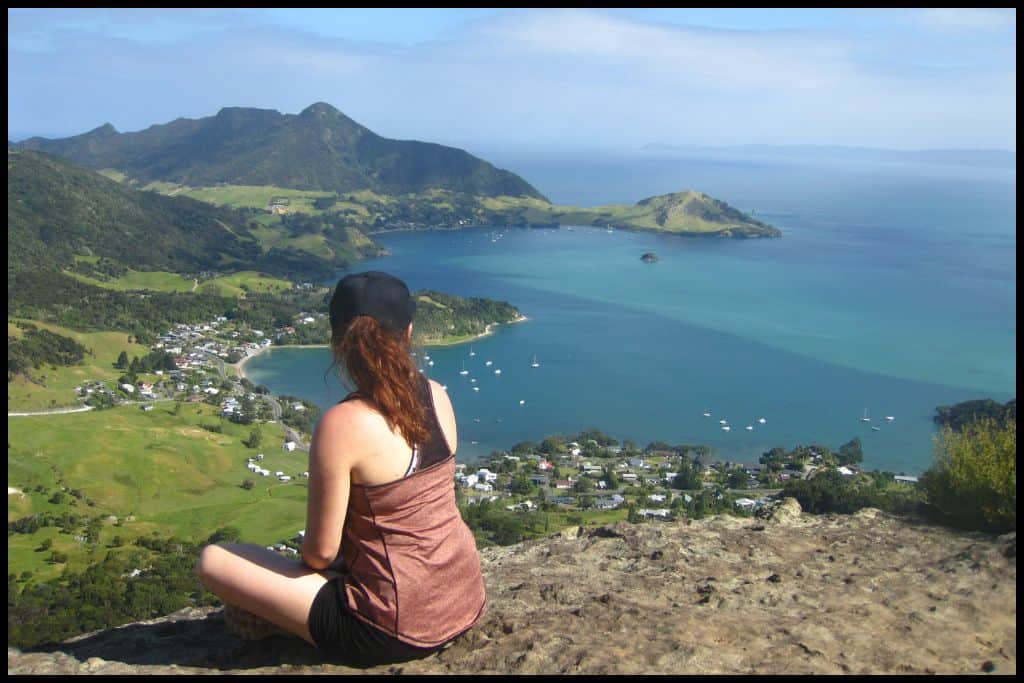
Go, Because: Three quarters of an hour’s drive in a south east direction from the small city of Whangārei will get you to Whangārei Heads, with the prime jewel in the crown here being Ocean Beach. It’s a lifeguard patrolled beach with excellent surf, boogie boarding conditions, and sand dunes to explore. Something Extra: The road out passes by Mount Manaia – the two hour ascent and descent up to these pinnacles leaves you gazing down upon Ocean Beach from above – from 420 metres up – and is so highly recommended (and increasingly insta-famous) if you have the time to do both. Last Updated: July, 2026.
Best Beaches in Bream Bay
I’ve popped Bream Bay down separately as a beach destination in its own right – there are several fantastic beaches within the bay, which all lie just south of Ocean Beach.
⛱️ Ruakākā Beach
General Location: Ruakākā Beach lies on the Northland East Coast, a bit north of the Auckland region. Nearest Civilisation: Aside from the settlement of Ruakākā itself, the small city of Whangārei would be the biggest place of any significance – a half hour drive (30 kilometres, or 19 miles), although the town of Waipū is just twelve minutes drive south (13 kilometres, or 8 miles).
Immediate Surroundings: Ruakākā Beach is contained within the sweeping arc of Breams Bay, and lies south of Whangarei Heads, across the mouth of the Whangārei Harbour. It faces out into the Pacific Ocean and sits south of Marsden Point and the Marsden Point Marina. The mouth of the Ruakākā River forms the Ruakākā Estuary and the Ruakākā Spit – vulnerable shorebirds nest here and it has been given status as the Ruakākā Wildlife Refuge. And the Hen and Chicken Islands are visible on the horizon, 12 nautical miles offshore!
Beach Name: Ruakākā translates to the “burrow/nesting hole of the kākā parrot”. Now an endangered species, plenty of them lived in the forests here until the 1880’s. Getting There: Ruakākā Beach can be accessed directly off beachfront Ruakākā Beach Road. The drive into the settlement can be achieved via Marsden Point Road or State Highway 1 (also known as The Twin Coast Discovery Highway along this stretch).
Vehicle Parking: There is vehicle parking at Ruakākā Beach. Walking Options: A bigger trek you have the option of doing – or just doing part of – is the Bream Bay Walk, which runs down the bay from Ruakākā Beach right down to Waipū Cove. The bay is huge, with sparkly blue water and sparkly white sand, so this is a very scenic coastal track and is part of the nation-long Te Araroa Trail.
The Bream Bay Walk is 22 kilometres and may take you anywhere from four to seven hours, one-way. Organise return transport, turn it into an overnighter, or prepare fo a long day if you are wanting to return to Ruakākā. Swimming: The safest time to swim at Ruakākā Beach is when lifeguards patrol over summer.
Surfing: Surf at Ruakākā Beach caters to all levels of surfer. Dogs: Dogs have a zone on Ruakākā Beach where they can be off lead any time of day, any time of year, so is a great one to take furry friends to. Amenities: Ruakākā Beach has toilets, changing rooms and showers, Princes Road Boat Ramp (in the estuary), a beachside playground with picnic areas and barbecues to use, and a café next to the surf club, with lots more amenities (stores and eateries) very close by in the town centre of Ruakākā.
Camping: Freedom campers can stay in designated spaces at Ruakākā Beach, and non self contained campers can use the beach adjacent Ruakākā Beach Holiday Park! Go, Because: Ruakākā Beach is a great all rounder – swimming, surfing, and ticking the boxes for beauty and being patrolled by lifeguards. Something Extra: Don’t neglect to spend time near the Ruakākā river mouth and estuary, home to native birdlife and a pleasant spot to paddle around, as my hubby and I did one evening on Easter Weekend in 2018.
Last Updated: July, 2026.
⛱️ Uretiti Beach
General Location: Ureititi Beach is located on Northland’s East Coast, nearing the bottom of the Northland Region. Nearest Civilisation: The city of Whangārei is a half hour drive from Uretiti Beach, 33 kilometres, or 21 miles. Smaller, but closer, is the town of Waipū, six minutes south (6 kilometres, or 3.6 miles).
Immediate Surroundings: Ureititi Beach is contained within the gorgeous Bream Bay, south of Ruakākā and the Ruakākā River Mouth, but north of Waipū and the Waipū River Mouth. It faces out into the Pacific Ocean, with the Hen and Chicken Islands visible on the horizon, 12 nautical miles out, and Uretiti Recreation Reserve forms the expansive area beyond the sand dunes where there is abundance of walks and tent sites. Beach Name: The name Uretiti is thought to refer to the site being a breeding ground for mutton birds, historically.
Getting There: Uretiti Beach is reached from the end of an unsealed road (which comes off the main highway), and then you should expect a fifteen minute walk over the dunes to the shore (1.5 kilometres, or a mile). Vehicle Parking: Parking is available at Uretiti Beach for day visitors, separate from the campsite vehicle parking.
Walking Options: From Uretiti Beach, choose if you would like to venture north to Ruakākā Beach, 11 kilometres (or 7.5 miles) return trip along the sand (a three hour walk). Or, head south to Waipū Cove, a longer walk if you are looking at return (18 kilometres, 11 miles, five hours return). Both are part of the Te Araroa Trail that runs the length of the country, and both are part of the Bream Bay Walk that connects all the beaches in the bay.
Swimming: No lifeguards patrol at Uretiti Beach, so while the water can be inviting, it can also be full of strong rips, and swimming at one of the neighbouring beaches with patrols is the safer option). Surfing: Uretiti Beach surf caters to all levels of surfers, but again, confidence is key as there is no lifeguard patrol here. Dogs: Parts of Uretiti Beach are fine for dogs off lead all year round, all day long, although they need to be off the main part of the beach and campground area in peak times during the Christmas Holidays (which is only half of the summer, and not quite as long of a ban as on beaches further north in this list).
Amenities: Basic toilets are available for day visitors to Uretiti Beach, but very little else. Camping: The Department of Conservation operates the beachside Uretiti Beach Campsite.
Go, Because: Facing directly east, Uretiti Beach is in prime position for beautiful coastal sunrise views. It also is a much loved surfing beach, and arguably the top spot in the country for naked bathers, being somewhere that this is permitted (south of the campground).
Something Extra: You can take an abundance of tuatuas (shellfish) from Uretiti Beach – 150 per person, per day, if you forage at low tide in the wet sand with your toes and dig down. Last Updated: July, 2026.
⛱️ Waipū Cove
General Location: The stunning Waipū Cove is located on the east coast of Northland region, as we head south approaching the boundary with Auckland Region. Nearest Civilisation: Waipū Cove a ten minute drive from the town of Waipū (9 kilometres, or 5.5 miles).
Immediate Surroundings: Waipū Cove is tucked into the beautiful big stretch of Bream Bay. Located on the beach is the mouth of the Waipū River, which forms the Waipū Estuary, and the area known as the Waipū River Mouth Wildlife Refuge Area, which protect marine life – eels and shellfish, as well as a wide range of coastal birdlife. The Hen and Chicken Islands are visible and located 12 nautical miles out to sea. Beach Name: Waipū translates to mean “sediment in the water” and refers to the river sediment that can wash into the sea here.
Getting There: Waipū Cove is accessed along Cove Road, which leads out of town (the town is just off State Highway 1). Vehicle Parking: Vehicle parking is available at Waipū Cove.
Walking Options: I would absolutely recommend the stunning Waipū Coastal Walkway. Ladders, staircases and steep cliffs make it unsuitable for young ones, however. Low tide is the best time to go unless you want to get wet up to your knees in parts. It’s 1.5 to 2 hours walk up to neighbouring Langs Beach, and double that for the return trip (5 kilometres return, or 3 miles).
Swimming: Swimming at Waipū Cove is amazing. The waves are gentle and fun, and lifeguards patrol during summer. A tributary of the river runs parallel to the sea behind the sand as provides a safe and sheltered paddling spot, too.
Surfing: Waipū Cove has a surfing school and is a great place for beginners to learn because of how gentle it is. (I got to have a go here in 2015 and found it a lot easier than Raglan!) Dogs: Dogs can be on Waipū Cove Beach outside of the summer holidays and must be kept away from bird life, sand dunes, the estuary and the wildlife refuge at all times. Amenities: Waipū Cove has toilets, changing rooms, showers, barbecues, a picnic area, a playground, a general store, a surf school, and the surf life saving club.
Camping: So close to shore is Camp Waipū Cove, a great option for campers. A cheaper option is the Waipū Caves Farm Park (but it’s back up toward town, across the highway, and further inland again, making it a 25 minute drive from the beach – 19 kilometres, or 12 miles). I have fond memories of camping here when I was 19 however, so I am including it as a great, affordable option (especially with the cave network right there!)
Go, Because: Beloved Waipū Cove was the winner of the 2025 Best Family Beach and Best Camping Beach awards and is also known for hosting IRB (inflatable rescue boat) championships each year. I have thoroughly enjoyed several beach days at the cove, and, during a week long camping trip here in 2015 I also loved exploring the Waipū Cave system at the Waipū Caves Scenic Reserve.
The first 100 metres are pretty beginner friendly for anyone to go and explore. We had a group and a guide so went further in where it narrowed, which I loved as a teenager but I shudder to think of doing it now, and I don’t think I would cope! All sorts of hazards present in cave networks so take on local advice, advise of plans, and go with others.
Something Extra: Plan to not only swim at the cove but visit the Waipū Caves Farm Park, the caves, walk the Waipū Coastal Walkway, or see the Waipū pancake limestone rocks! The pancake rocks are accessed from the coastal walkway and are the North Island’s answer to the more famous Punakaiki Pancake Rocks in the South Island. Last Updated: July, 2026.
⛱️ Langs Beach
General Location: Langs Beach is on Northland’s East Coast, just near the bottom of the region. Mangawhai Heads, just below, serves as the boundary. Nearest Civilisation: Mangawhai and Waipu are both 15-20 minutes drive away, depending on which direction you are coming in from – both 13 kilometre (8 mile) trips.
Immediate Surroundings: Langs Beach is the southernmost beach in Breams Bay and faces out into the Pacific Ocean. The Waipu Coastal Walk connects Langs Beach with Waipu Cove. South of Langs Beach is Bream Tail, the name for the headland separating Langs Beach from Mangawhai Heads. Langs Beach Scenic Reserve occupies the area, also, and offshore (12 nautical miles) you can see the Hen and Chicken Islands.
Beach Name: Langs Beach is the namesake for early settler William Lang, who purchased land here in 1856. Getting There: Langs Beach is accessed from further down Cove Road, that runs past Waipu Cove.
Vehicle Parking: Roadside parking is available at Langs Beach.
Walking Options: Langs Beach Scenic Reserve Walk is an hour’s loop spanning 3 kilometres (1.5 miles) return trip. Swimming: There’s beautiful swimming at Langs Beach but it does not have a lifeguard patrol, so opt for neighbouring Waipu Cove or Mangawhai’s Main Beach – it’s much safer there!
Surfing: Decent breaks can be found for those wanting to surf at Langs Beach – but better at Mangawhai, really, to the south. Dogs: Dogs can be off lead at Langs Beach but are banned entirely from being on it during peak hours in the Christmas Holidays (six weeks of the summer period). Amenities: Langs Beach has toilets and changing rooms, a set of swings, and an icecream truck during summer (Zippy’s).
Camping: There is nowhere to camp at Langs Beach specifically – go north or south for some great options in Breams Bay or Mangawhai Heads. Go, Because: Langs Beach shares the beauty of the other beaches in Breams Bay but is one of the quieter beaches in comparison. During weekends in summer, Zippy’s food truck cafe parks up offering coffees and real fruit icecreams to beach goers in search of a treat.
Something Extra: Spot the Hen and Chicken Islands offshore (12 nautical miles). Boaties can travel out there (but not land there), and keen divers can get under the surface to enjoy the marine life! Last Updated: July, 2026.
⛱️ Mangawhai Heads Surf Beach
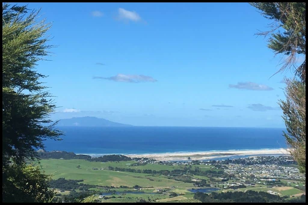
General Location: Gorgeous Mangawhai Heads Surf Beach, aside from Te Arai and Langs Beach, is the main surf beach for the area. It’s on Northland’s eastern coastline and the southern end is across the boundary, in the Auckland region. Nearest Civilisation: It’s an eleven minute drive (7 kilometres, or 4.3 miles) between Mangawhai township and the beach.
Immediate Surroundings: Mangawhai Heads Surf Beach looks out into the Pacific Ocean. At the southern end is the Mangawhai River Mouth and Mangawhai Estuary – and Sentinel Rock, marking the entrance – popular with fishermen after blue cod, snapper, kingfish and kahawai! Mangawhai Heads Reserve occupies some of the area beyond the beach.
Beach Name: Mangawhai translates to “stream/river of the stingray”. Names Mangawhai Surf Beach and Mangawhai Heads Beach all refer to the same beach. Getting There: Surf Road, Wintle Street and Tangaroa Roads provide access to Mangawhai Heads Surf Beach. Vehicle Parking: Vehicle parking is available at Mangawhai Heads Surf Beach, with a wooden staircase leading down to the sand.
Walking Options: The Mangawhai Cliffs Walk, leaving from the northern end of Mangawhai Heads Surf Beach is a must! The views are stunning – and you’ll get great ones after the first 20 minutes (a steep ascent) if that’s as far as you want to go. The whole trail is three hours (8 kilometres, or 5 miles return – it’s a loop).
Swimming: Definitely swim at Mangawhai Heads Surf Beach – or boogie-board! Lifeguards patrol in summer and its best to go in when they are on duty.
Surfing: If the name wasn’t a hint already, Mangawhai Heads Surf Beach has fantastic surf catering to all levels. Beginner surfers would do well to stay closer to shore, while more advanced surfers can head out onto the bar or around Sentinel Rock. Dogs: There are some off lead areas for dogs at Mangawhai Heads Surf Beach but its popularity as a beach amongst Aucklanders, visitors and locals alike means that they are generally required to be on lead – and off the main part of the beach during peak times in summer.
Amenities: Mangawhai Heads Surf Beach has showers, toilets and changing rooms, often a coffee and/or icecream truck or two parked there in summer, a surf life saving club, a surf gear shop, the adjacent estuary with jetty and boat ramp, and a kids play area a few minutes drive away (Mangawhai Activity Zone). The zone is a big facility with pump tracks, a playground, a skate park, tennis courts, soccer field, netball and basketball courts, a forest walk and bike trail – all within 2 kilometres (1.2 miles) of the shoreline!
Camping: The best camping is to be had at Mangawhai Heads Holiday Park, not far from the beach. Go, Because: Mangawhai Heads is a very popular spot, for very good reason. The surf beach is fantastic, but swimmers and boogie boarders will also enjoy the waves very much under the watchful eye of the lifeguards that patrol in summer. The Mangawhai Cliffs Walkway is a fantastic trek along the cliff tops offering spectacular views and just the right amount (three hours) of exercise!
Something Extra: Head into the harbour and on the side you’ll find the Mangawhai Sand Dunes (and sandspit) – these dunes are about 100 metres high and can be sledded down, which is such fun, so bring something to slide upon! The dunes are also home to lots of native bird life (so keep your doggies out of the dunes). Access to the dunes can be via walking or paddling across the estuary, as a group of us enjoyed doing during summer camp in 2009. Last Updated: July, 2026.
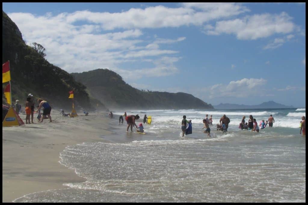

Whether you’re chasing quiet hidden bays, postcard-perfect white sand, or that feeling of being in the tropics, Northland arguably delivers some of the most unforgettable beaches in the country. Slow down, explore as much as you can, and soak up all the coastal goodness you’ll find here.