Where Are The Best Beaches In Marlborough, New Zealand?
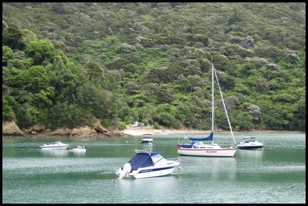
One fifth of New Zealand’s total coastline winds its way through Marlborough — mostly accounted for by the Marlborough Sounds with its countless bays, inlets, and sheltered coves. This region specialises in calm, beautiful coves – perfect for swimming, boating, and fishing. Here are the best bits of coastline in Marlborough.
Best Beaches near Blenheim
Blenheim has a beach which is an absolute local favourite – and it’s Whites Bay. Add it to the itinerary if you are in town!
⛱ Whites Bay / Pukatea
General Location: Whites Bay is located in the top, right hand corner of the South Island, in the Marlborough region. It is northeast facing, just south of the sounds. Nearest Civilisation: The nearest town is Rārangi, a very small town, just a 10 minute drive away (8 kilometres, or 5 miles). Immediate Surroundings: Pukatea / Whites Bay is tucked into the northern curve of the wider Cloudy Bay (Te Koko o Kupe) – which means “Kupe’s oyster dredge”.
Beach Length: Pukatea / Whites Bay is just a small cove, not a big beach at all. Beach Name: The European name for the bay, Whites Bay, is after Black Jack White, who settled in the bay in 1828 (he was a whaler) and the Maori name, Pukatea, is after the pukatea tree. The official name for the bay is inclusive of both (“Pukatea/Whites Bay”) and has been so since 2014.
Don’t confuse this beach with Te Pukatea Bay, which is a separate bay in the Abel Tasman National Park. Getting There: From Rārangi, not far out of the bigger town of Blenheim, you need to drive over the Rārangi Hill to access Pukatea / Whites Bay. Vehicle Parking: Pukatea / Whites Bay has a big, free, vehicle parking area.
Walking Options: At Pukatea / Whites Bay you can walk the Pukatea Walk, which is 10-15 minutes, and is 1 kilometre long (0.6 miles). Included on this walk is the Whites Bay Lookout. Swimming: Whites Bay is a beloved swimming spot with gentle conditions.
Surfing: The waves are not suitable for surfing at Whites Bay (head to Rārangi Beach instead). Dogs: No dogs at Pukatea / Whites Bay (take them to nearby Rārangi Beach instead). Amenities: Pukatea / Whites Bay has cold showers, toilets and a picnic area.
Camping: Yes! The Department of Conservation has the Whites Bay Campsite here. Go, Because: Go, because Whites Bay is safe, and it’s sheltered, so very family friendly!
It also is the site of the Whites Bay Cable Station, and has historic telegraph ruins that are protected by the Department of Conservation. Historically (in 1866), a telegraph cable was laid on the sea bed of the Cook Strait so that the North and South Islands could be connected with a means of communication, (amazing!) and this was where one of the cable stations for it was located.
Something Extra: Head along the Pukatea Bushwalk track at night to see the glow worms. Also make sure you have a look at the Whites Bay Rock Arch at the end of the beach – accessible at low tide but visible at all times. Last Updated: April, 2026.
Best Beaches near Picton
Picton, where the ferries come into port from across the Cook Strait, has lots of coastline but one beach in particular that everyone flocks to for a good time swimming.
⛱ Shelley Beach
General Location: Shelley Beach is a tiny little beach at the end of the Picton Harbour, at the top of the South Island. Nearest Civilisation: Shelley Beach is actually in downtown Picton, so very walkable from the town centre. Immediate Surroundings: Shelley Beach is inside the Picton Harbour, just across from the marina bridge.
Beach Length: Shelley Beach is a very short little beach just at the downtown end of the harbour. Beach Name: Shelley Beach goes by the Shelly Beach spelling interchangeably. Not to be confused with Shelley Beach on the Coromandel Peninsula in the North Island.
Getting There: From downtown Picton, Shelley Beach is a short walk (toward the marina). Vehicle Parking: There’s limited parking at Shelley Beach. Pay for a park in the CBD or marina and go the rest of the way on foot.
Walking Options: From Shelley Beach you can walk over to Bob’s Bay, which is 20 minutes one way (1 kilometre long, or 0.6 miles). Swimming: Swimming is safe and enjoyable at Shelley Beach.
Surfing: Shelley Beach is a harbour beach and not suitable for surfing. Dogs: Dogs are prohibited from the sandy area of Shelley Beach, but can walk to Bob’s Bay with you if on a lead. Amenities: Shelley Beach is a downtown beach, so there is access to all sorts within a short walk.
Camping: You cannot go camping at Shelley Beach, being a downtown beach. Go, Because: Go, because there is safe swimming and easy access here.
Something Extra: Head out onto the water on a boat, kayak or paddleboard to enjoy Shelley Beach fully. Last Updated: April, 2026.
Best Beaches in Queen Charlotte Sound
Queen Charlotte Sound is one of three sounds in Marlborough. These sounds are kilometres upon kilometres of coastline, so I can hardly mention even a fraction of the little beaches, bays and coves here, but four of the most notable would be these next four.
⛱ Governors Bay
General Location: Governors Bay is tucked in toward the head (inner end) of Queen Charlotte Sound – the sound that the Cook Strait inter-islander ferry comes through (but a little further in). Nearest Civilisation: Governors Bay is closest to the port town of Picton, where the ferry docks. It’s a 15 minute drive away (9 kilometres, or 5.5 miles).
Immediate Surroundings: Governors Bay is down at the head of Queen Charlotte Sound. Beach Name: Governors Bay is distinct from Governors Bay on the Banks Peninsula in Canterbury region.
Getting There: From Picton, you can drive to Governors Bay via Queen Charlotte Drive. You’ll need to walk 10 minutes down to the beach. Vehicle Parking: There’s a little bit of offroad parking for Governors Bay, but there’s not much and you have to ensure you will not block traffic who are using this windy, gravel road.
Walking Options: The Governors Bay Track is a 10 minute walk to the beach, from the road. Swimming: Be sure to enjoy a swim in the calm waters of Governors Bay.
Surfing: There is no surf at Governors Bay. Amenities: There are long drops and a picnic area at Governors Bay. Camping: You cannot go camping at Governors Bay. Go, Because: Go, because Governors Bay is a delightfully pretty spot for a picnic and a swim.
Something Extra: Consider walking or cycling part of – or all – of the Queen Charlotte Track, which runs between Anakiwa and Ship Cove. Last Updated: April, 2026.
⛱ Anakiwa / Thompsons Bay
General Location: Anakiwa / Thompsons Bay is tucked away within the Marlborough Sounds, the entry point for the inter-islander ferry crossing between the North and South Islands. Nearest Civilisation: Anakiwa refers also to the coastal village located within Thompsons Bay, so they are virtually interchangeable. Anakiwa village is the closest civilisation to the bay.
Immediate Surroundings: Anakiwa / Thompsons Bay is located on the opposite shoreline to Governors Bay, at the head of Queen Charlotte Sound. Beach Name: Anakiwa translates to Cave of Kiwa, guardian of the ocean. There is also a Thompson (NB not Thompsons) Bay in Pelorus Sound, and they are different beaches, so not to be confused.
Getting There: You can access Anakiwa by road or by water taxi. Vehicle Parking: There is some places to park for free in the village of Anakiwa, not far from the beach – but parking is limited. Walking Options: Anakiwa is the trailhead for the multi-day Queen Charlotte Track! Walk a little, or a lot.
Swimming: There is a jetty and a pontoon at Anakiwa and the swimming is very safe there. Surfing: There is no surf in the Marlborough Sounds. Amenities: Green Caravan Café operates at Anakiwa in peak season, and there are public toilets in the village, too.
Camping: Self-contained camping is on offer at the village green in Anakiwa. Go, Because: Go, because this is a great place to experience the clear, beautiful waters of Queen Charlotte Sound. Something Extra: Consider taking watercraft out onto the water or bringing a bike – the Queen Charlotte Track is open to cyclists, too. Last Updated: April, 2026.
⛱ Umugata / Davies Bay
General Location: Umugata / Davies Bay is part of the Marlborough Sounds, sitting up the northern end of the South Island of New Zealand. Nearest Civilisation: The nearest civilisation of any significance is the port town of Picton, from where you can take a water taxi to Umugata / Davies Bay.
Immediate Surroundings: Umugata / Davies Bay is contained within the coastline of Queen Charlotte Sound. Beach Name: The Davies were a local family at some point in the history of the settlement of Queen Charlotte Sound.
Getting There: Access to Umugata / Davies Bay is via the multiday Queen Charlotte Track, or by water taxi. Vehicle Parking: There is no vehicle parking at Umugata / Davies Bay – walk here, or boat here. Walking Options: Umugata / Davies Bay lies along the Queen Charlotte Track – Anakiwa, the trailhead, is two hours away on foot.
Swimming: The swimming is fantastic at Umugata / Davies Bay. Surfing: There’s nowhere to surf in the Marlborough Sounds. Amenities: There are basic amenities at the campsite at Umugata / Davies Bay.
Camping: The Department of Conservation operates the Davies Bay Campsite. Go, Because: Go, because, like many bays in the sounds, the water is beautiful and calm, and the bay is incredible scenic. Umugata / Davies Bay is further up the Queen Charlotte Track and consequently a little less visited than those closer to Picton.
Something Extra: Water skiiers love Umugata / Davies Bay because it is so shallow. Last Updated: April, 2026.
⛱ Ship Cove / Meretoto
General Location: Ship Cove / Meretoto is at the northern end of the Marlborough Sounds, right on the upper fringe of the South Island. Nearest Civilisation: The nearest civilisation to Ship Cove / Meretoto would be the port town of Picton, but it is still an hour away by boat. Immediate Surroundings: Ship Cove / Meretoto is up at the mouth – the entrance – to Queen Charlotte Sound.
Beach Name: Ship Cove was named by Captain Cook, first European to set foot in New Zealand – and he named the cove such because it was a good place to anchor for boat repairs and they spent some time there across a few different visits. Getting There: Ship Cove / Meretoto is the endpoint for the multi-day Queen Charlotte Track – so you can walk or bike there from anywhere along the trail prior to it, or just catch a water taxi directly there. You cannot drive there.
Vehicle Parking: You cannot access Ship Cove / Meretoto by road so there is no parking there. Walking Options: Walking options from Ship Cove / Meretoto include hiking to Resolution Bay and/or Endeavour Inlet (2 hours and 6 hours respectively).
Swimming: Swimming is amazing at Ship Cove / Meretoto because the water is so clear. Surfing: You won’t find anywhere to surf in the Marlborough Sounds. Amenities: Toilets can be found at Ship Cove / Meretoto.
Camping: You cannot camp at Ship Cove / Meretoto. Go, Because: Go, because Ship Cove / Meretoto is one of incredible beauty, has a nearby waterfall, beautiful clear waters, and lots of native bush. You may also see penguins and seals!
Something Extra: Many visitors to the area opt for a scenic cruise of Queen Charlotte Sound – we went when I was sixteen and it is a worthwhile day out! I remember the dolphins best of all – they swam with the helm of the boat for some of the day. Don’t miss the monument to Captain Cook, or the small track down to the stream where he used to brew beer. Last Updated: April, 2026.
Best Beaches in Kenepuru Sound
Kenepuru Sound is the second of the three Marlborough Sounds. These next two bays are really quite special.
⛱ Cowshed Bay
General Location: Cowshed Bay is located in the Marlborough Sounds up the top end of the South Island. Nearest Civilisation: The closest place to Cowshed Bay of any significance is the port town of Picton, still an hour away by boat, or an hour and a quarter by road.
Immediate Surroundings: Cowshed Bay is hidden away within Kenepuru Sound – the second of the three Marlborough Sounds. Beach Name: Cowshed Bay is named for the cowshed there!
Getting There: Cowshed Bay is also along the multi-day Queen Charlotte Track, so can be accessed by the track on foot, or by water taxi. You can drive there from Picton – it’s an hour and a quarter (50 kilometres, 31 miles). Vehicle Parking: There is some parking at Cowshed Bay – self contained vehicles can stay at the campsite, too.
Walking Options: From Cowshed Bay you can continue along the Queen Charlotte Track in either direction; Davies Bay / Umugata is just 1-2 hours away on foot. Swimming: Swimming is amazing in the clear waters of Cowshed Bay. Surfing: There is no surf to speak of at Cowshed Bay.
Amenities: Toilet, cooking and picnic facilities can be found at Cowshed Bay. 200 metres away is the Portage Resort, which has a restaurant (that walk is called the Portage Walk). Camping: There is a Department of Conservation campsite right on the beach at Cowshed Bay.
Go, Because: Go, because Cowshed Bay is so peaceful and safe for swimming in – and the accessibility from the Queen Charlotte Track is a major plus. Something Extra: Your something extra is to head down to the Portage Resort for a drink – or consider staying there a night to make full use of their facilities – a pool overlooking the bay, and free kayak and paddleboards to use. Last Updated: April, 2026.
⛱ Double Bay
General Location: Double Bay is located in the Marlborough Sounds, right up the top of the South Island. Nearest Civilisation: While Queen Charlotte Sound has Picton, it’s Havelock that is the gateway to Kenepuru Sound. Havelock to Double Bay can be driven via the Kenepuru Road, but it’s a two and a half hour journey (70 kilometres, 43 miles). It’s half an hour from Havelock by boat (and three quarters of an hour from Picton by boat).
Immediate Surroundings: Specifically, Double Bay is located within Kenepuru Sound, the second of the three Marlborough Sounds. The peninsula that extends north that separates the water into Queen Charlotte Sound and Kenepuru Sound is the stretch of land that the Queen Charlotte track covers, so frequently, walkers and cyclists can head down the hill in either direction, toward either sound (off the main track).
Beach Name: Double Bay got its name for having two distinct parts to the beach. Getting There: You can drive to Double Bay from either Havelock or Picton, or you can take a water taxi from either town.
Vehicle Parking: There is only a small, unsealed area for parking at Double Bay. Walking Options: Enjoy the double arc of Double Bay fully by walking the length of the bay. Swimming: Definitely enjoy a swim during your time at Double Bay. The water is so clear in the Marlborough Sounds.
Surfing: Double Bay is not a surfing bay.
Amenities: Toilets and picnic tables are available at Double Bay. Camping: Camping is not permitted at Double Bay. Go, Because: Go, because Double Bay has an amazing array of seafood that can be caught and collected and enjoyed – but it also has a glow worm grotto and the bay is one such bay where bioluminescence can be seen in the water after dark!
Something Extra: A lovely place to stay in remote Double Bay is Hopewell Lodge – they have fishing gear and dinghies you can take out, and they can point you in the direction of the glowworms, the shellfish you can go out and collect, and the bioluminescence you may get to see on the water at night! Last Updated: April, 2026.
Best Beaches in Pelorus Sound
Pelorus Sound is the third of the three Marlborough Sounds and, if you are visiting, Titirangi Bay is particularly worthwhile, albeit remote.
⛱ Titirangi Bay
General Location: Titirangi Bay is northfacing on the outskirts of the Marlborough Sounds at the top of the South Island – very north, and very isolated! Nearest Civilisation: The nearest place of any significance to Titirangi Bay is the port town from Picton, at the head of Queen Charlotte Sound (that means it’s down the bottom of it). You can access Titrangi Bay by road – but it’s a two hour drive (three hours from Nelson, the main city in the neighbouring Tasman region).
Immediate Surroundings: Titirangi Bay is part of the Pelorus Sound coastline, the third of the three (and the westernmost) sound in the Marlborough Sounds. Beach Name: I believe Titirangi translates to “edge of heaven” or “edge of the sky” which explains why it is often given as a name to places on the edge of others.
Getting There: You can access Titirangi Bay via Titirangi Road – a long, winding road up there. The last hour of the drive is all unsealed. Check the size of your vehicle as bigger campervans are discouraged from this route. Sometimes this access is only for the general public on weekends – so also worth checking.
Vehicle Parking: There is paid parking available at the campsite at Titirangi Bay. It’s paddock parking up there. Walking Options: There aren’t ample walking track options at Titirangi Bay but do walk the length of the bay! Swimming: There is excellent swimming at Titirangi Bay.
Surfing: There is no surfing at Titirangi Bay. Amenities: You can find toilets (flushing ones!) and cold showers at Titirangi Bay. Camping: The campground at the bay is called Titirangi Farm Campground – a privately owned campground.
Go, Because: Go, because Titirangi Bay is beloved by fishermen – especially for the abundance of blue cod here. Something Extra: Make sure you get the chance to view Titirangi Bay from above – there are lots of little lookout spots, which I would really recommend making use of. Last Updated: April, 2026.
Marlborough’s coastline feels a little different to the rest of the country’s — quieter, more secluded, and often only reached with a bit of a journey. But that’s exactly the appeal of it! Add one or two – or all! – of these to the bucket list and get planning!