Where Are The Best Beaches In Southland, New Zealand?
Southland is home to some of New Zealand’s most remote and yet most remarkable beaches; dramatic coastlines meet ancient history, amazing wildlife, and vast, open stretches of sand. From fossilised forests and sea caves in the Catlins Coastal Area, to the sweeping surf in Invercargill, and the lesser visited shores of Stewart Island, this is a region full of wonderful coastal experiences.
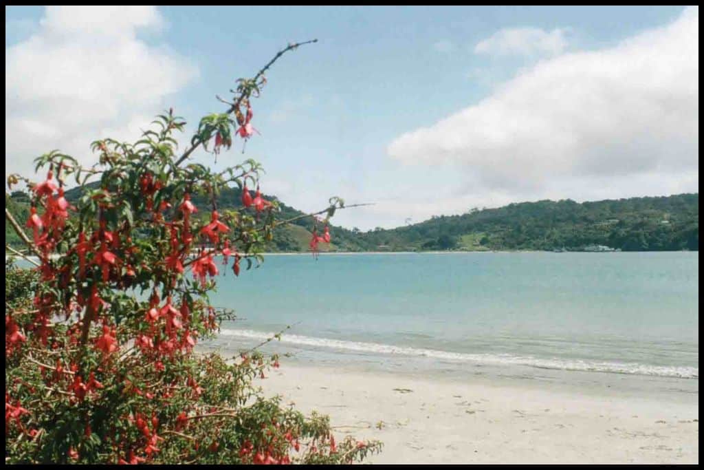
Best Beaches in the Catlins Coastal Area
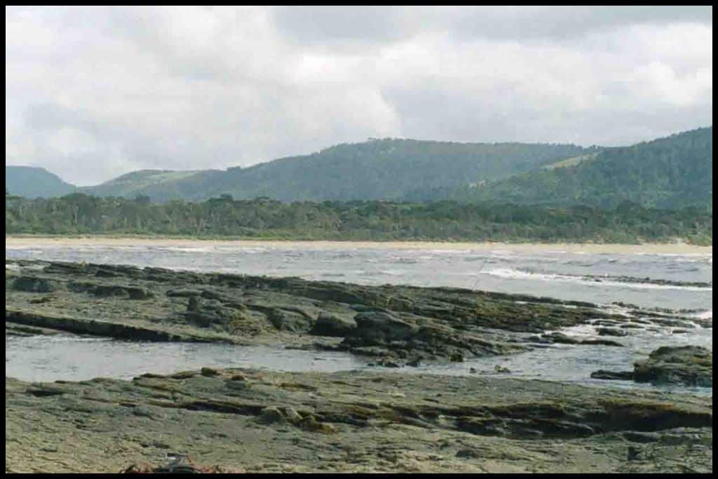
⛱ Waipati Beach
General Location: Waipati Beach lies on the southernmost coastline of New Zealand’s South Island, in the southeastern corner of the island. Nearest Civilisation: The coastal settlement of Papatowai would be the nearest civilisation to Waipati Beach – a fifteen minute drive away (13 kilometres, or 8 miles). Immediate Surroundings: Waipati Beach is part of the Waipati Beach Scenic Reserve, part of the Catlins Coastal Area, and at the mouth of the Waipati River.
Beach Name: Waipati Beach is named for Waipati River, which winds up at the beach. Cathedral Caves, the most famous feature of the beach, were named in 1896 for the acoustics inside the caves. Getting There: Waipati Beach is accessed via the Chaslands Highway, part of the Southern Scenic Route. Vehicle Parking: There is the Cathedral Caves Carpark available at Waipati Beach.
Walking Options: The major one if visiting Waipati Beach is the Cathedral Caves Walk! It’s season and tide dependent so do plan your visit for low tide in summer. It’s a half hour walk one-way, despite it being not much more than a kilometre (0.6 miles).
Swimming: Any swims here will be cold ones! Only go in if you are a confident swimmer as the currents are strong here. Surfing: The surfing at Waipati Beach is okay for advanced surfers. Dogs: Dogs are allowed on Waipati Beach if on a lead, just not in the caves themselves.
Amenities: Toilets are available at the Cathedral Caves carpark.
Camping: There is no campsite at Waipati Beach but there is the Papatowai Campsite quarter of an hour’s drive away. Go, Because: Go, because Waipati Beach is the location of the Cathedral Caves! 30m high and 200m long, these two caves are amongst a couple of the longest sea caves in the world!
It’s only safe to go through in the summer months and two hours either side of low tide. There is a small fee to go through (and the opening months are November, December, January, February, March and April – and sometimes the end of October).
Something Extra: Keep an eye out for sealions and seals on Waipati Beach! Give them a berth of 10 metres if you see them. Last Updated: May, 2026.
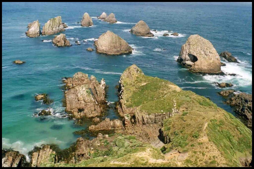
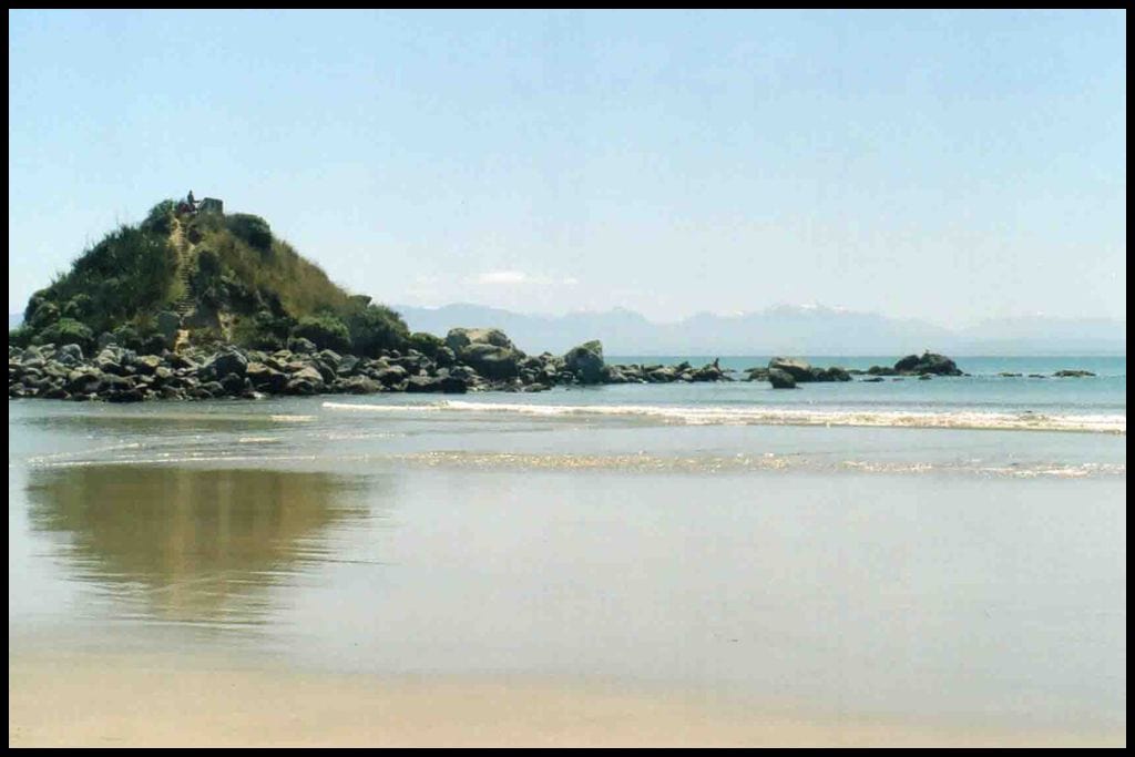
⛱ Curio Bay
General Location: Curio Bay is located in the southeastern corner of the South Island, part of the Catlins Coastal Area. Nearest Civilisation: The tiny settlement of Waikawa is closest to Curio Bay, a six minute drive away (6 kilometres, or 3.7 miles). Immediate Surroundings: Curio Bay is one over from the larger Porpoise Bay, separated by South Head, a small peninsula.
Beach Name: Curio Bay is named for the curios on the beach – the fossils found there! Petrified trees from the jurassic area can be seen there. Getting There: Curio Bay is accessed from the Waikawa-Curio Bay Road, which you access from the Chaslands Highway – a section of the Southern Scenic Route. Vehicle Parking: There is vehicle parking available at Curio Bay.
Walking Options: Take the Petrified Forest Walk to the viewing platform – less than a kilometre, return (0.6 miles).
Swimming: Swimming is a bit too dangerous to chance at Curio Bay but neighbouring Porpoise Bay has great swimming conditions. This lucky couple from Craving Adventure – and others present that day – got to swim with the native Hector’s Dolphins that frequent the bay in summer! Surfing: There are some surf breaks at Curio Bay for those interested.
Dogs: Dogs are banned from Curio Bay to protect the penguins that live there. Take doggo to next-door Porpoise Bay, instead. Amenities: Toilets are available at Curio Bay.
Camping: Campers wanting to stay at Curio Bay can stay at Tumu Toka Curio Scape Campground. Go, Because: Curio Bay is a petrified forest – a fossilised forest that is revealed at low tide, from 180 million years ago. You can see where all the tree stumps used to be – it’s one of the easiest-to-view fossilised forests from the Jurassic era in the world.
Something Extra: If the dolphins weren’t selling point enough, there’s a colony of endangered yellow eyed penguins here! Enjoy them at a distance – there’s a penguin walk platform installed for you to be able to do so. They are best spotted at dusk in summer and autumn.
Last Updated: May, 2026.
Best Beaches in Invercargill
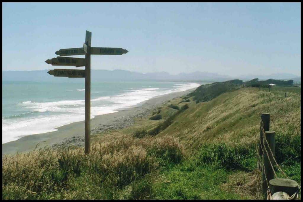
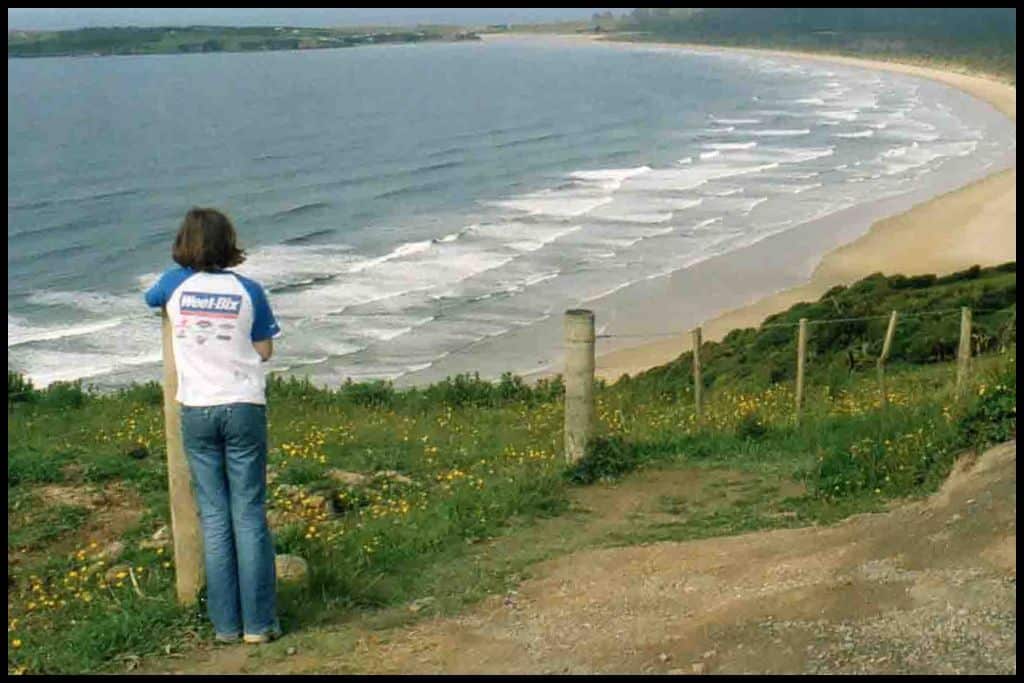
⛱ Ōreti Beach
General Location: Ōreti Beach is on the southernmost coastline of the South Island, opening out into the Foveaux Strait that runs between the South Island and Stewart Island. Nearest Civilisation: The nearest civilisation to Ōreti Beach is the southernmost city of Invercargill, a 10 minute drive away (10 kilometres, or 6 miles). Immediate Surroundings: Ōreti Beach is a long stretch that has New River Estuary curve around and behind it.
Beach Name: Ōreti Beach takes its name from a longer Maori phrase that translates to, “the bay that catches the south wind”. Getting There: Access to Ōreti Beach is an easy short stroll from the carpark. Vehicle Parking: There is vehicle parking at Ōreti Beach.
Walking Options: The big one is the length of Ōreti Beach – 32 kilometres (20 miles)!! Walk any stretch of this that fits into your time here. This officially named ‘Ōreti Beach Track’ is a segment of the Te Araroa Trail that runs the length of New Zealand.
Swimming: Ōreti Beach is patrolled by the Ōreti Surf Life Saving Club in summer – swim between the flags so that you have eyes on you. Surfing: Ōreti Beach is popular amongst surfers of all levels. Dogs: Dogs are permitted on Ōreti Beach and can be off lead if they are under control.
Amenities: Toilets – and an information centre at Sandy Point – are available at Ōreti Beach. Camping: Beach Road Holiday Park is the place to go if you’d like to camp at Ōreti Beach.
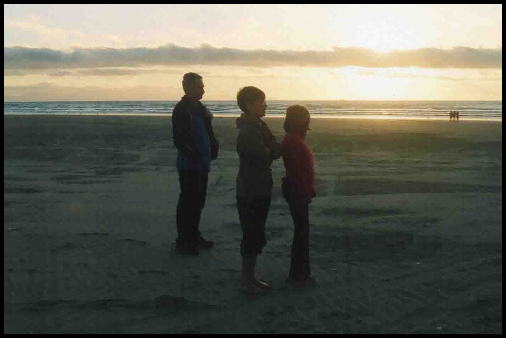
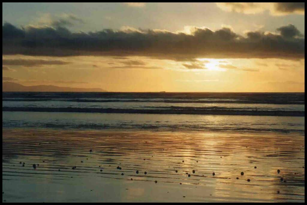
Go, Because: Ōreti Beach is wide, and long, and popular with all sorts of adventurers (think horse-riding, windsurfing, and more!) People love to drive along the beach and it was actually a filming location for The World’s Fastest Indian, the true story of Burt Munro, famous for the speed he clocked on his Indian motorcycle, and the actual beach he trained on. My family saw one of our best sunsets from Ōreti Beach.
Something Extra: Definitely head to the end of Ōreti Beach to the Sandy Point sand dunes – they’re thousands of years old! Last Updated: May, 2026.
Best Beaches in South West Southland
⛱ Ōraka / Colac Bay
General Location: Ōraka / Colac Bay is located on the southernmost coastline of New Zealand’s South Island, west of Invercargill. Nearest Civilisation: Ōraka / Colac Bay is ten minutes out of the small coastal town of Riverton, 11 kilometres, or 7 miles. Immediate Surroundings: Ōraka / Colac Bay is tucked into the headlands that separate Ōreti Beach from Te Waewae Bay.
Beach Name: Colac Bay has gotten its name from a mispronunciation of the name of the chief who is the namesake of the bay’s Maori name, Ōraka. Getting There: Ōraka / Colac Bay is accessed from Colac Bay Road, just off the Southern Scenic Route (the main highway). Vehicle Parking: Vehicle parking for Ōraka / Colac Bay is by the boatramp.
Walking Options: Ōraka / Colac Bay to Riverton can be walked via the Tīhaka Beach Track, which is four hours long, and a (nearly) 13 kilometre (8 mile) trip, one way. Swimming: There’s great swimming to be had at Ōraka / Colac Bay, particularly at the northern end of the beach. Surfing: There’s even better surfing to be had at Ōraka / Colac Bay – it’s a favourite spot amongst surfers.
Dogs: Dogs can be off lead at Ōraka / Colac Bay. Amenities: At Ōraka / Colac Bay, there are toilets, and in the small settlement on the bay (that shares its name with the beach) is a pub, a bakery and a gallery. Camping: Freedom camping is welcomed at Ōraka / Colac Bay!
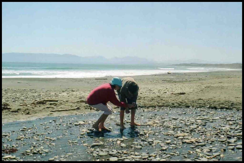
Go, Because: Ōraka / Colac Bay is the best surf beach in the region. There’s even a giant surfer statue by the pub! Something Extra: At low tide, you can wander out into Ōraka / Colac Bay and collect pāua (and clams) – or you can snorkel and/or dive for them, if the water has not receded enough. You can take a maximum of ten, to prevent overfishing.
Last Updated: May, 2026.
⛱ Gemstone Beach / Aropaki
General Location: Gemstone Beach / Aropaki is located on the southern coastline of New Zealand’s South Island – west of Invercargill. Nearest Civilisation: Gemstone Beach / Aropaki is just a kilometre (0.6 miles) – a two minute drive – from the small coastal settlement of Orepuki. Immediate Surroundings: Gemstone Beach / Aropaki is situated within the larger Te Waewae Bay.
Beach Name: Gemstone Beach is named for the gemstones that can be found on the shore, with its Maori name, Aropaki, translating to “bright expanse”. Getting There: Gemstone Beach / Aropaki is located just off the Southern Scenic Route – State Highway 99. Vehicle Parking: There is a gravel area for vehicle parking at Gemstone Beach / Aropaki.
Walking Options: The best walk at Gemstone Beach / Aropaki is the one out to Monkey Island which can be attempted at low tide. It’s two hours return, with most of that walk being down to one end of the beach, before the crossing. It’s simply called, “Gemstone Beach Walk to Monkey Island” and it’s 6 kilometres (3.7 miles). It’s only a few hundred metres offshore and very walkable at low tide.
Swimming: Swimming at Gemstone Beach / Aropaki is seriously discouraged due to strong currents, and there are signs up advising against it. Surfing: Surfing is very good at Gemstone Beach / Aropaki for experienced surfers. Dogs: Gemstone Beach / Aropaki is a good beach for dogs.
Amenities: The closest amenities are in the settlement of Orepuki, so there is nothing at Gemstone Beach / Aropaki directly.
Camping: Yes! There is freedom camping at Gemstone Beach / Aropaki. Go, Because: It’s sometimes possible to find quartz, jade, jasper or even garnet on the shores of Gemstone Beach! Go at low tide for the best time to comb the beach.
Something Extra: Orepuki Horse Treks operate guided rides on the beach, which is a memorable way of experiencing the bay. Last Updated: May, 2026.
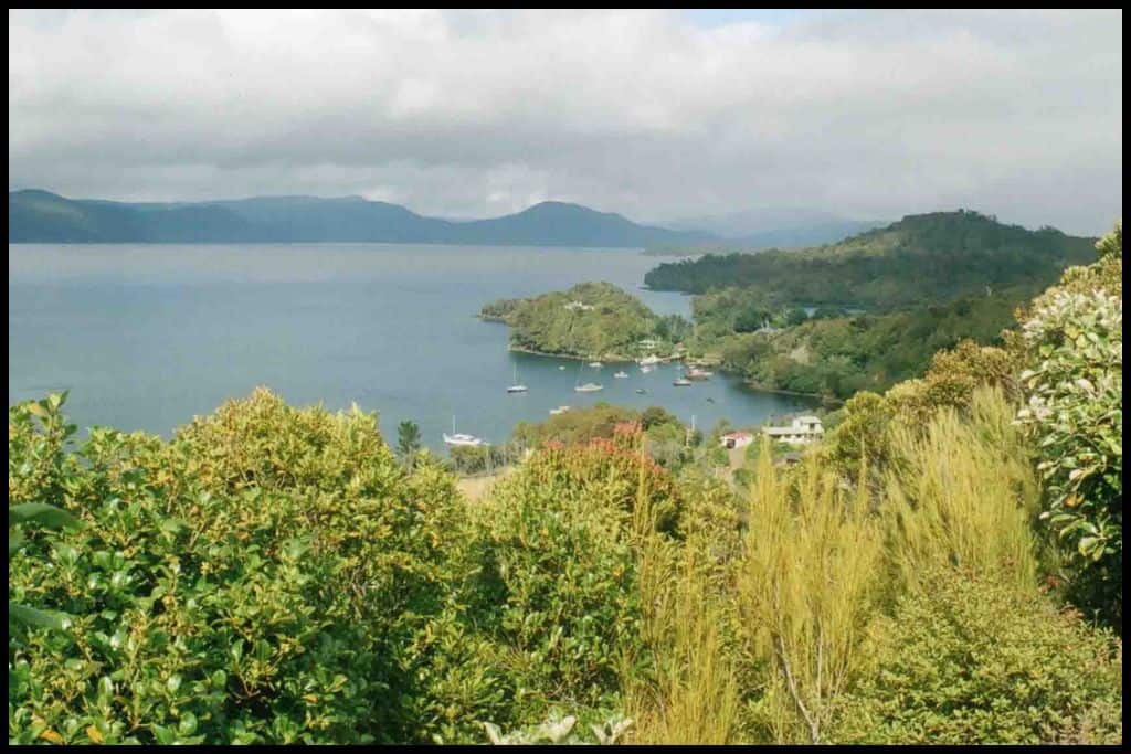
Best Beaches on Stewart Island
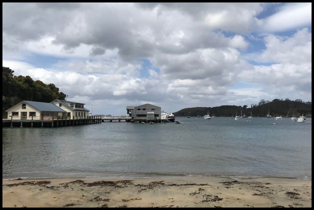
⛱ Bathing Beach
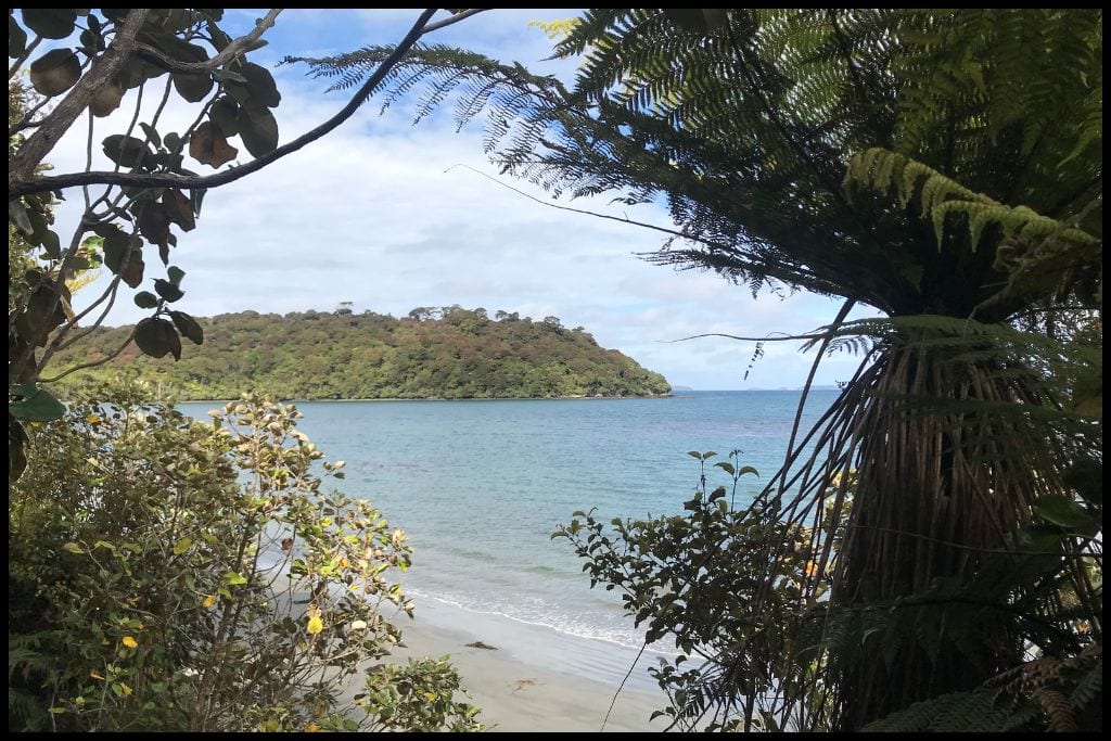
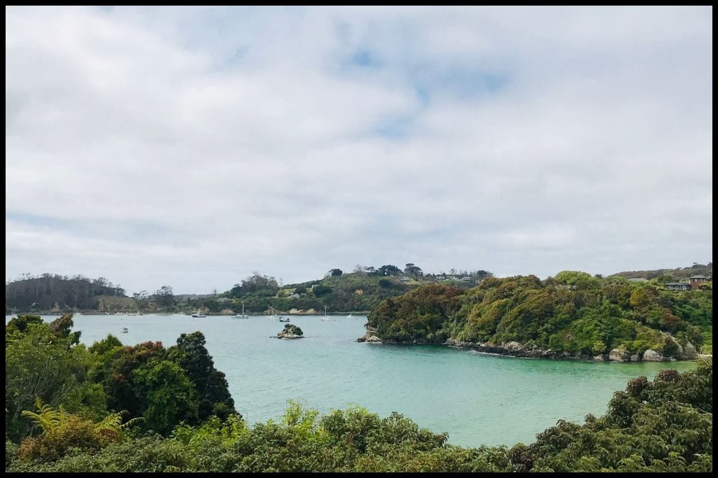
General Location: Bathing Beach is located on Stewart Island – underneath the South Island, closest to the mainland. Nearest Civilisation: The town of Oban is 1.3 kilometres (0.8 miles) from Bathing Beach – just a fifteen minute walk away (one-way). Immediate Surroundings: Bathing Beach is situated within the wider Half Moon Bay, adjacent to the Paterson Inlet, which cuts into the island.
Beach Name: Bathing Beach takes its name from the idyllic swimming conditions there. Getting There: After catching a ferry to Stewart Island, you can walk up to Bathing Beach. Vehicle Parking: Some roadside parking is available near Bathing Beach.
Walking Options: Consider walking the fifteen minutes down to the Oban Visitor Centre, even if you came by road.
Swimming: The conditions at Bathing Beach are perfect for swimming – in warm weather! Surfing: There is no surf at Bathing Beach. Dogs: Dogs are forbidden at Bathing Beach – and all of Rakiura National Park. Amenities: There are no facilities at Bathing Beach – use what is in town before you go.
Camping: There is no campsite at Bathing Beach. Go, Because: You can walk to Bathing Beach from the ferry terminal – plus, it has lovely clear water for swimming in. Something Extra: Stroll up to the cemetery for high angle views of Bathing Beach. Last Updated: May, 2026.
⛱ Horseshoe Bay
General Location: Horseshoe Bay is located on Stewart Island, the southernmost of the three main islands that make up New Zealand. Nearest Civilisation: The town of Oban is a 3 kilometre (1.8 mile) walk from Horseshoe Bay, which is just a ten minute drive.
Immediate Surroundings: Horseshoe Bay is adjacent to the neighbouring Half Moon Bay, on the side of Stewart Island closest to the mainland. It sits between Horseshoe Point and Mamaku Point (and the Mamaku Point Conservation Reserve). Beach Name: Horseshoe Bay is named for the shape of the bay.
Getting There: Horseshoe Bay is easily accessed on foot or by road from the township of Oban. Vehicle Parking: Horseshoe Bay has a small carpark. Walking Options: If up for a walk, tackle the Horseshoe Point Track – a three to four hour walk across Horseshoe Point at the southern end of Horseshoe Bay (8.8 kilometres, or 5.5 miles).
Swimming: The water at Horseshoe Bay is incredible for swimming in. Surfing: There is no surf in Horseshoe Bay. Dogs: Dogs are not permitted at Horseshoe Bay.
Amenities: A toilet is available at Horseshoe Bay. Camping: There isn’t any camping at Horseshoe Bay. Go, Because: You’ll find white sand and clear waters at Horseshoe Bay – so, so inviting!
Something Extra: Ulva’s Guided Walks operate kiwi spotting night walks in the Mamaku Point Conservation Reserve – why not pay to join one and have an encounter with our most famous bird? Last Updated: May, 2026.
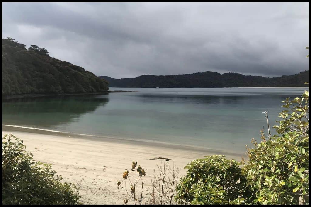
⛱ Lee Bay
General Location: Lee Bay is located on Stewart Island, southernmost of the three main islands that make up New Zealand. Nearest Civilisation: The township of Oban is closest to Lee Bay, just 5 kilometres (3 miles) away, which is a fifteen minute drive or hour and a half’s walk. Immediate Surroundings: Lee Bay is one over from Horseshoe Bay, which is one over from Half Moon Bay – where the Stewart Island ferry docks.
Beach Name: Lee Bay is named for John Lee who was in the area catching seals in the 1800’s. Getting There: Lee Bay can be accessed on foot via the main road from the township of Oban. Alternatively, it is a short, easy drive from town. Vehicle Parking: Lee Bay has a carpark because it is the starting point of the Rakiura Great Walk.
Walking Options: Lee Bay is the trailhead for the three day Rakiura Track – one of the Great Walks of New Zealand! The full loop is 32 kilometres, or 20 miles, but you’ll need to book ahead. Swimming: Swimming is awesome at Lee Bay.
Surfing: There are no surf breaks at Lee Bay. Dogs: Dogs are not permitted at Lee Bay or anywhere in Rakiura National Park.
Amenities: There are toilets available at Lee Bay. Camping: The nearest campsite is at Māori Beach but there is not a specific Lee Bay campsite. Go, Because: Lee Bay is the trailhead for the Rakiura Track – one of the 10 Great Walks of New Zealand.
Something Extra: Why not stay at the Hananui Pure Pod on Lee Bay Road if heading into the national park for a couple of nights in huts? It would be the perfect place to spend a night in luxury after completing the track, too, if doing it the other way around. Last Updated: May, 2026.
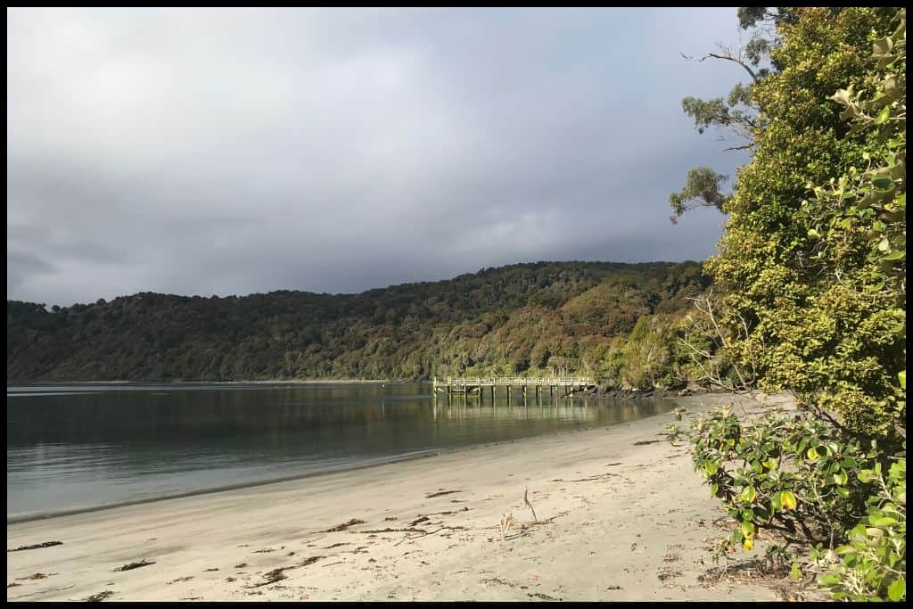
⛱ Māori Beach
General Location: Māori Beach is located on Stewart Island, at the bottom of New Zealand. Nearest Civilisation: The township of Oban is three and a half hours of walking away from Māori Beach, 10 kilometres, or 6 miles. Immediate Surroundings: Māori Beach is actually part of the wider Wooding Bay, which leads up to Port William.
Beach Name: Māori Beach is not to be confused for Māori Beach on the West Coast, near Haast. Getting There: There is no road access to Māori Beach. It is accessed via the Rakiura Great Walk. Vehicle Parking: There is no vehicle parking at – or access to – Māori Beach.
Walking Options: The way in and the way out of Māori Beach is via the Rakiura Track – one day back to Lee Bay, or two days onward to complete the loop. Swimming: Māori Beach is beautiful for swimming in. Surfing: There is no surfing at Māori Beach.
Dogs: There is a ban on dogs at Māori Beach – and the entirety of the Rakiura National Park.
Amenities: There is water, a toilet and a shelter at Māori Beach – all part of the campsite.
Camping: The Department of Conservation operates a campsite at Māori Beach. Go, Because: Go for the sheer beauty of Māori Beach! This beach is very beautiful and located along the coastal part of the Rakiura Track.
Something Extra: There used to be a sawmill (and a school!) here, and you can go looking for old relics from the sawmill in the nearby forest. Last Updated: May, 2026.
Whether you’re here for the petrified forest, want to drive along a vast stretch of sand, or step onto the remote shores of Stewart Island, Southland’s coastline feels completely unique. It’s the kind of place where nature takes centre stage — and every beach feels like a new discovery.