Where Are The Best Beaches On The West Coast, New Zealand?
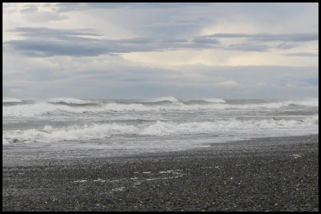
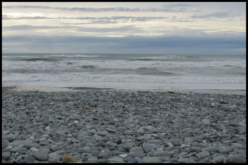
The West Coast is such a unique stretch of coastline in New Zealand — very wild, very remote, and pounded by the Tasman Sea – which mean many of its beaches have currents that are too strong for safe swimming. Find rugged rock formations, find driftwood-covered shores, and find quiet, isolated beaches – find it all to be have that untouched vibe!
Best Beaches on Farewell Spit
Okay, so I wrote about Wharariki Beach on my Best Beaches in Tasman Region page as well .. but it’s a bit borderline as to which region it fits under, and it’s worth a second mention anyway!
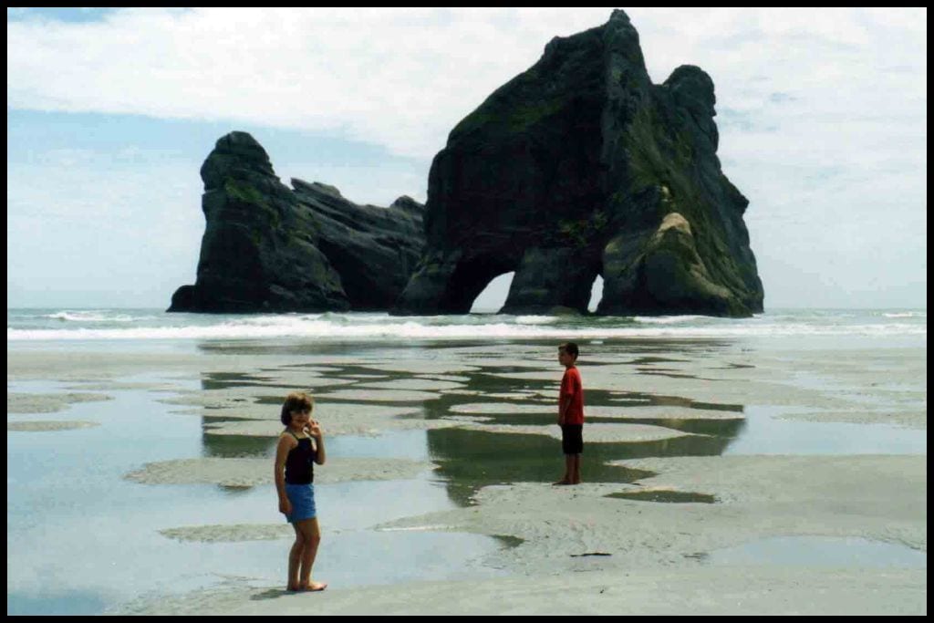
⛱ Wharariki Beach
General Location: Wharariki Beach is on the outward facing coast of Cape Farewell – the northernmost tip of the South Island. Nearest Civilisation: The nearest town to Wharariki Beach is Collingwood, a half hour drive away (28 kilometres, 17 miles).
Immediate Surroundings: Wharariki Beach is at the base of Cape Farewell at the top of the western coast of New Zealand, part of Farewell Spit Nature Reserve.
Beach Name: Wharariki Beach is named for the coastal flax (wharariki) that grows well beyond the shoreline.
Getting There: To get to Wharariki Beach, you need to walk for 20-30 minutes (1 kilometre, 0.6 miles one-way). Vehicle Parking: Vehicle parking is available at the Wharariki Beach Carpark, from where you will need to walk the last kilometre (0.6 miles).
Walking Options: Pillar Point Lighthouse is an alternative walk from the Wharariki Beach Carpark and will take you an hour and a half return (3 kilometres, 1.8 miles). Swimming: Strong currents mean it is not safe to swim at Wharariki Beach.
Surfing: Wharariki Beach is enjoyed amongst surfers. Dogs: Dogs are banned at Wharariki Beach. Amenities: Toilets are available at the Wharariki Beach Carpark – and there is also a café there named Archway Café, after the Archway Islands.
Camping: You can go camping at Wharariki Beach Holiday Park. Go, Because: The Archway Islands – that famous hole in the rock at Wharariki Beach – is quite beautiful at sunset and is actually the screensaver for Microsoft Windows 10 and 11 – you will have seen it for sure. Something Extra: Keep an eye out for baby seals – they swim in the tidal pools on Wharariki Beach and are most likely to be seen during spring and summer. Just remember to give them their space (20 metres is the rule).
Last Updated: April, 2026.
Best Beaches in Kahurangi National Park
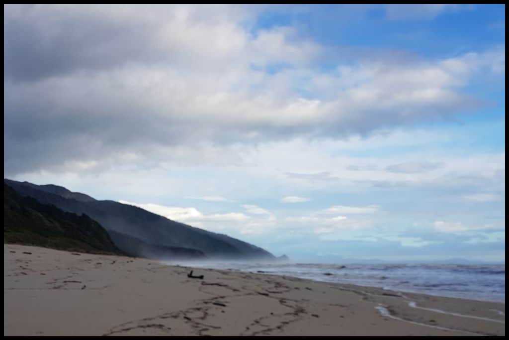
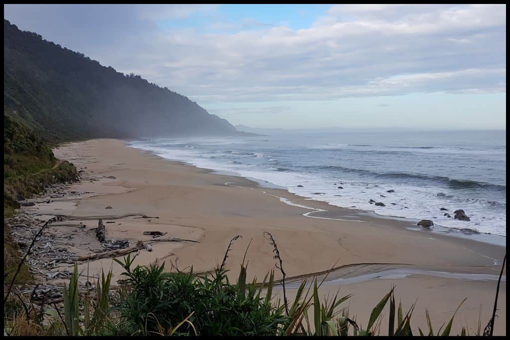
⛱ Scotts Beach
General Location: Scotts Beach is one of the northernmost beaches of the West Coast of New Zealand. Nearest Civilisation: The nearest place of any significance to Scotts Beach is a tiny town called Karamea, the gateway to Kahurangi National Park (a 17 minute drive – 18 kilometres, or 12 miles away).
Immediate Surroundings: Scotts Beach is part of the Kahurangi National Park, and located along the Heaphy Track – one of the Great Walks of New Zealand. Beach Name: It is generally assumed that Scotts Beach would have been named for one of the early settler families in the area.
Getting There: To get to Scotts Beach, you need to drive up Karamea-Kōhaihai Road – a dead-end road, and then continue on by foot (an hour and a half’s walk there, and the sam back again – 7 kilometres return, or 4.3 miles). Vehicle Parking: There is no road access to Scotts Beach itself – instead, you would park at the Kōhaihai Carpark – the endpoint of the multi-day Heaphy Track hike.
Walking Options: Aside from the walk to Scotts Beach, which is the last couple of hours of the Heaphy Track, and also referred to as the Scotts Beach Walk, there is a 10 minute ascent from the Kōhaihai Carpark – up to the Kōhaihai Lookout. It’s a short, 200 metre walk with awesome views.
Swimming: Do not swim at Scotts Beach! The currents are far too dangerous for swimmers. Instead, consider swimming in the Kōhaihai River Lagoon, at the Kōhaihai river mouth on your way there. Surfing: Scotts Beach is not ideal for surfing because you have to walk so far to access it.
Dogs: Dogs are not permitted at Scotts Beach – or anywhere in Kahurangi National Park. Amenities: There is little in the way of amenities at Scotts Beach, but at the Kōhaihai Carpark before the one and a half hour walk to the beach, there is a picnic area, toilets and a campsite.
Camping: The Department of Conservation operates the Scotts Beach Campsite. It’s primarily used by walkers on the Heaphy Track. You should book in advance. Go, Because: Scotts Beach is wild, wide, rugged and expansive – classic West Coast scenery, and so quiet, as well.
Something Extra: Consider taking on the full Heaphy Track – all 78 kilometres (48 miles) of it! We walked it in 2019 and for many in our group, it was the favourite of all the walks we ever did. Last Updated: April, 2026.
Best Beaches near Westport
South of the Kahurangi National Park, the first noteworthy town along the West Coast is Westport.
⛱ Carters Beach
General Location: Carters Beach is at the upper end of the west coast of New Zealand’s South Island. Nearest Civilisation: Carters Beach is just a five minute drive (5 kilometres, 3 miles) from the town centre of Westport.
Immediate Surroundings: Carters Beach is part of the shoreline of the wider Buller Bay, named for the river mouth of the mighty Buller River. Beach Name: Carters Beach is named after George Carter, a farmer from the area at the end of the 1800’s.
Getting There: From the town of Westport, Carters Beach is an easy drive out down the State Highway. Vehicle Parking: There is lots of parking for vehicles down the beachfront of Carters Beach (Marine Parade).
Walking Options: One to do is the Kawatiri Coastal Trail, part of which runs from the town of Westport out to Carters Beach (5 kilometres, or 3 miles, just over an hour’s walk), and part of which runs the length of the beach down to Cape Foulwind (8 kilometres, or 5 miles, just under two hour’s walk). It continues on down to Charleston .. but that would take you days! Swimming: Carters Beach is a safe beach for swimming!
Surfing: Carters Beach can be a good learning beach for beginner surfers. Dogs: Dogs need to be on a leash on some parts of Carters Beach and are okay off leash on other parts of the beach – local signage applies. Amenities: Carters Beach has a beachfront café, Donaldos, as well as a picnic area, toilets and a playground.
Camping: Carters Beach Top 10 Holiday Park is the place to go for campers! Go, Because: Much of the West Coast is too wild for swimming, but it’s safe to swim at Carters Beach, and there’s a beachside Top 10 holiday park, here, too. Something Extra: Do make the trip to Cape Foulwind at the other end of Carters Beach, to see the lighthouse and the seal colony there. Keep an eye out for Little Blue Penguins on the beach, too!
Last Updated: April, 2026.
Best Beaches in Paparoa National Park
South of Westport is Punakaiki, famous for one thing in particular ..
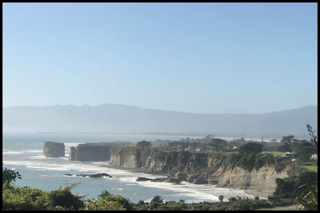
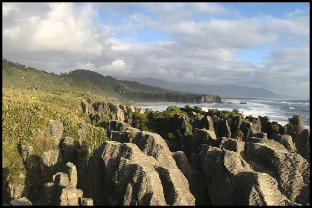
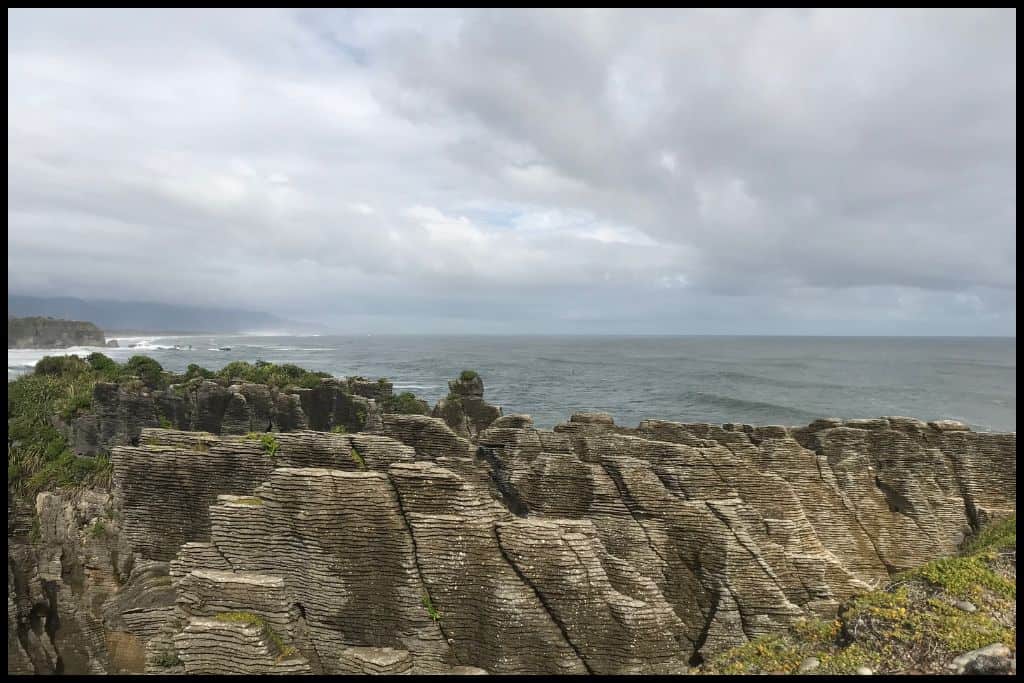
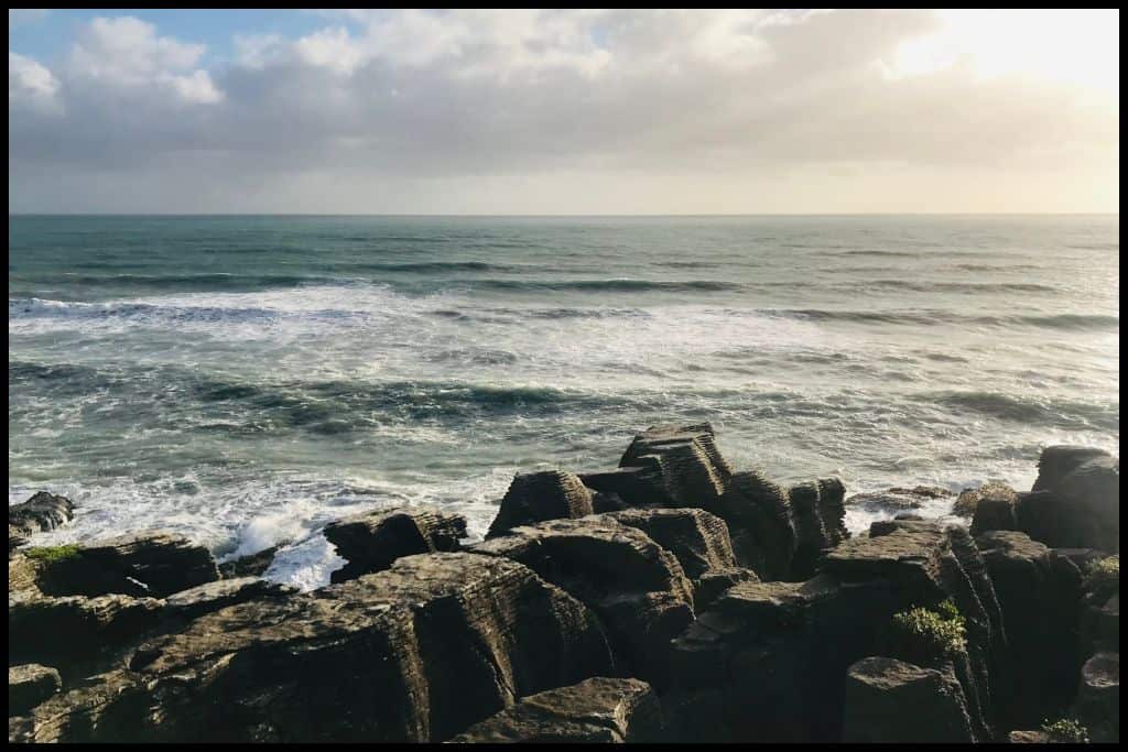
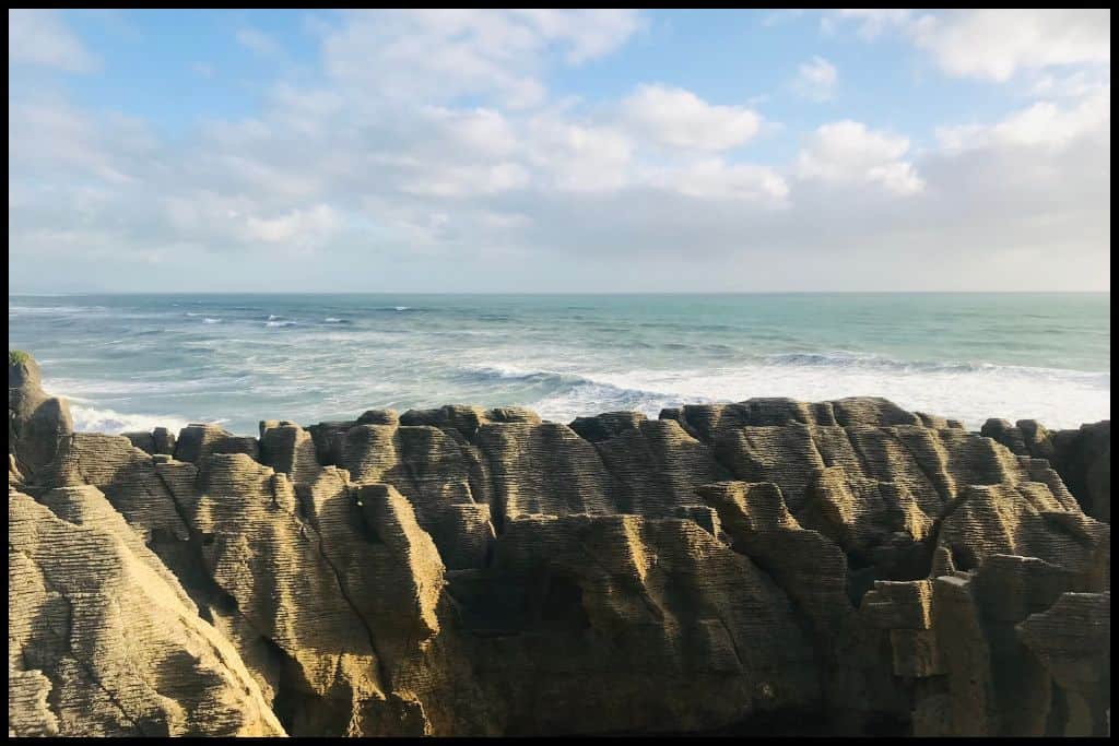
⛱ Punakaiki Beach
General Location: Punakaiki Beach is about a quarter of the way down the west coast of New Zealand’s South Island. Nearest Civilisation: The little village of Punakaiki is within a stone’s throw of Punakaiki Beach itself.
Immediate Surroundings: Punakaiki Beach is on the edge of the Paparoa National Park and looks out to the Tasman Sea, and the Pancake Rocks are situated on Dolomite Point at the southern end of the beach. Getting There: Access Punakaiki Beach via the Punakaiki Beach Camp or via the Truman Track – at low tide. Vehicle Parking: The Department of Conservation carpark for Punakaiki Beach and the famous Pancake Rocks will be paid for visits exceeding 20 minutes.
Beach Name: There is a little bit of division over the true meaning behind the name but it is generally accepted that Punakaiki is the translation for ‘pancakes’ – which will make so much sense to you when you see the famous Pancake Rocks!
Walking Options: Punakaiki is one of the trailheads for the Paparoa Track – one of the Great Walks of New Zealand. It’s a beautiful multi-day walk through the Paparoa Ranges, if you have the time. If you don’t, just do the start bit – the Pororari River Track, which is 7 kilometres (4.3 miles) – an hour and a half’s walk, return.
Swimming: It is not safe to swim at Punakaiki Beach but the water is calm in the nearby Pororari Lagoon, which lends itself to kayaking and paddleboarding. Paddle N Carve hire out paddleboards, offer a limestone carving experience, and a sauna experience!
Surfing: There is some good surfing at Punakaiki Beach. Dogs: Dogs are not allowed at Punakaiki Beach. Amenities: The village of Punakaiki, just over the road from the beach, has a visitor centre, dining options and the beach camp nearby.
Camping: Consider staying at Punakaiki Beach Camp if you’d like to camp here. Go, Because: Punakaiki Beach is where you’ll find an impressive set of geological rock stacks, all layered, and famously known as the Pancake Rocks – and the blow holes, which are most impressive at high tide. Head to the Pancake Rocks Lookout. Something Extra: Also check out the Punakaiki Cavern – there’s 150 metres of cavern to explore – and glow worms at night!
Last Updated: April, 2026.
Best Beaches near Greymouth
South of Punakaiki is the town of Greymouth – the biggest town on the West Coast, and home to the mouth of the Grey River, too.
⛱ Rapahoe Beach
General Location: Rapahoe Beach is about a third of the way down the west coast of the South Island. Nearest Civilisation: The nearest place of any real significant size to Rapahoe Beach is the town of Greymouth, 12 kilometres (or 7.5 miles) south. Immediate Surroundings: Rapahoe Beach sits immediately north of Point Elizabeth.
Beach Name: Rapahoe translates to ‘flash of the paddle’. Getting There: From Greymouth, head north on the main State Highway for 12 minutes (12 kilometres, or 7.5 miles) to Rapahoe Beach. Vehicle Parking: Campervan parking is available at the Rapahoe Beach Holiday Park.
Walking Options: From Rapahoe Beach, it’s an hour and a half’s walk to Point Elizabeth (one-way) – 6 kilometres, or 3.7 miles, where you may just spot a seal or a dolphin! Swimming: You can swim at Rapahoe Beach – it is patrolled by volunteer lifeguards over the summer holidays during the day.
Surfing: Yes, you can surf at Rapahoe Beach. Dogs: Dogs are okay to be off lead at Rapahoe Beach but must be under control! Amenities: Toilets and showers are available at the Rapahoe Beach Holiday Park for those staying there.
Camping: Rapahoe Beach Holiday Park is the place to be for campers! Go, Because: Sometimes you can find greenstone on Rapahoe Beach – surely worth a look, right? Success is cited as ‘frequent’, but you’ll want to comb the beach after high tide or stormy weather to ensure that. You can keep what you can find!
Something Extra: Riding a horse down Rapahoe Beach is something you need to look into! A wild West Coast adventure! Last Updated: April, 2026.
Best Beaches near Hokitika
South of Greymouth we have Hokitika..
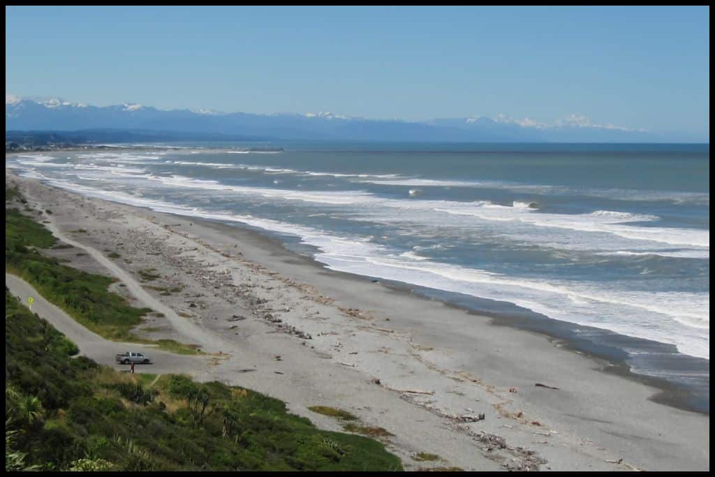
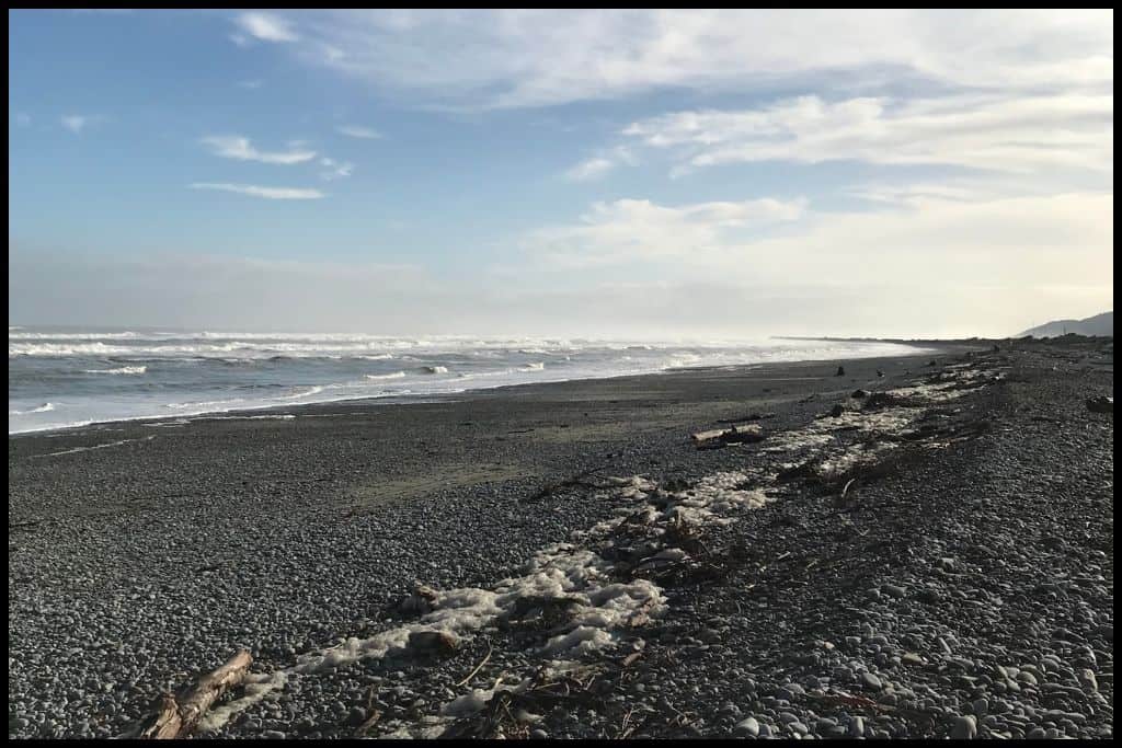
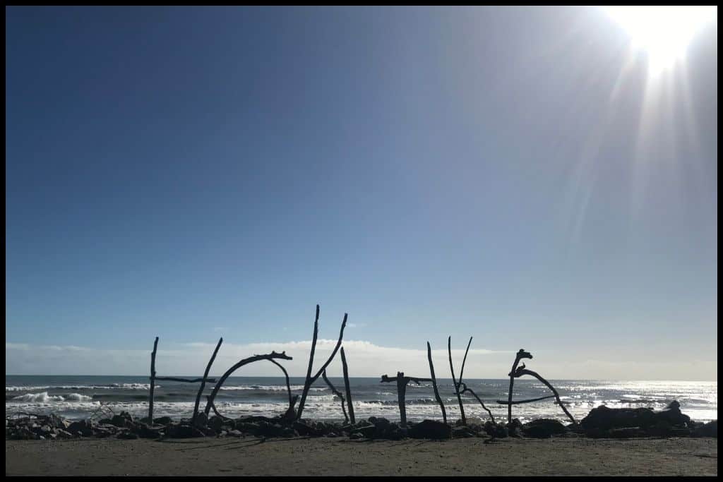
⛱ Hokitika Beach
General Location: Hokitika Beach is about a third of the way down the west coast of New Zealand’s South Island. Nearest Civilisation: Hokitika Beach is very much in the township of Hokitika itself. Immediate Surroundings: Hokitika Beach is immediately north of Sunset Point and the Hokitika River mouth.
Beach Name: Hokitika translates to ‘to turn back’ and was named for the turning back of warriors who had been defeated in a battle over the greenstone (pounamu) found here. Getting There: Hokitika Beach is not far at all from the centre of the township of Hokitika, – practically on its doorstep. Vehicle Parking: There is a gravel carpark at the end of Beach Street for access to Hokitika Beach.
Walking Options: Strongly recommended is the Hokitika Beach Walk, an hour’s stroll up the coast (2 kilometres, 1 mile) there and back, starting from Sunset Point but also accessed from town. Swimming: Hokitika Beach is not a safe swimming beach. Surfing: Advanced surfers will enjoy the swells at Hokitika Beach.
Dogs: Near the sand dunes and near town, dogs need to be on lead at Hokitika Beach. Amenities: Toilets and shops are just across the road from Hokitika Beach. Camping: Hokitika Holiday Park is the ideal place to stay for campers.
Go, Because: Hokitika Beach is full of driftwood – it is driftwood that the famous ‘Hokitika’ letters are spelled out of – and each January they have a week long driftwood sculpture festival here to celebrate everyone’s creations. Something Extra: Keep an eye out for Little Blue Penguins on the beach – they nest in the sand dunes! Last Updated: April, 2026.
Best Beaches near Ross
And south of Hokitika we have Ross..
⛱ Ross Beach
General Location: Ross Beach is a third of the way down the South Island’s west coast. Nearest Civilisation: The township of Ross is 2 kilometres (1 mile) from Ross Beach, just a couple of minutes drive. Immediate Surroundings: Ross Beach is part of the Tasman Sea’s coastline.
Beach Name: Ross Beach is the namesake of George Ross, treasurer of the Provincial Council in the 1860’s when Ross was established as a settlement. Getting There: From the State Highway, Ross Beach Road takes you out to Ross Beach. Vehicle Parking: You can park at the end of Ross Beach Road, which is also where the holiday park is located.
Walking Options: Walk the Ross Water Race Walkway, an hour’s walk (1.6 kilometres, or 1 mile), which is a loop track with views of the beach – and other historical points of interest. Swimming: It is not safe to swim at Ross Beach. Surfing: Advanced surfers will find waves to catch at Ross Beach.
Dogs: Dogs need to be on a leash at Ross Beach. Amenities: Facilities are available at the Ross Top 10 Holiday Park, should you stay there. Camping: The place to be is the Ross Top 10 Holiday Park.
Go, Because: There are Little Blue Penguins (a native species) that live at the beachside Ross Top 10 Holiday Park and you can see them on the beach at dawn and dusk! Something Extra: It’s possible to find gold and/or greenstone (pounamu) on the beach! If you have no luck, maybe try a spot of gold panning at the Heritage Centre instead!
Last Updated: April, 2026.
Best Beaches in Westland Tai Poutini National Park
Make it into Westland Tai Poutini National Park, and you’ve made it as far south as one of New Zealand’s best kept secrets..
⛱ Gillespies Beach
General Location: Gillespies Beach lies halfway down the West Coast of New Zealand’s South Island. Nearest Civilisation: The nearest town to Gillespies Beach is the village of Fox Glacier, a half hour drive inland (21 kilometres, 13 miles).
Immediate Surroundings: Gillespies Beach lies just north of where the Cook River meets the Tasman Sea. Fox Glacier is not far inland from this. Beach Name: Gillespies Beach takes its name from James Edwin Gillespie. He found gold on Gillespies Beach in 1866, and a gold rush ensued.
Getting There: Access to Gillespies Beach is via the village of Fox Glacier – past the Lake Matheson turnoff. Vehicle Parking: A gravel carpark is available at Gillespies Beach.
Walking Options: A popular walk at Gillespies Beach is the Miners Cemetery Walk, which is only half a kilometre return (a third of a mile) and will only take you a few minutes. Gillespies Suction Dredge Walk, Gillespies Bucket Dredge Walk and Miners Tunnel Track are longer (and longer still) extensions to each other and worth doing if you are interested in the mining history of the area.
Swimming: Gillespies Beach is not safe for swimming but visitors to the area do enjoy a swim in Gillespies Lagoon nearby. Surfing: Advanced surfers after challenge may enjoy the breaks at Gillespies Beach. Dogs: Dogs need to be on lead at Gillespies Beach.
Amenities: A water tap and long drop toilets are available at Gillespies Beach. Camping: The Department of Conservation operates Gillespies Beach Campsite. Go, Because: Being down in glacier country, you are in a UNESCO World Heritage Site, and will be able to see the Southern Alps .. from the beach!
Something Extra: On your way back to the main highway, stop at Lake Matheson, renowned for its reflections of the Southern Alps and glassy surface. This spot is especially awesome at sunrise or sunset. Last Updated: April, 2026.
Best Beaches near Haast
South of Glacier Country we have Haast..
⛱ Monro Beach
General Location: Monro Beach is halfway down the West Coast of New Zealand’s South Island. Nearest Civilisation: The nearest place of any significance to Monro Beach is the town of Haast, which is a half hour drive away (33 kilometres, or 20 miles).
Immediate Surroundings: Monro Beach is just north of where the Moeraki River meets the Tasman Sea. Beach Name: Monro Beach is the namesake of Sir David Monro, who was one of our earliest politicians in the 1860’s.
Getting There: Access to Monro Beach is via a walk – it’ll take you between an hour and. an hour and a half to walk into and from this isolated beach (5 kilometres, or 3 miles return). Vehicle Parking: There is a gravel park at the trailhead to the Monro Beach Track.
Walking Options: While you’re in the area, consider walking to Ship Creek (a fifteen minute drive down the coast from Monro Beach). The Kahikatea Swamp Forest Walk is a track that will take you 20 minutes, return (1 kilometre, or half a mile). Swimming: Swimming is not recommended at Monro Beach.
Surfing: Monro Beach offers some exciting breaks to advanced surfers but is not a designated surfie hotspot. Dogs: Dogs are forbidden at Monro Beach – it’s a penguin sanctuary!! Amenities: There is a long drop toilet at the trailhead for Monro Beach Track – but it’s another hour and a half of walking to the beach and back, from that point.
Camping: There are no opportunities for camping at Monro Beach. Go, Because: Monro Beach is a secluded, secret little spot – and in the spring, its where the Fiordland Crested Penguin (much rarer than our little blue penguins and yellow eyed penguins .. one of the rarest species of penguins in the world, in fact) make their nests! They breed here and it can be an incredible wildlife encounter – just give them a 30 metre berth, so that they can do their thing in peace.
Something Extra: Treat yourself to a night at nearby Lake Moeraki Wilderness Lodge – they offer kayak safaris, penguin spotting guided excursions, and luxury accommodation. Last Updated: April, 2026.
⛱ Ship Creek / Tauparikākā
General Location: Ship Creek is located a little over halfway down the West Coast of the South Island. Nearest Civilisation: The town of Haast is the closest to Ship Creek: it’s a 13 minute drive (17 kilometres, or 10 miles). Immediate Surroundings: Ship Creek – Tauparikākā Point – is north of the mouths of the Haast and Waita Rivers, and south of Monro Beach, part of the Tauparikākā Marine Reserve.
Beach Name: Ship Creek is named for the pieces of shipwreck that were washed up ashore here in 1871. Getting There: The track down from the Ship Creek carpark to the beach is not far. The main highway is near the coast here, so Ship Creek is not too far out of the way. Vehicle Parking: Vehicle parking is available upon arrival at Ship Creek.
Walking Options: There are two great walks at Ship Creek – the Kahikatea Forest Swamp Walk, mentioned above, and the Dune Lake Walk, which is a half an hour return walk (1 kilometre, or half a mile). Swimming: Swimming is not advised at Ship Creek. Like most West Coast beaches, the currents can be strong.
Surfing: Ship Creek is not renowned for its surfing, although advanced surfers may catch a break. Dogs: Dogs are not permitted at Ship Creek. Amenities: There are toilets at the Ship Creek carpark, and a visitor centre.
Camping: There is no campground at Ship Creek. Go, Because: This is a really beautiful area with a lagoon, swamp, dunes and the surf – in which you may be able to spot some Hector’s dolphins swimming by, which would be a truly special sighting indeed. Something Extra: Climb up the Ship Creek Viewing Tower, which is part way along the Kahikatea Swamp Forest Walk. Last Updated: April, 2026.
⛱ Haast Beach
General Location: Haast Beach is two thirds of the way down the West Coast of New Zealand’s South Island. Nearest Civilisation: Haast is the closest civilisation to Haast Beach, just a five minute drive out (6 kilometres, or 3.7 miles).
Immediate Surroundings: Haast Beach is just south of the Haast River mouth. Beach Name: Haast Beach is the namesake of Haast the town, named for Sir Julius von Haast, a European geologist who was surveying this area in the 1800’s. Getting There: Haast Beach is accessed from the Haast-Jackson Bay Road. Vehicle Parking: A parking lot is available free of charge at Haast Beach.
Walking Options: A great walking option is the Kōkako Track, which runs between Haast Beach and the township (5.5 kilometres, or 3.5 miles, one way). Swimming: Currents are strong at Haast Beach, so a safer alternative for swimming is Neils Beach, a little further down the coastline. Surfing: Haast Beach is a good destination for intermediate to advanced surfers.
Dogs: Dogs are permitted at Haast Beach, if they are under control. Amenities: There is very little in the way of amenities at Haast Beach, so use the facilities in the town before you go. Camping: Camping is available at Haast Beach Holiday Park.
Go, Because: Haast is a bit of a gateway into the UNESCO World Heritage Area down here – one of only three that are located in New Zealand – and the beaches down here are so remote, so wild, so unique, with their rainforests and swamplands, it’s something you need to see for yourself. Something Extra: If you have a vehicle, head on over to Knights Point Lookout, a spot with really stunning views. It can also be accessed on foot from town. Last Updated: April, 2026.
⛱ Jackson Bay / Ōkahu
General Location: Jackson Bay Beach is two thirds of the way down the West Coast of New Zealand. Nearest Civilisation: Jackson Bay is just south of Haast, a half an hour drive (38 kilometres, or 23 miles). Jackson Bay village itself is a little fishing village in the bay (there are just thirty houses there!)
Immediate Surroundings: The Waiatoto and Arawhata rivers flow into the wider Jackson Bay. It’s a long coastal stretch with various different beaches along it, but these details mostly refer to Jackson Bay Beach, one of those beaches. Beach Name: It was a sealer from the 1840’s named William Jackson that Jackson Bay is named after.
Getting There: Jackson Bay is an end of the road destination! You can’t continue down the coast after Jackson Bay; you have to go inland at Haast. It’s sealed road all the way down to Jackson Bay though, so accessible, if you have the time. Vehicle Parking: Free parking is available at Jackson Bay.
Walking Options: Head up to Lake Ellery, a glacial lake, which is a two hour return walk from Jackson Bay (3 kilometres, or 1.8 miles). Swimming: Swimming in Jackson Bay is safe enough. Neils Beach, mentioned above, is located in the bay.
Surfing: There is some decent surf at Jackson Bay. Dogs: Dogs are not permitted on the beaches of Jackson Bay but can obtain a permit from the visitor centre to be on lead on a couple of the nearby walking tracks. Amenities: There’s a shelter at the trailheads of the various walking tracks and toilets available at Jackson Bay.
Camping: Freedom camping is permitted at Jackson Bay.
Go, Because: Jackson Bay is at the end of the road! You’ve hit the bottom of the accessible parts of the West Coast once you’ve hit Jackson Bay, and you’ve got to go inland from Haast. Jackson Bay has that isolated feel – so isolated that Hector’s dolphins actually have their babies down here, so you may see baby dolphins (or orcas, even). Rare, Fiordland Crested Penguins are also seen here sometimes.
Something Extra: Head into The Craypot as you finish up on the beach for some amazing seafood. Last Updated: April, 2026.
West Coast beaches aren’t the best for safe swimming conditions — rather, they’re best for scenery, for wildlife, and that untamed feeling that you don’t quite get anywhere else. Wild beauty: this, they do well.